So we meteorologists have been keeping this a secret for the last couple of days, but one of our computer models has been advertising a major snow storm for New England. The model that has been doing this is the European Model; which statistically speaking is our most accurate model. For the last couple of days, the Euro was all by itself in thinking a major storm was coming. But overnight the American model; the GFS, trended toward the European. And finally this morning came in with an almost exact match to the Euro.
So it time to show everyone what the Euro has been showing me. This morning’s run of the Euro is the most extreme run we have seen. So I will show you the important images that you need to see. Outlining what the worst (or best) possible outcome is.
Each image that follows will have the description of what it means above it.
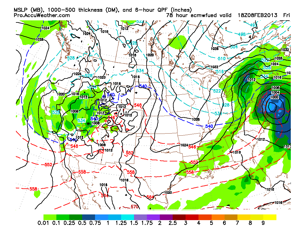
First image is the surface reflection of what our storm could look like at 1 pm on Friday. The green shading is potential precipitation in inches for the previous 6 hours. The dark blue shading is .5″. Or potentially 5 inches of snow in 6 hours.
The next image is what our storm could look like at 7 pm Friday Evening.
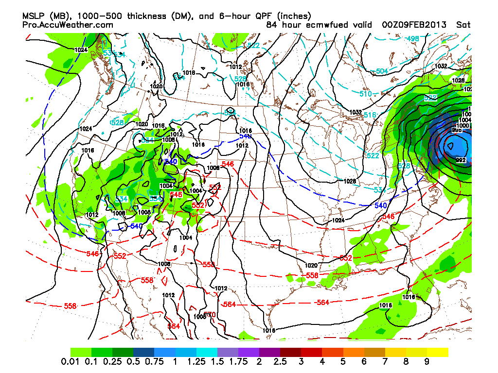
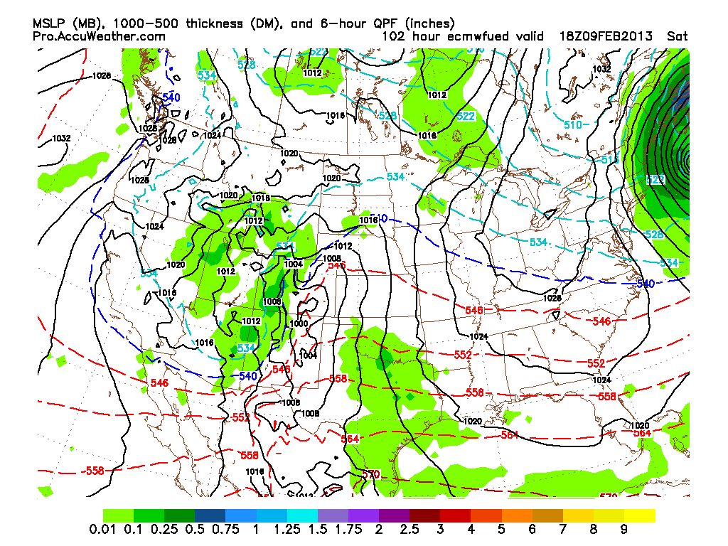
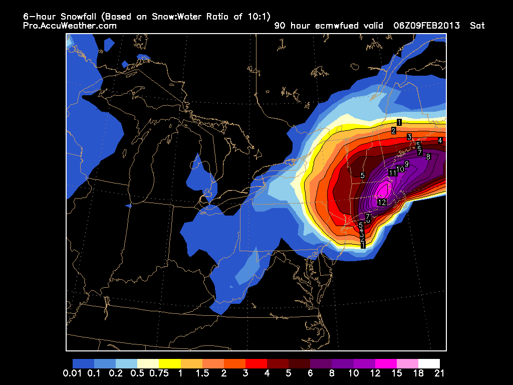
Our possible storm at 1 am Saturday morning. The light blue over eastern Mass is 1.25″ of precip or more in 6 hours…….12″+!!!!
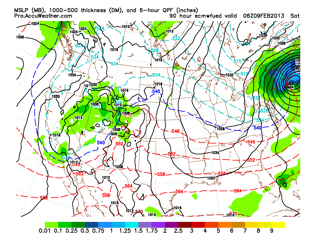
Our storm at 7 am Saturday. Still going strong.
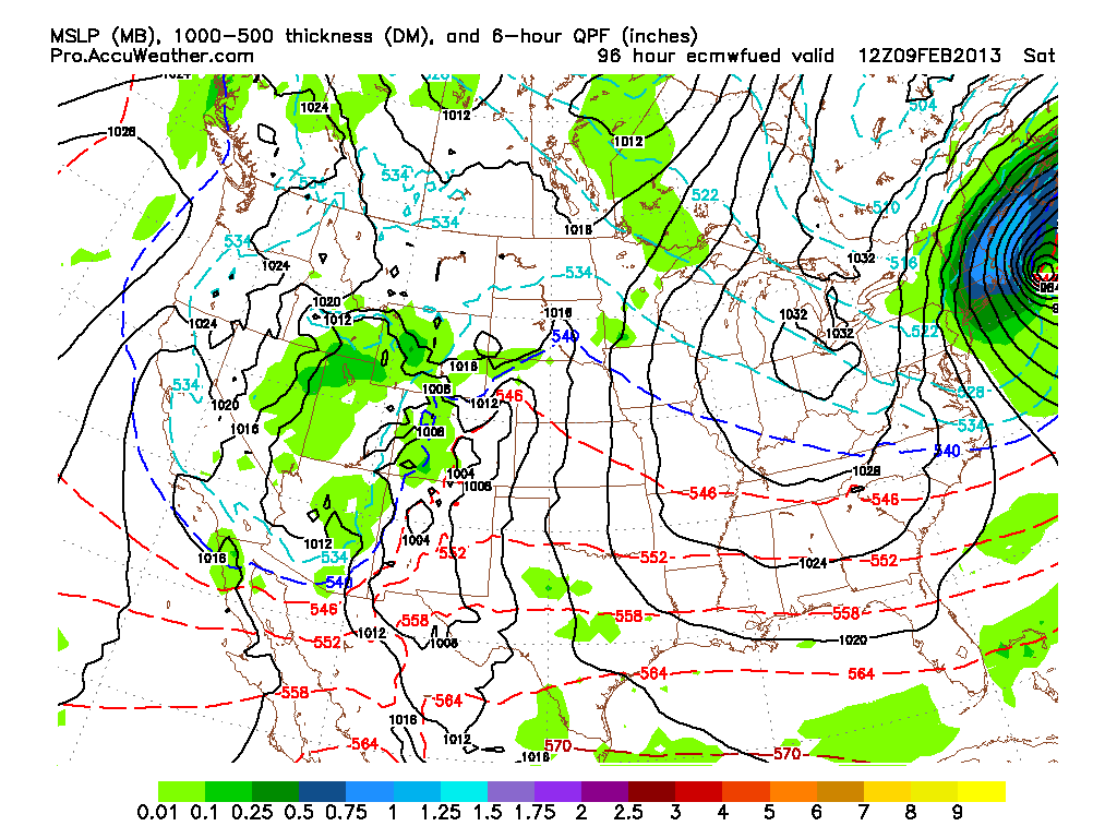
Storm at 1 pm Saturday. Finally moving away.
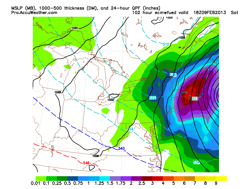
Total liquid that falls out of sky based on the European model. Majority of Eastern Mass sees over 3″ of liquid…….or possibly over 30″ of snow.
The next set of images is the amount of snow that falls in the previous 6 hours based on the model and a 10 to 1 ratio.
First image is from 1 pm Friday. Storm just moving in.
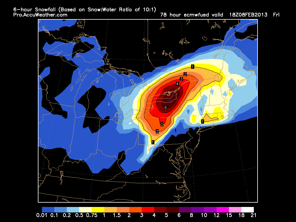
7 pm Friday night. Storm starting to crank. 1″ per hour snows.
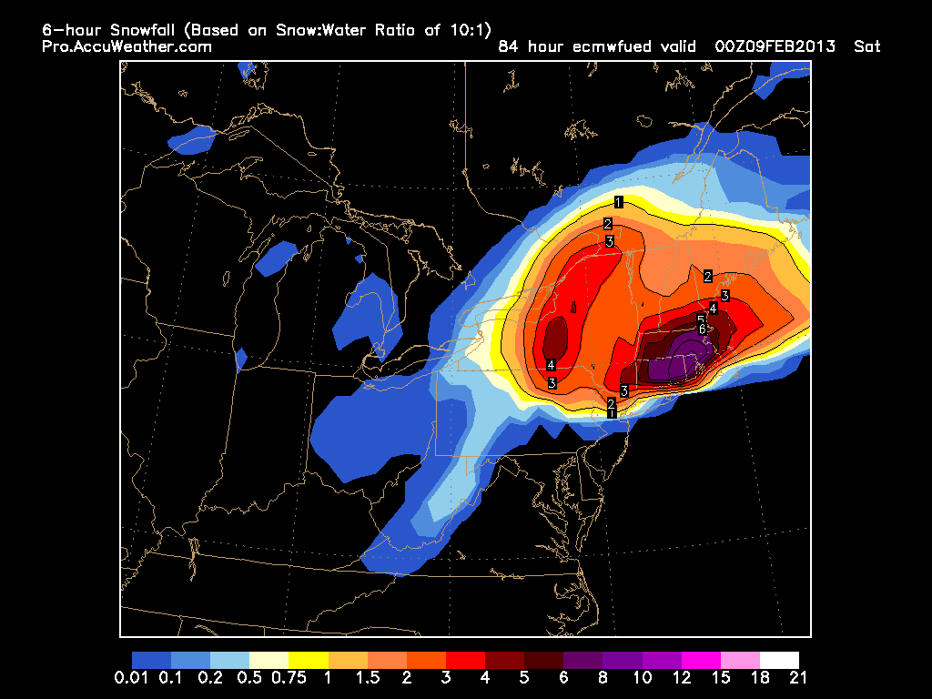
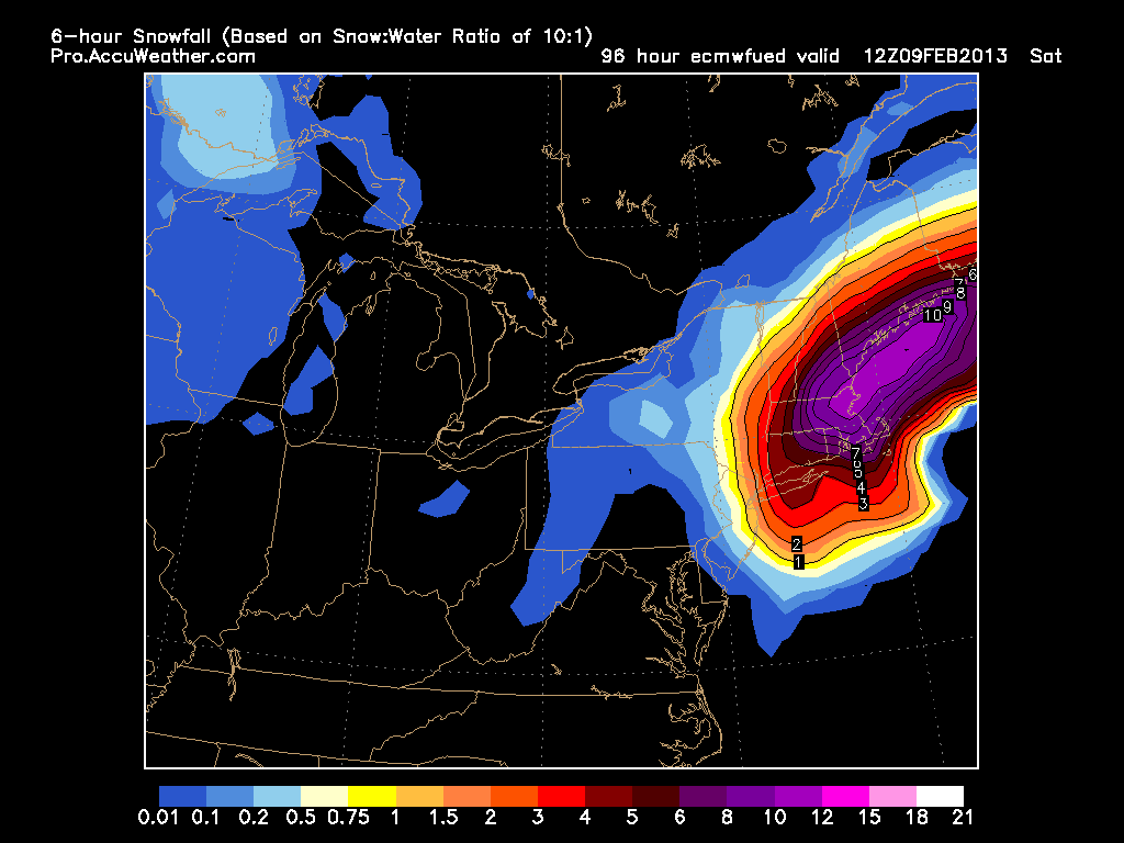
1 am Saturday. Full on blizzard. 2″ per hour snows. Possibly over 12″ in 6 hours. Insane!
7 am Saturday. Storm still going. Beginning to pull away.
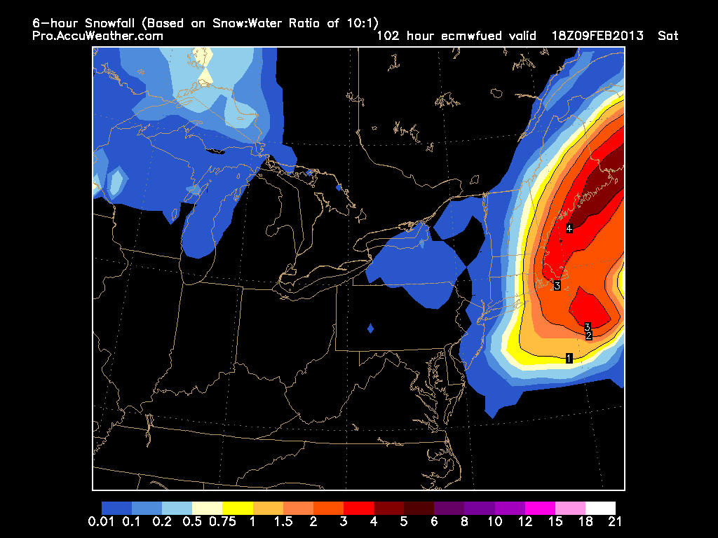
1 pm Saturday. Storm pulling away.
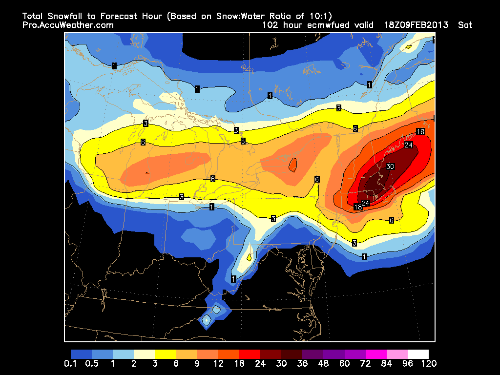
Finally the total amount of snow for entire storm. Based on 10 to 1 ratio. 24″+ for most with 30″+ for a good chunk. Would be one for the record books.
Reminder that this is most likely the most extreme scenario we could possibly see……..I think. We are still 3 days away so a lot will change, but I just wanted to show everyone what I have been seeing for the last two days.
Fitting that the anniversary of the Blizzard of ’78 is tomorrow. More to come tomorrow as things become more clear.
-Chris
In my last post, I went in-depth about the possibility of an area of low pressure impacting the Cape this morning. Well I just happen to be down the Cape this weekend and when I woke up it was to bright sunny skies and calm conditions. Looking into what happened, it all comes down to the individual mesoscale features. By mesoscale I am referring to phenomena that are bigger than individual storm cells, but smaller than synoptic features like fronts and large areas of High or Low pressure. The models have handled the timing and position of synoptic features very well. They are struggling to forecast mesoscale events (like the small area of low pressure I detailed).
The low pressure that I showed to impact the Cape and Islands turned out to be a batch of thunderstorms that stayed out over the ocean. The storms were also about 12 hours ahead of schedule. This 12 hours ahead of schedule has been a trend recently with weather phenomena in the Northeast. You may remember back 2 Friday’s ago; when we were under a tornado watch because off a system that had the appearance of a tropical system and an “eye-like” feature (The technical name for this event is: Mesoscale Convective Vortex). Well this event was forecasted (not to this intensity though), but it occurred roughly 12 hours ahead of schedule.
Hopefully our computer guidance models will be able to figure out the timing issues that they are experiencing and going forward our(my) forecasts will be improved.
LOOKING AHEAD:
Today will feature increasing clouds ahead of a system that is impacting the Southeast and Mid-Atlantic states. It should skirt just south-east of Southern New England; but a stray shower can not be ruled out across the Cape.
Looking ahead our week looks great. Daytime highs should be around 80 for each day this week. The only real chance of rain comes our way Monday Night and Early Tuesday Morning. And this is only a chance and only a problem for places south and east in Southern New England.
-Chris
