High temperatures today, Wednesday 2-23 will reach into the 60s across many locations ahead of a strong cold front.
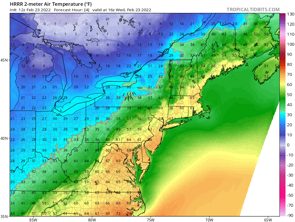
However watch what happens Wednesday evening and overnight into Thursday.

By Thursday morning we are right back below freezing setting the stage for our next storm system to approach from the southwest overnight Thursday into Friday.
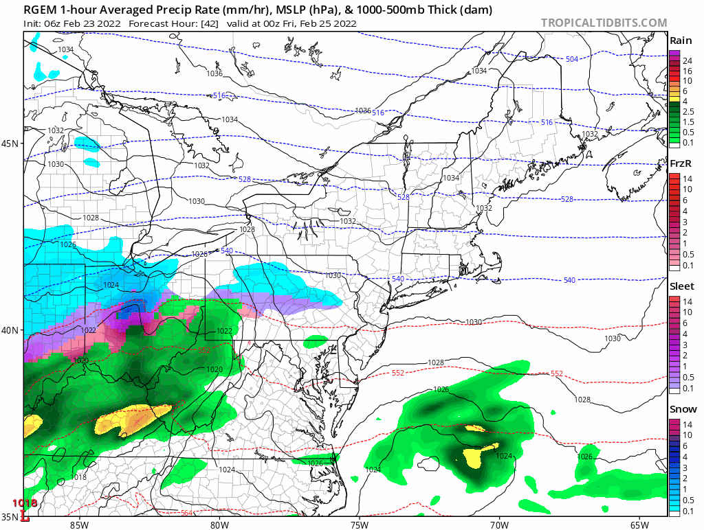
A low pressure system tracking through the Ohio River valley will lift a plume of moisture northward and overrun the region early Friday morning and throughout the day. Because of the cold temperatures in place following Wednesday nights cold front, all locations should start as snow.
Eventually, warmer air aloft will flip southern locations over to a mixed event or plain rain along the coast. Mixed precipitation in the form of sleet may make it as far north as the MA/NH & VT border for a time, but should collapse back south as the low pressure center passes south of the area.
Precipitation is the only hazard with this event as winds and tides are not expected to be an issue. Sporadic power outages may be possible in those areas that receive greater than 6 inches of heavy wet snow.
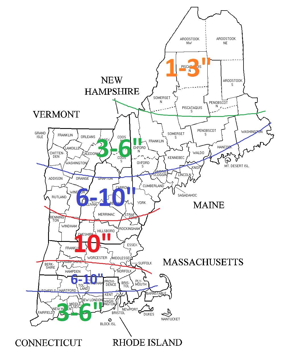
In summary, snow moves in before sunrise and is heaviest around the noon hour. Mixed precipitation moves northward during the day. Those locations that stay all snow could approach 10-12″ but a widespread 6-10″ is expected as shown below.
Snow Forecast
-Chris
