High temperatures today, Wednesday 2-23 will reach into the 60s across many locations ahead of a strong cold front.
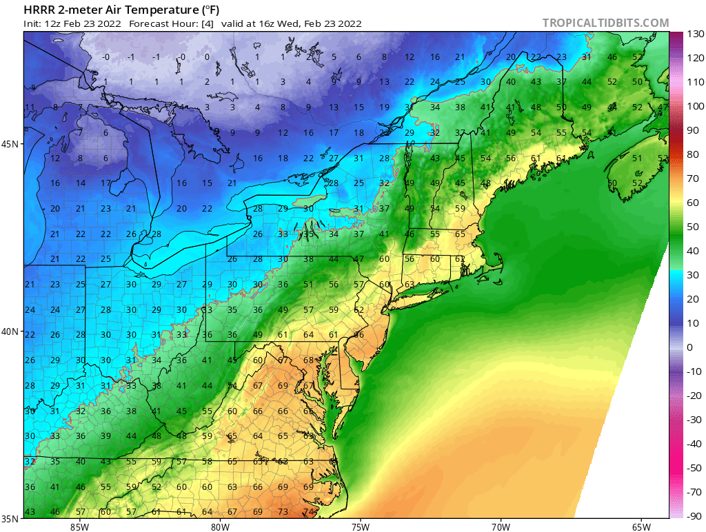
However watch what happens Wednesday evening and overnight into Thursday.

By Thursday morning we are right back below freezing setting the stage for our next storm system to approach from the southwest overnight Thursday into Friday.
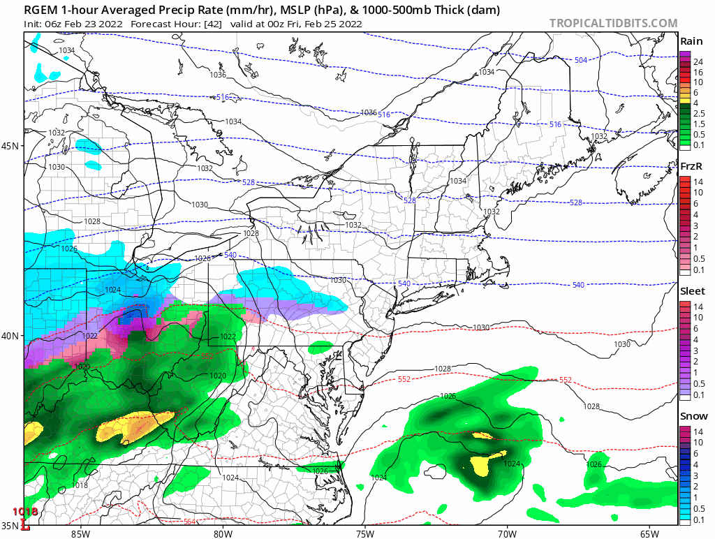
A low pressure system tracking through the Ohio River valley will lift a plume of moisture northward and overrun the region early Friday morning and throughout the day. Because of the cold temperatures in place following Wednesday nights cold front, all locations should start as snow.
Eventually, warmer air aloft will flip southern locations over to a mixed event or plain rain along the coast. Mixed precipitation in the form of sleet may make it as far north as the MA/NH & VT border for a time, but should collapse back south as the low pressure center passes south of the area.
Precipitation is the only hazard with this event as winds and tides are not expected to be an issue. Sporadic power outages may be possible in those areas that receive greater than 6 inches of heavy wet snow.
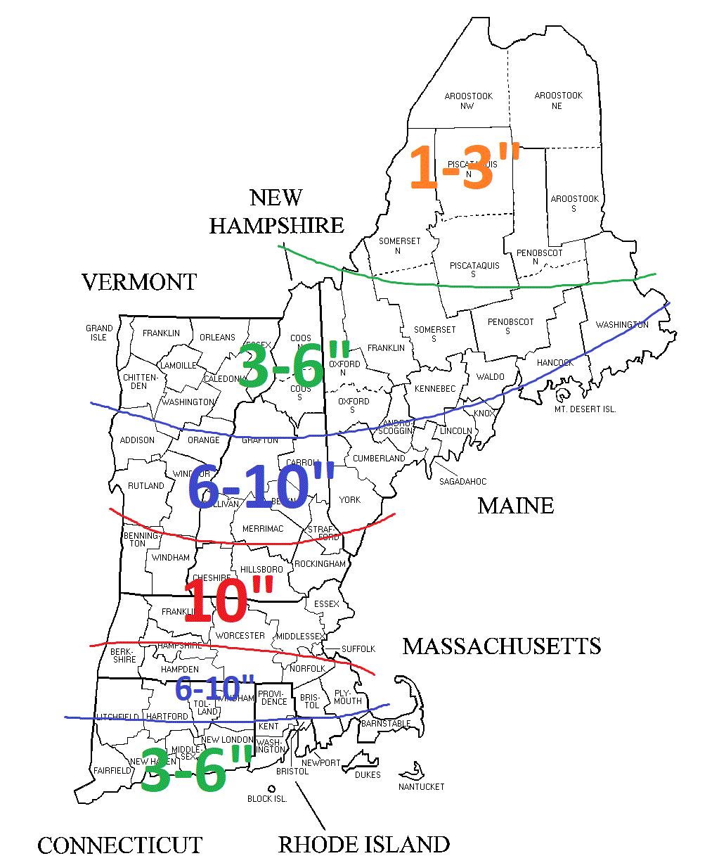
In summary, snow moves in before sunrise and is heaviest around the noon hour. Mixed precipitation moves northward during the day. Those locations that stay all snow could approach 10-12″ but a widespread 6-10″ is expected as shown below.
Snow Forecast
-Chris
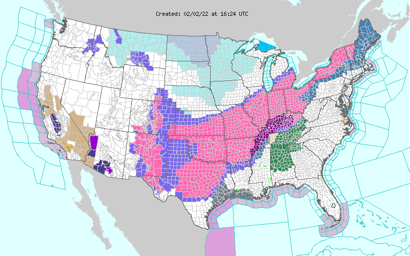
Shown above is the watches and warnings map from the National Weather Service. It is quite hard to miss the shadings of purple and pink from New Mexico to Maine. These shadings represent winter storm advisories (light purple), winter storm watches (blue), winter storm warnings (pink) and ice storm warnings (dark purple). Regardless, it’s obvious that some form of winter weather must be occurring from Roswell to Caribou.
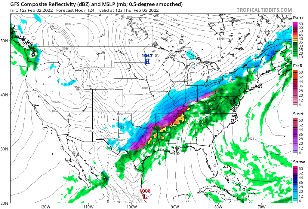
In an attempt to demonstrate why such a wide expanse is being impacted by this event, please see the image above. First I’ll draw your attention to Minnesota, where a 1047 mb high pressure system is pushing southeast from Canada. Just off the image screen east-southeast of New England is another strong high pressure center.
Winds around high pressures flow clockwise. So if you can picture in your mind a clockwise rotating pinwheel for each high pressure…the blades of the pinwheel are bumping into each other right? And they are doing that generally between New Mexico and Maine.
Now the clockwise flow from the Atlantic high pressure system brings air/moisture from the Gulf of Mexico northward and then it starts bumping into the Minnesota high pressure. The air is being compressed along this line. So what happens when you compress a wet paper towel? The moisture is squeezed out.
But what does that mean for New England?
Thursday
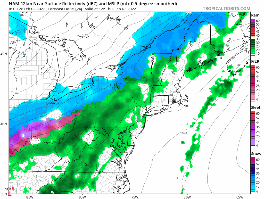
Well depending on where you live it means its either going to rain or snow. General thinking is simple, rain for the southern half of Maine, New Hampshire, Vermont and the rest of SNE. Snow for the mountains.
Thursday Night
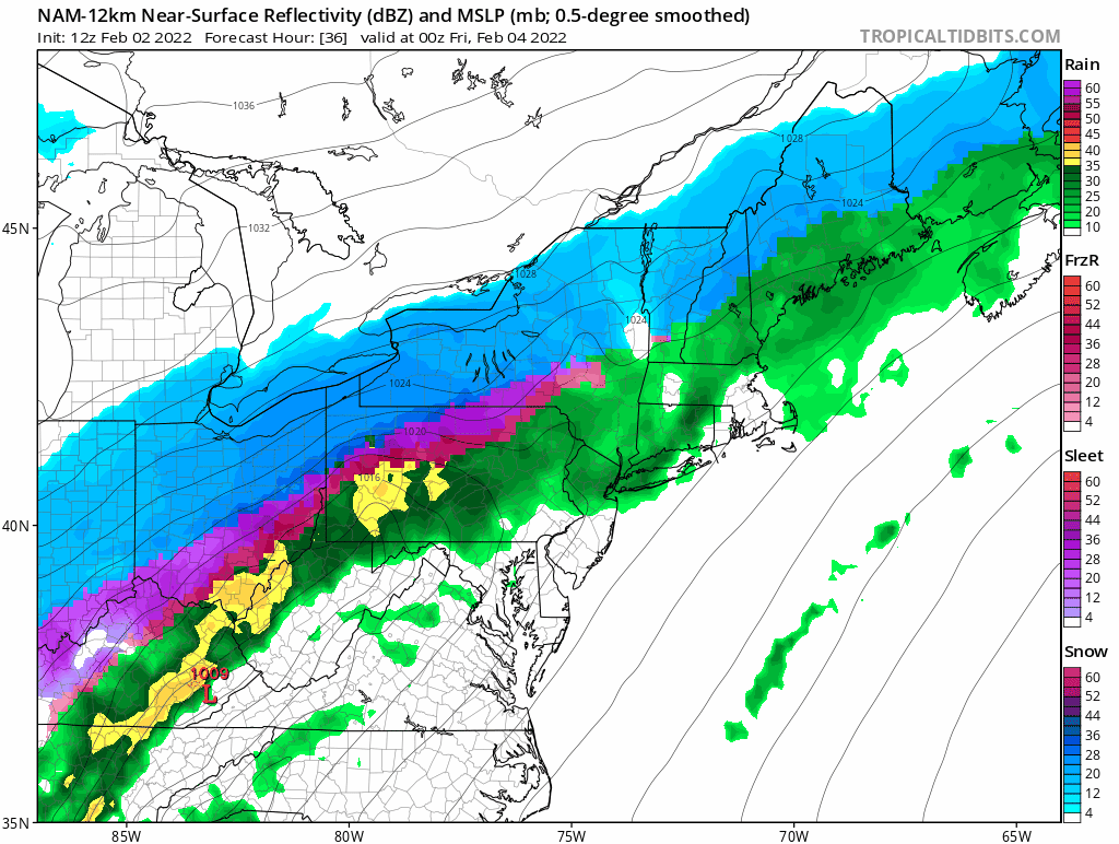
Overnight Friday a bit more cold air trickles into the region so we will see the rain snow slowly drop south. The transition is not expected to be a clean on from rain to snow. There will likely be a prolonged period of sleet or freezing rain in between.
Friday
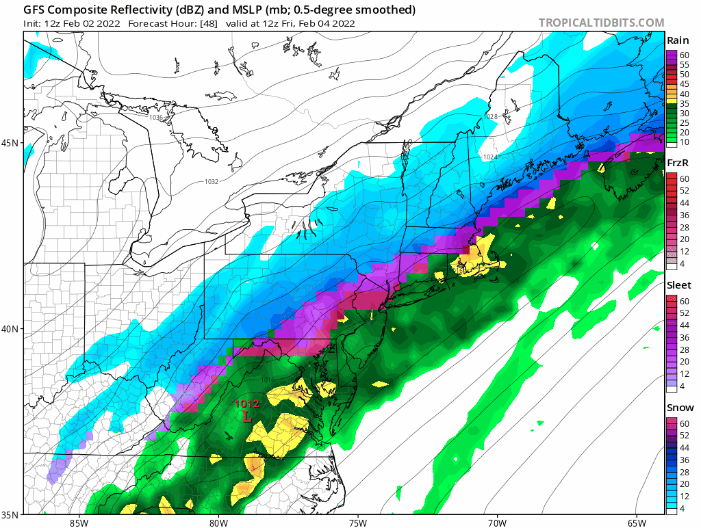
The last slug of moisture moves through Friday. We’ll continue to watch the southward march of cold air and the rain/snow line. Right now it appears that most regions may end as snow. The further north one resides the better chance of accumulations. The mountains and northern New England look good for 6-12″. While here in Southern New England a few inches might do it.
It’s a very tricky forecast trying to predict the battle between cold and warm air. I’m inclined to think that cold air wins at the surface while warm air intrudes aloft. So a messy solution is in store. Either way, travel on Friday may be tricky; especially for those areas that flip over to a mix or snow.
-Chris
