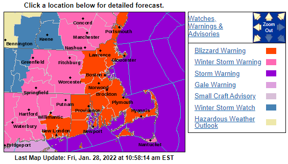
As highlighted a few days ago the forecast for Saturday has held and a strong nor’easter with blizzard conditions is on our doorstep.
Key points:
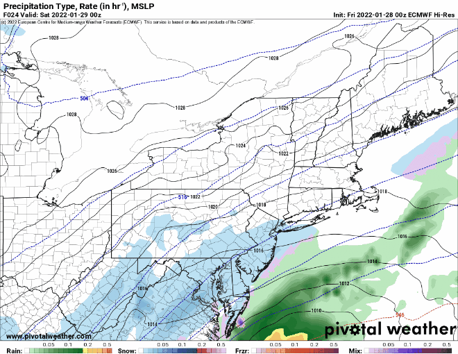
- Low pressure develops south of Charleston, South Carolina Friday afternoon and rapidly strengthens as it tracks northeast towards Nantucket. Yes; it is undergoing bombogenesis.
- Snow overspreads the region early Saturday morning from south to north. Flakes begin flying at approximately:
- 11p along the south coast.
- 1a along the Massachusetts turnpike.
- 4a along the MA/NH border.
- 7a south of Concord, NH and along the Maine coast.
- 10a the rest of New England.
- Snow will fall heavy during the day Saturday. Snowfall rates 1-2″ per hour are expected. Localized 3-4″ per rates are possible. Across eastern areas thundersnow is possible later in the day.
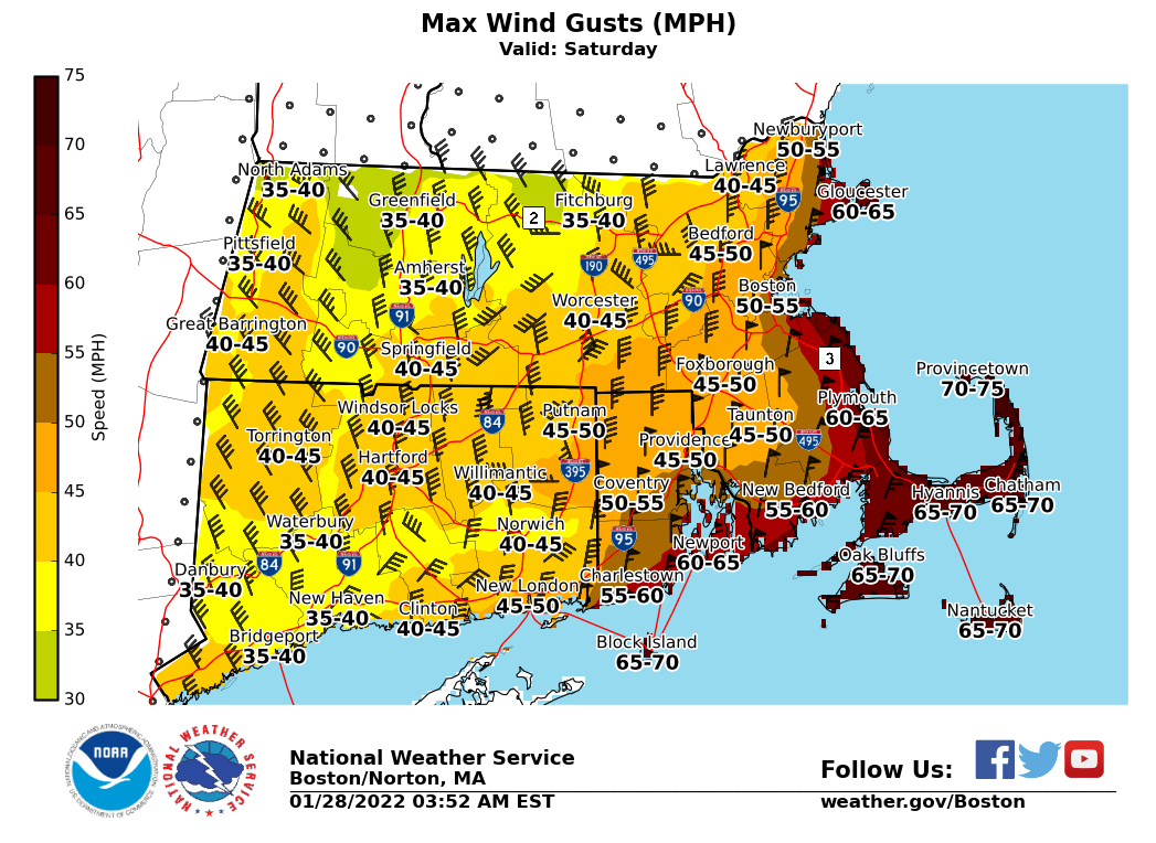
- Wind and coastal flooding issues will be a problem. If you live on the coast and you’ve flooded in the past, you will again during this one. Near hurricane force winds are possible on the Cape and islands. Inland; occasional gusts will be quite strong 30-50 mph.
- The storm winds down from southwest to northeast Saturday night.
- 7p southwest CT.
- 10p the Boston area.
- 4a along the Maine coast.
Storm Evolution
Wind Gusts
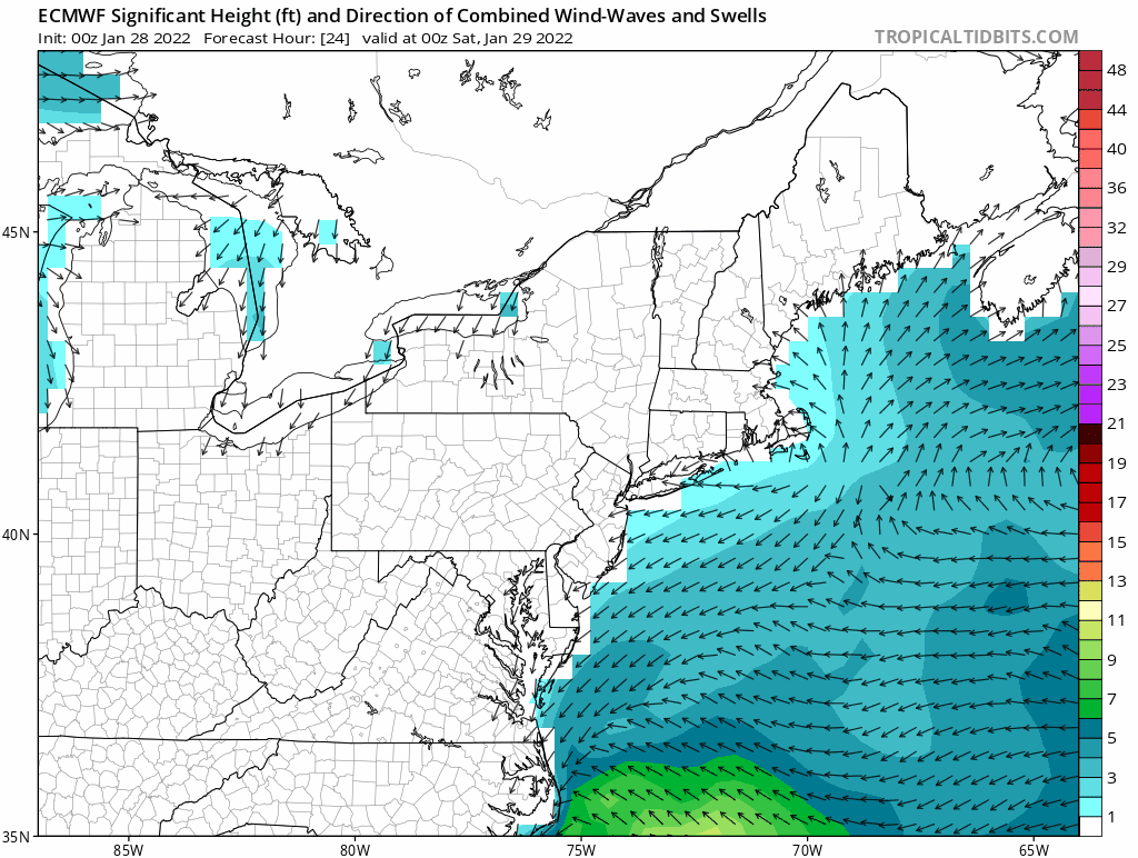
Coastal Issues
Below is a loop of project wave heights. Doesn’t take much interpretation to know that’s a lot of water and energy being pushed up against the coast.
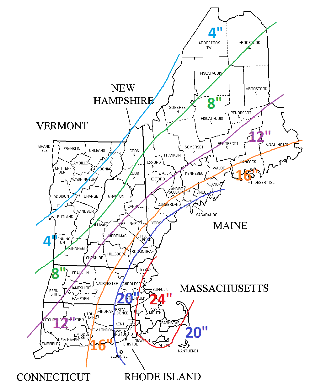
Snowfall
-Chris
