Was it cold enough for you this morning? Morning lows across the region were generally near 0 if not just below. Fortunately temperatures are on the rise today with a rather nice day in store tomorrow save for a few flurries or snow showers.
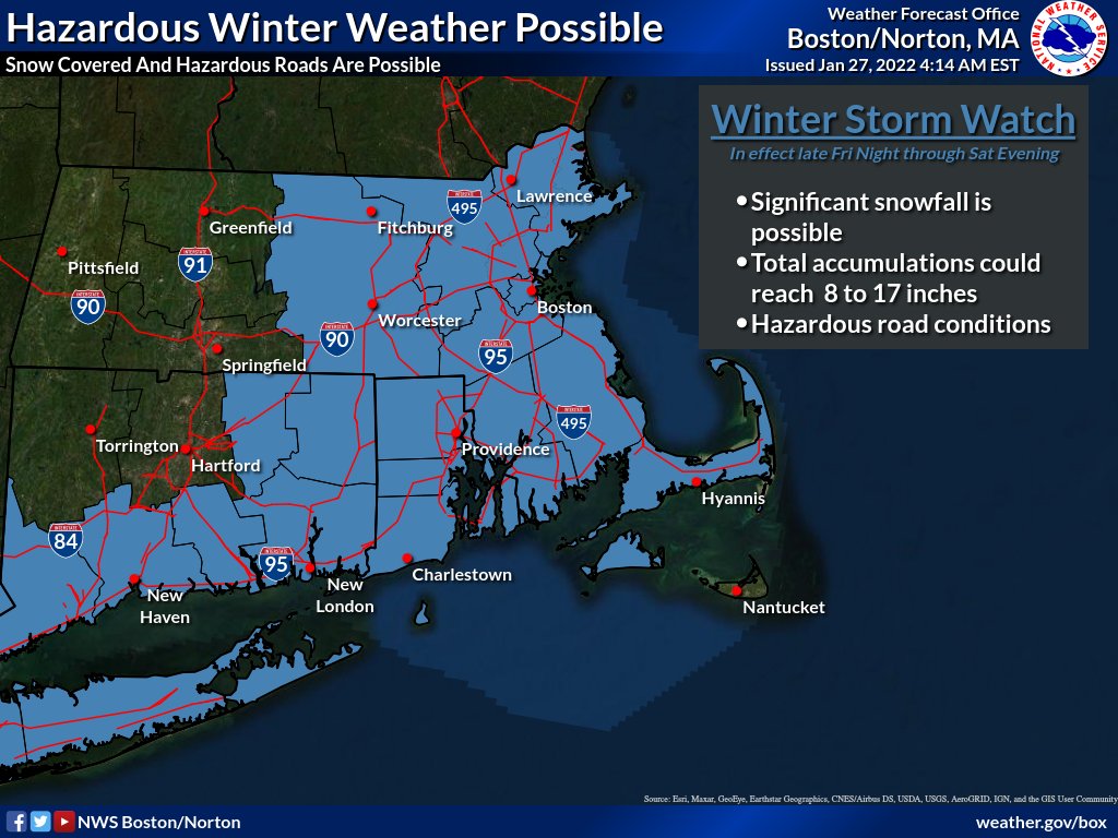
All attention is focused on the forecast for Saturday. As highlighted in my last post, confidence for a major snowstorm has only continued to increase, especially the further east one lives. Winter Storm watches have been issued by the National Weather Service.
Friday
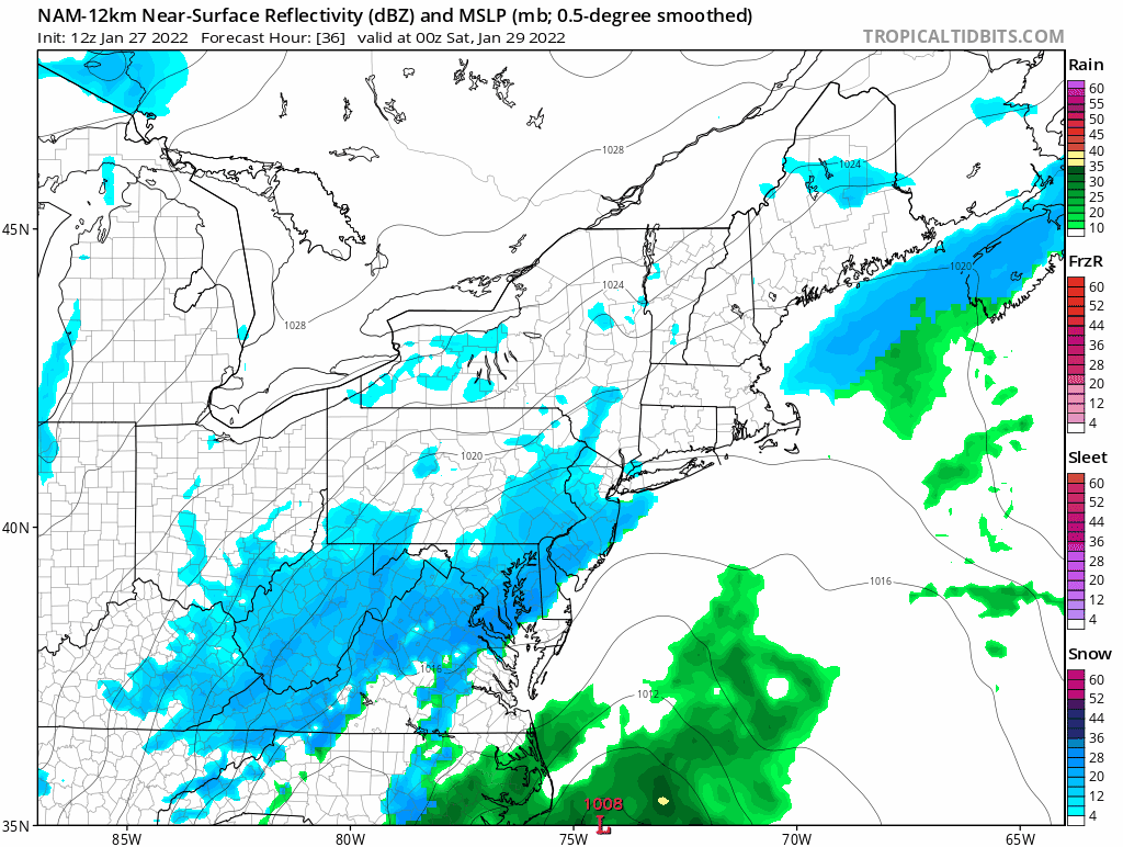
In response to an approaching upper level trough cyclogenesis will occur off the southeast coast. The storm center will be tugged north along the east coast while rapidly strengthening throughout the day and night.
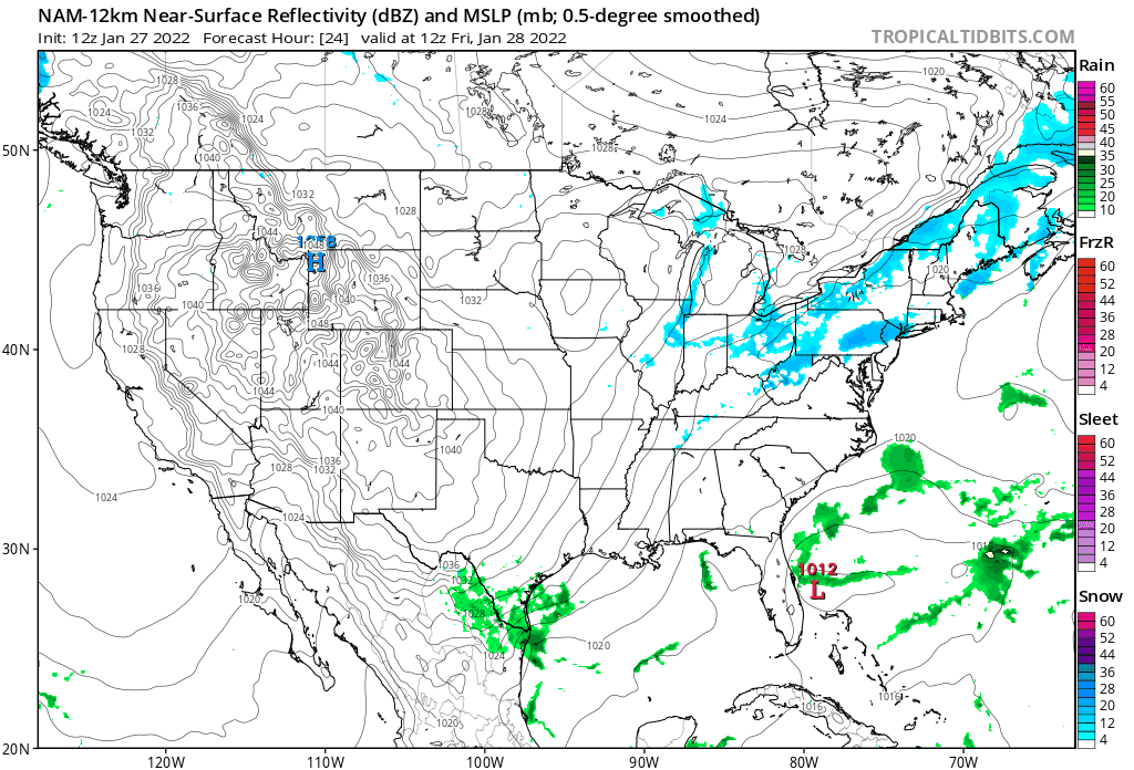
You’ll notice that there are a few flurries and snow showers over the region during the day Friday. Little accumulation is expected as not much should reach the surface.
Friday Night
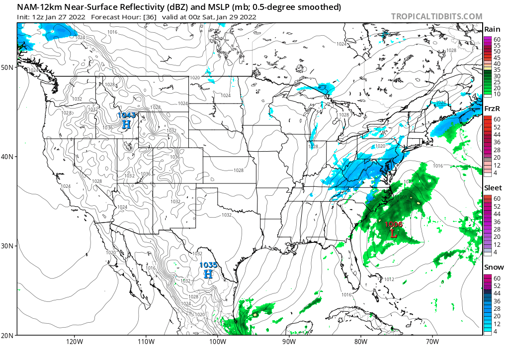
Friday night is when things really start to get going as the storm system rapidly intensifies and precipitation blossoms to the north and west of the center. Snow will increase in coverage from north to south and by morning, nearly everyone in southern New England should have snow outside their window.
Saturday
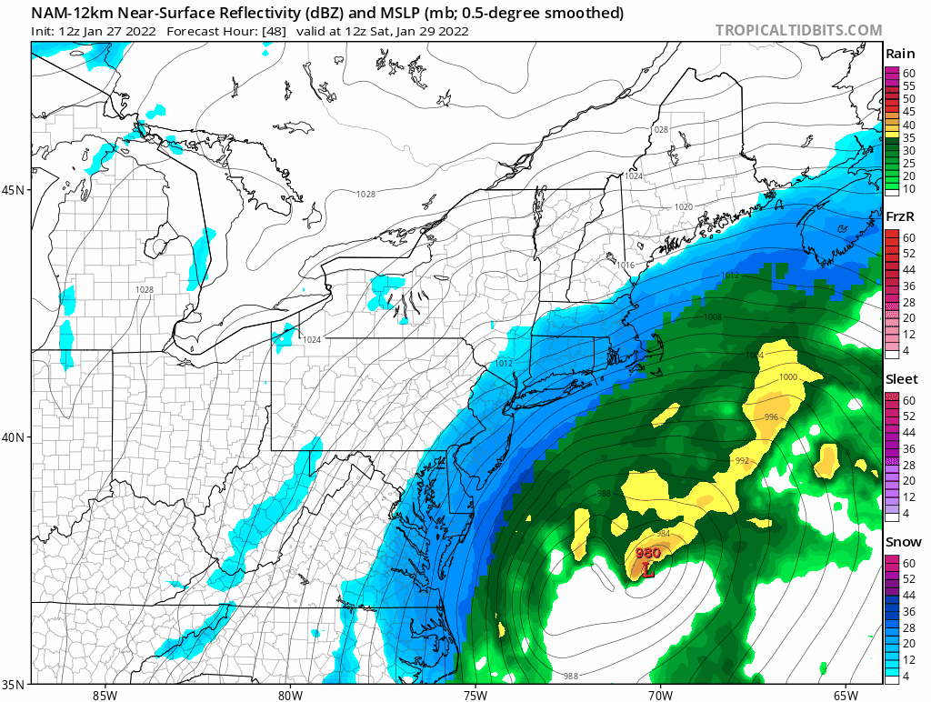
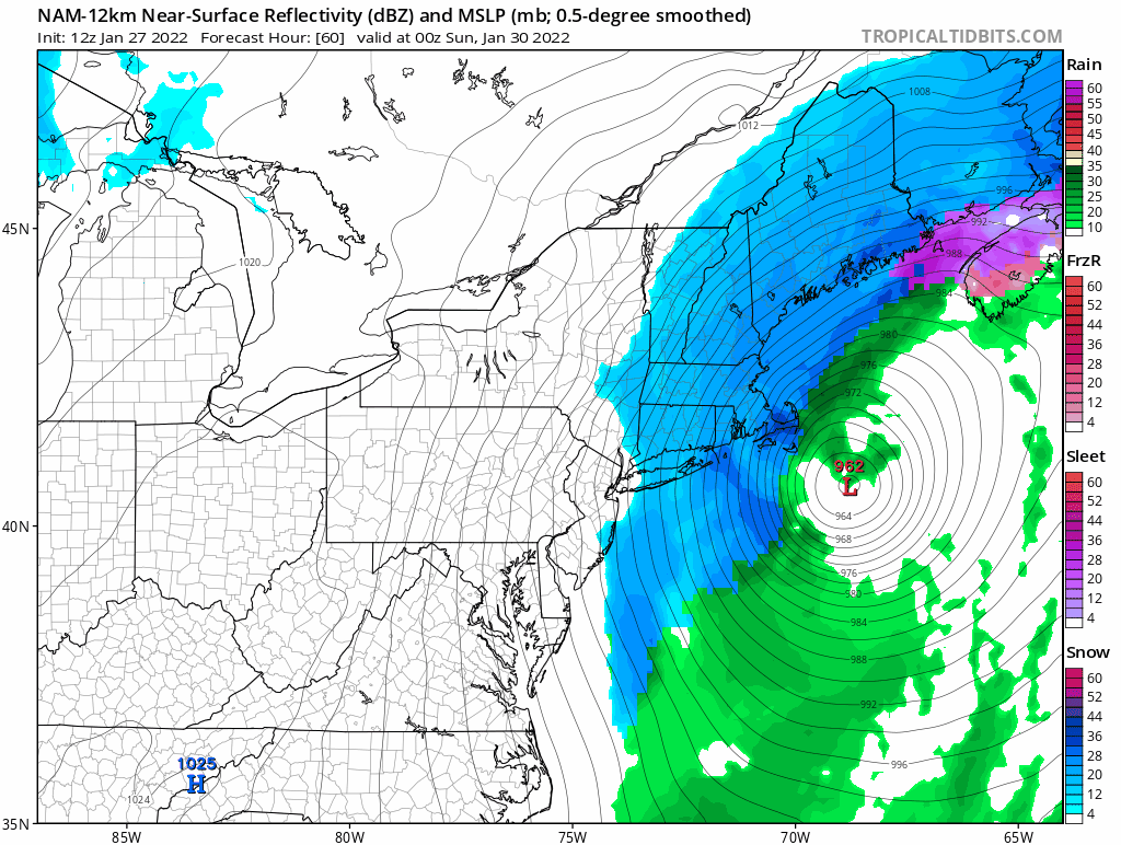
Zooming in to a more local view. As the storm system reaches its peak intensity southeast of Nantucket it will begin to slow down. I do not currently expect the storm to stall and loop south of the islands, but it will slowly exist northeast. It is during the day Saturday when the bulk of the snow will fall.
Saturday Night
Finally Saturday night as the storm drifts off to Nova Scotia snow will wind down from southwest to northeast. Leaving us all to dig out Sunday morning.
Total Storm Loop
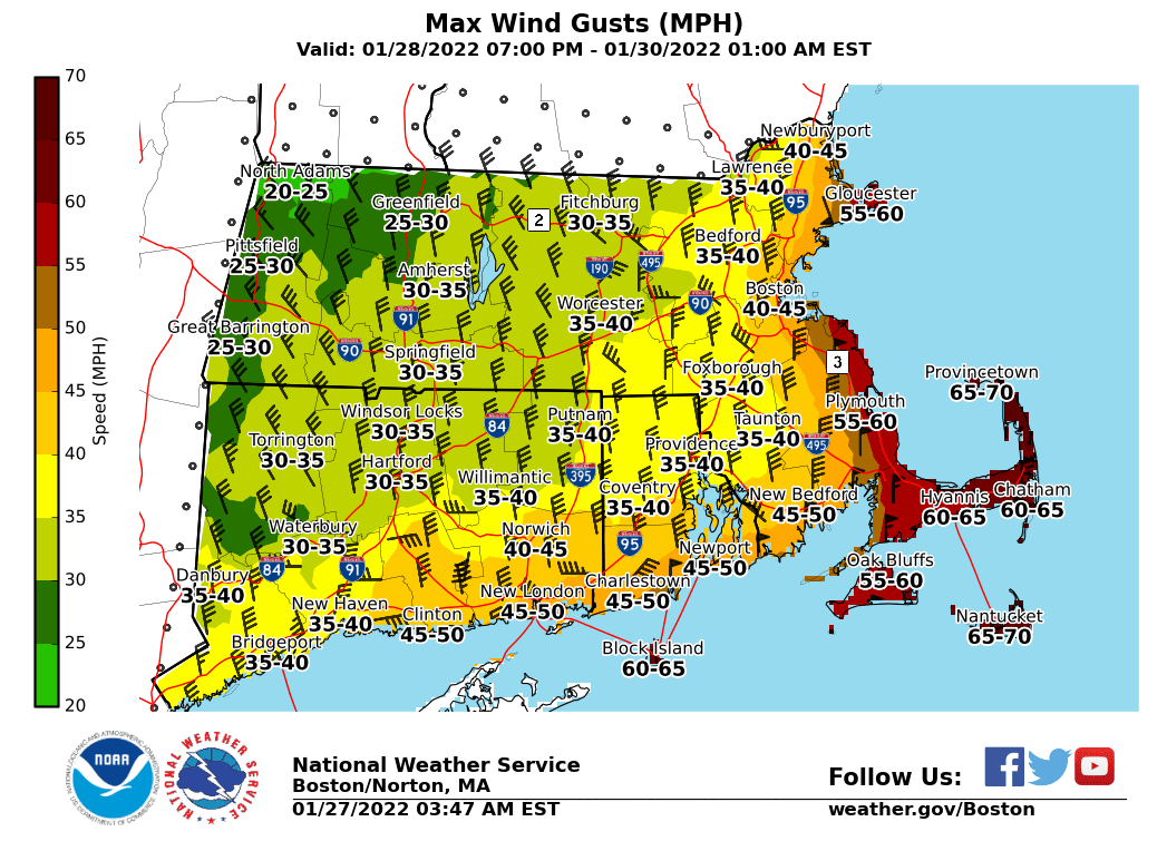
Wind Gusts
Wind gusts from this system will be quite strong. Particularly the closer to the coast one lives. For areas inside and southeast of the 128 loop in eastern Massachusetts, it would not be surprising to see the National Weather Service issue Blizzard warnings. Regardless, blizzard-like conditions are expected at times.
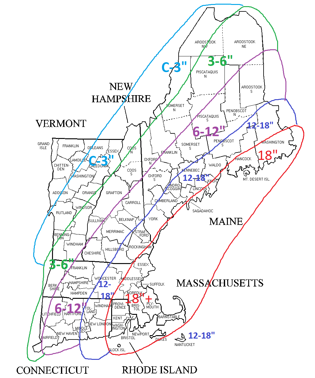
Snowfall
Here is my current thinking for the storm. Felt these ranges are both bold and conservative. There are questions to how far northwest the heaviest precipitation expands. In the Boston area, the 18″ number may be low in a few spots. Someone insides of 495 down to the Cape will see 24″. Just not sure who.
-Chris
