It only takes one right? Winter 2021-2022 has been relatively quiet across much of New England with most locations below normal on the year for snowfall. That may be about to change this weekend.
Many of the weather computer guidance models are indicating the potential for a rather significant storm system for the Friday night and Saturday period.
What do we know right now?
- A significant storm system will be somewhere off the east coast.
- Temperatures are sufficiently cold for snow (storm track dependent).
- The tide cycle is astronomically high.
The Set-up
Friday afternoon an area of low pressure will begin organizing off the southeast coastline.

From here the storm system will progress north-northeast up the coast.
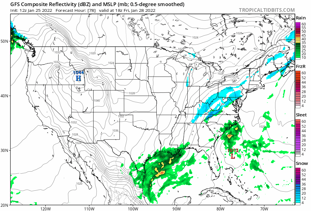
As you can see from the model simulation above the storm system is currently forecasted to pass close enough to New England to overspread the region with snowfall. We are still ~4 days away from first snowflakes so the track is far from set in stone. So will hold off on snowfall amounts for now.
Key Takeaways
- A significant storm system is likely to form off the east coast Friday into Saturday.
- The airmass is sufficiently cold for snowfall depending on track. A closer track could introduce the idea of a mix or changeover to rain.
- In addition to snow, strong winds and coastal flooding are a concern due to both the strength of the storm itself and astronomically high tides.
- Specific details such as snow amounts and exact timing are to be refined in the coming days.
In summary, the potential is there for a storm system where one measures snowfall with a yard stick rather than a ruler. However, a lot can change over the next few days. Stay tuned.
-Chris
