The old saying is that the month of March comes in like a lion and goes out like a lamb. This year March was a lamb the entire month as most of southern New England received nearly zero snowfall. April has started out pretty slow as well. In fact, the region is currently experiencing moderate drought conditions.

Fortunately a significant dent should be put into these drought conditions over the next 24-48 hours. A large upper level storm system drifting southeast over the Great Lakes region will pass over or south of New England tonight and tomorrow.

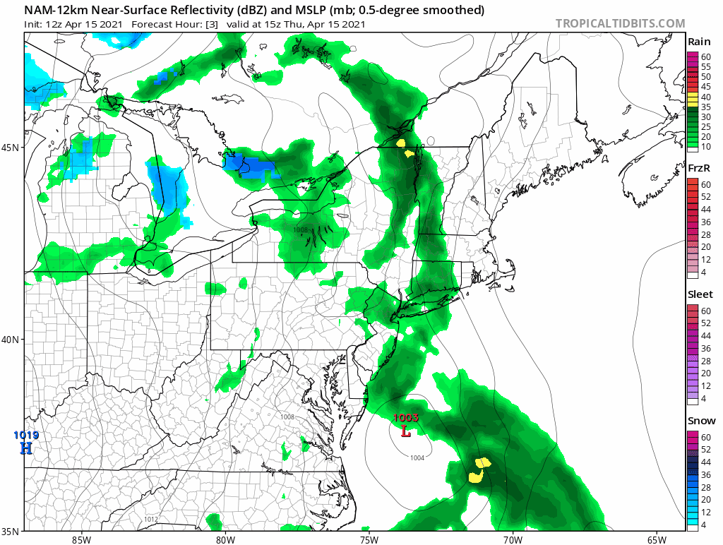
In response an area of low pressure is in the process of developing off the developing off the Maryland coast. This low pressure will drift northward and strengthen bringing periods of rain and snow to the region.
Thursday
Thursday morning is overcast and dry for most of the region; except for the Hudson River Valley.
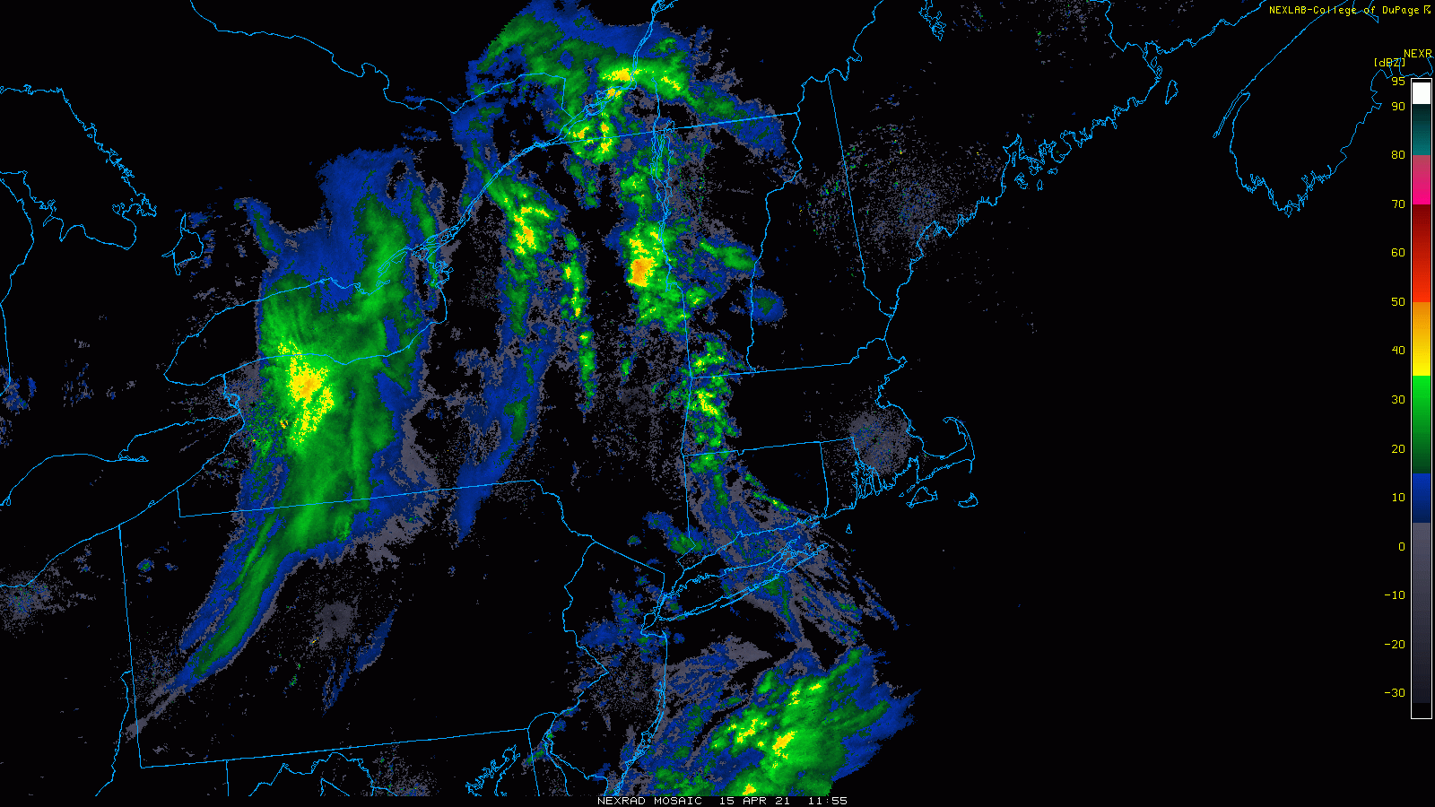
Throughout the morning and afternoon the radar will fill in across the region from west to east. By evening many areas are raining. It may take a bit longer across eastern Southern New England.
Thursday Overnight
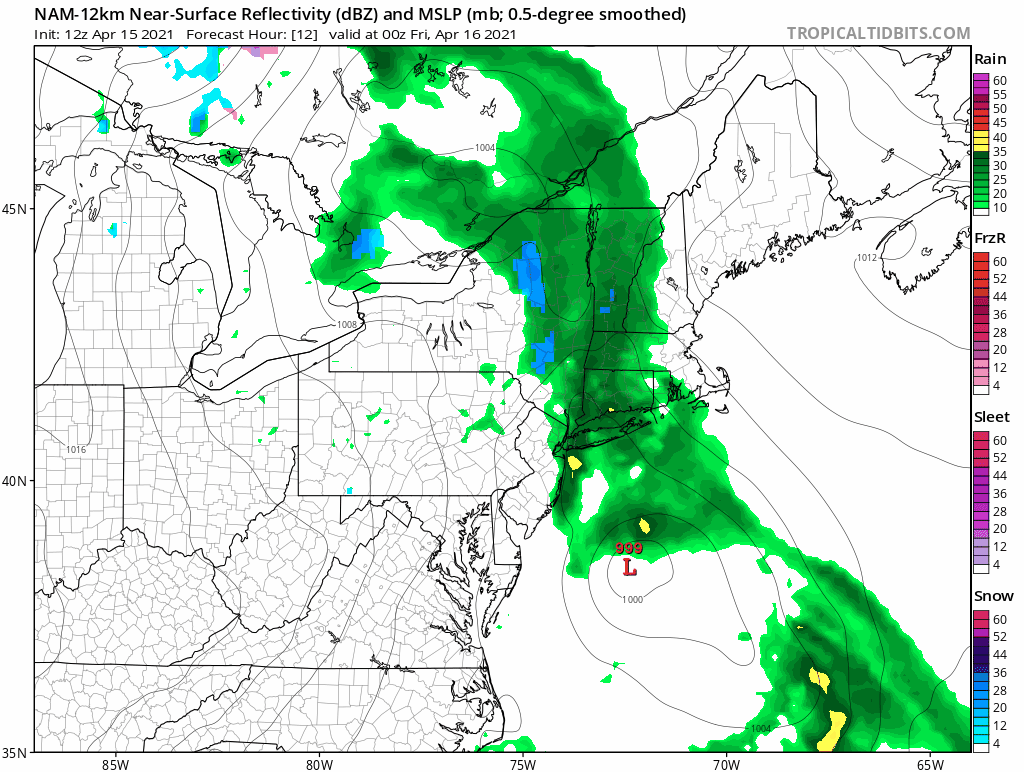
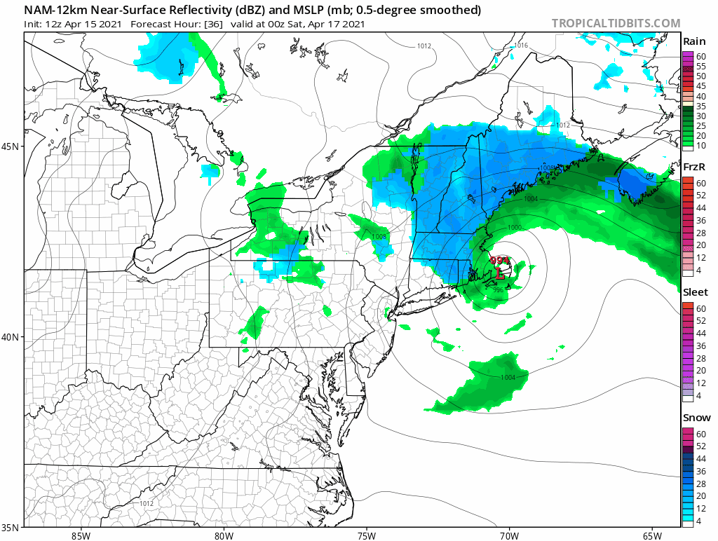
During the overnight hours the storm system will continue its march towards Nantucket. Colder air, potentially supportive of snow, will wrap into the northern and western side of the system. By Friday AM, many of the elevated areas (Berkshires, Green Mountains, Monadnock Range, northern Worcester County) have likely flipped over to snow.
Friday
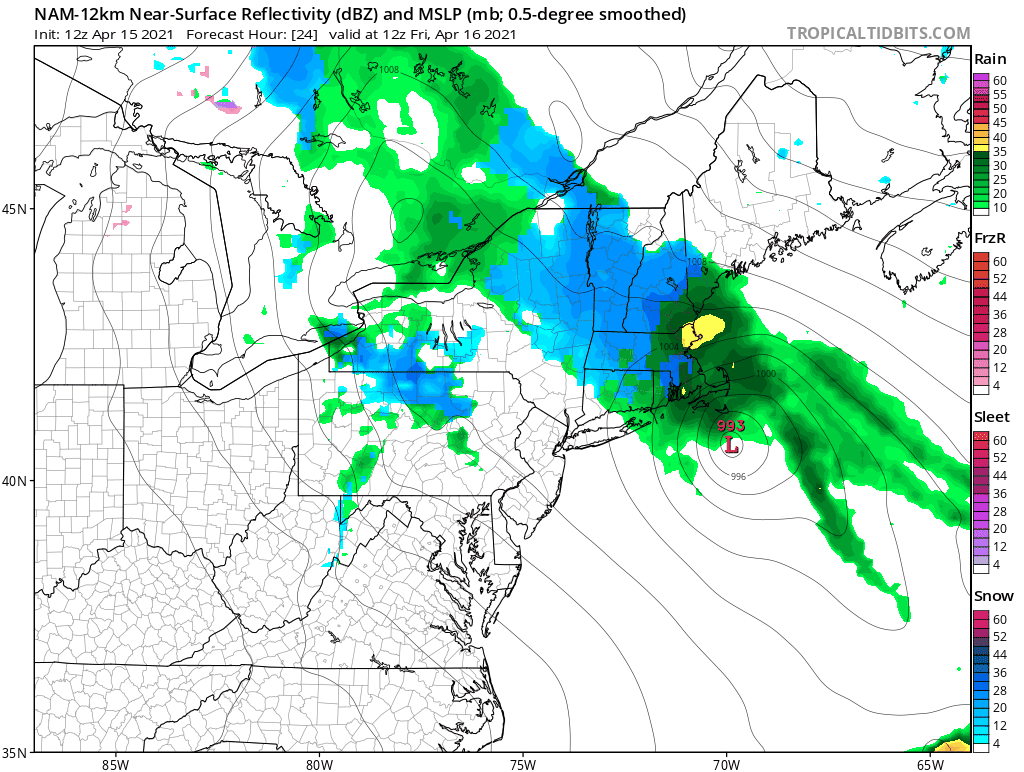
Friday is the wild card. How much cold air gets wrapped into the system? Does the lowest 3,000 feet of the atmospheric column cool enough to support snowfall? This is certainly a tricky situation.
Computer model guidance is trending towards yes. But it is April 15th, so caution needs to be exercised. Currently I expect most locations to at least have snow in the air at some point on Friday as the storm center reaches peak intensity near Nantucket. However, accumulations at elevations below 1,500 feet are likely to be minimal.
However, this is a very dynamic system and there are countless examples where a late fall or late spring storm system has brought snow to the region.
Friday Overnight
There is currently a bit of a traffic jam over the north Atlantic so this system will be slow to exit. Though the storm center will linger near southern New England overnight Friday, the bulk of precipitation will have fallen and the area will be left with off and on rain/snow showers through the night until the storm center finally drifts off to the east.
Total Precipitation
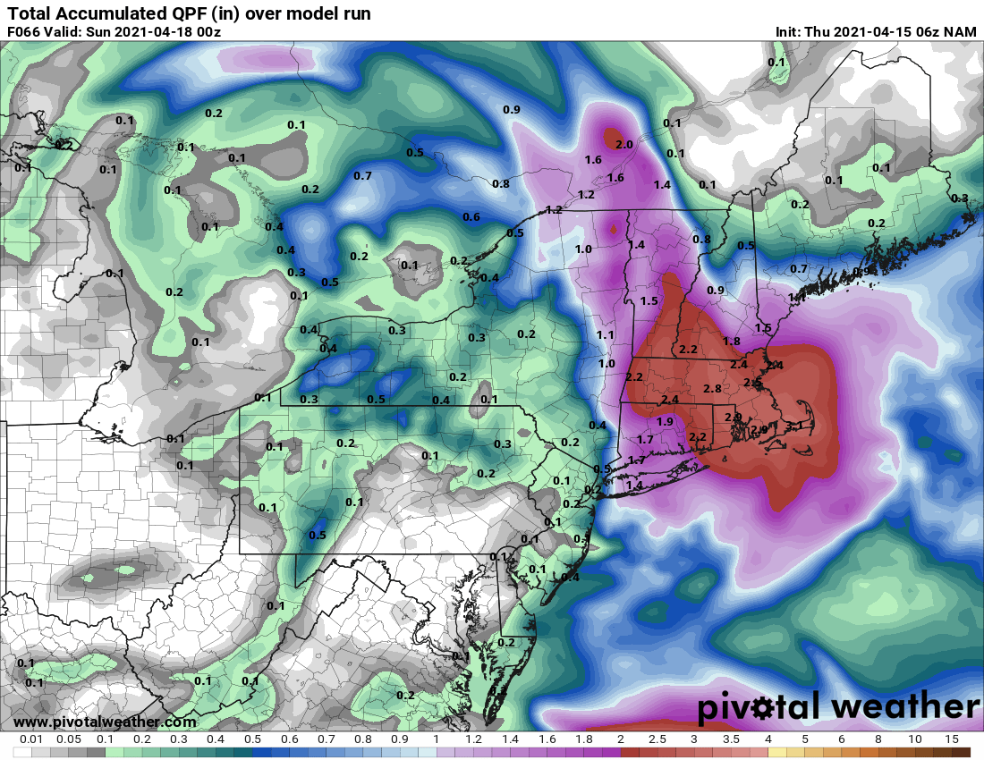
This storm system will not lack for precipitation and should but a major dent in the previously discussed drought. And inch of rain looks likely for most locations with some areas receiving > 2″.
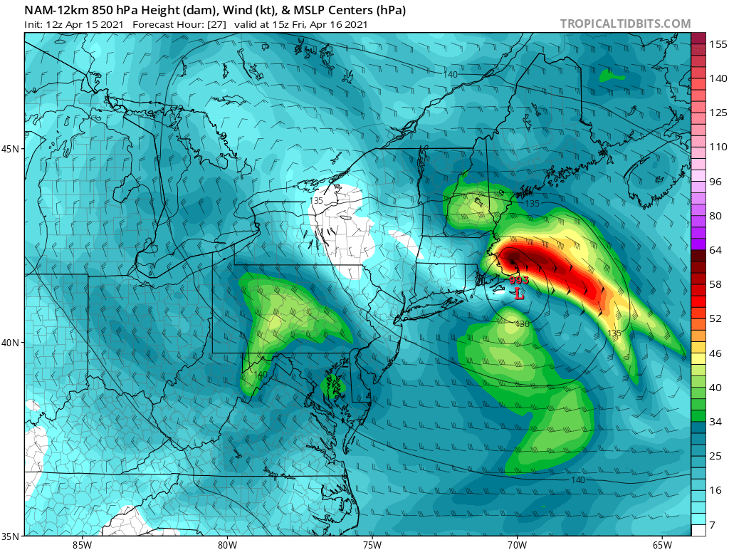
Part of what will aid the copious amounts of precipitation will be a strong low level jet pointing in off the ocean transporting moisture rich ocean air over the region. Shown below is a figure for Friday morning. Note the strong “jet” of air pointing directly at southern New England from the east.
Snowfall
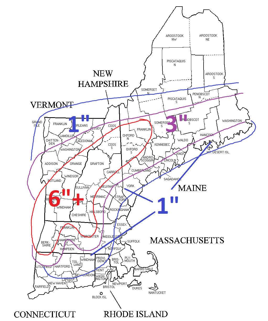
This is a tricky one and very likely will be elevation dependent which I tried to highlight with the below map.
-Chris
