Below is the active alerts map from the National Weather Service. All blues and pinks represent winter weather advisories, watches or warning of some kind. Now this is a map that you don’t see every day. From Texas to Maine winter storm watches and warnings are flying while Montana to Kansas to Wisconsin are under Wind Chill Warnings.
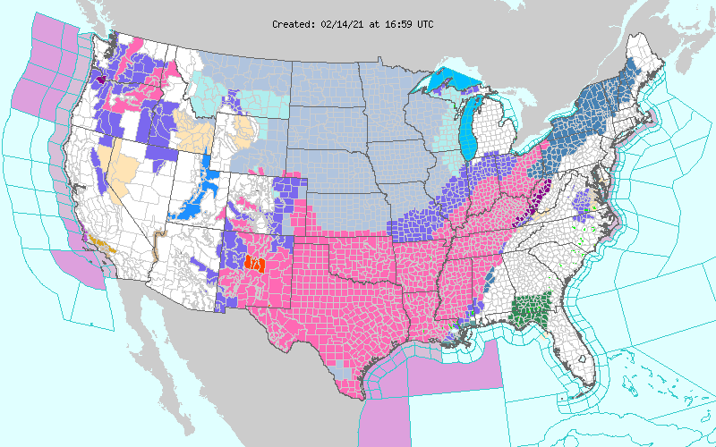
You may notice that southern New England appears to be missing out on the fun based on the map above. Just because there isn’t a shading doesn’t mean the weather is going to be quiet.
Monday
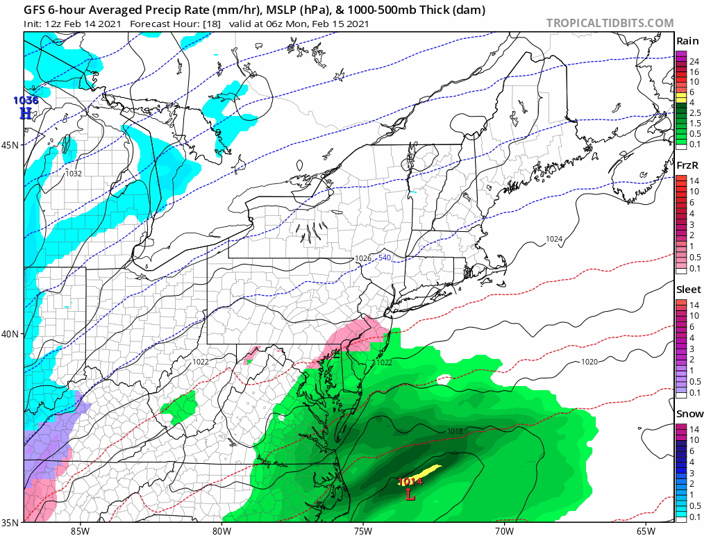
Monday starts quiet and should be overall. During the afternoon a few flurries, periods of drizzle or sleet should start to show up. But the primary slug of precipitation is moving northeast through the Mid-Atlantic.
Tuesday
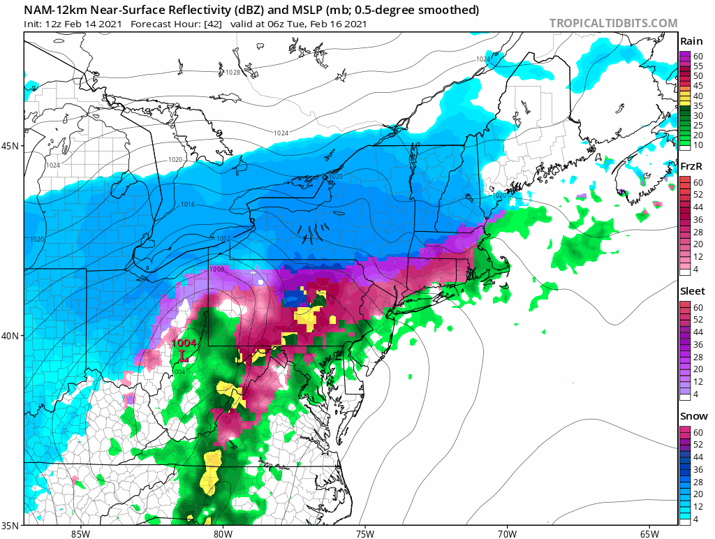
Overnight Monday into Tuesday morning is when the first system moves through the region. The low pressure center should pass along the south coast allowing for above freezing temperatures to move into southern New England. This above freezing air will move in aloft first and then at the surface. Most places start as either snow or sleet before transitioning to sleet, freezing rain or plain rain.
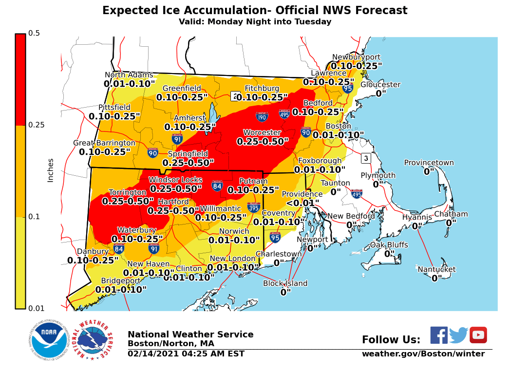
There is an increasing threat of freezing rain for those locations that stay below freezing at the surface. Below is the current projection from the National Weather Service. First things first: any amount of freezing rain is enough to cause dangerous travel conditions. Google what happened in Dallas this week. Secondly, while this amount of ice isn’t extreme, it could be enough to cause a power outage or two. Just something to be prepared for.
Temperatures Tuesday afternoon do not warm very much as the storm departs so any slippery conditions could persist after precipitation stops. Best to let road crews apply salt, sand and other chemicals first before travelling.
Wednesday is quiet and cold.
Thursday
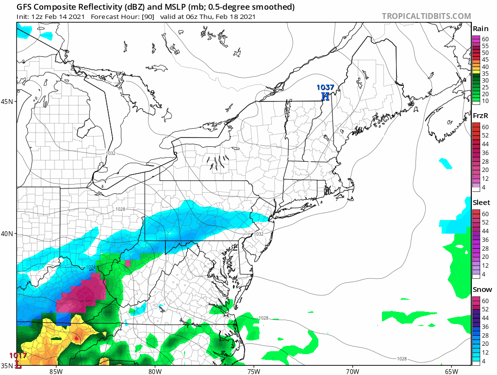
Another storm system is in the forecast for Thursday afternoon and overnight. An area of low pressure moving up the Appalachian Trail will bring a period of snow, sleet, freezing rain and rain to the region. For southern New England, this one should have more snow to start than the Monday/Tuesday system, but does not look like an all snow storm at this point. More details to come on this one a little later.
-Chris
