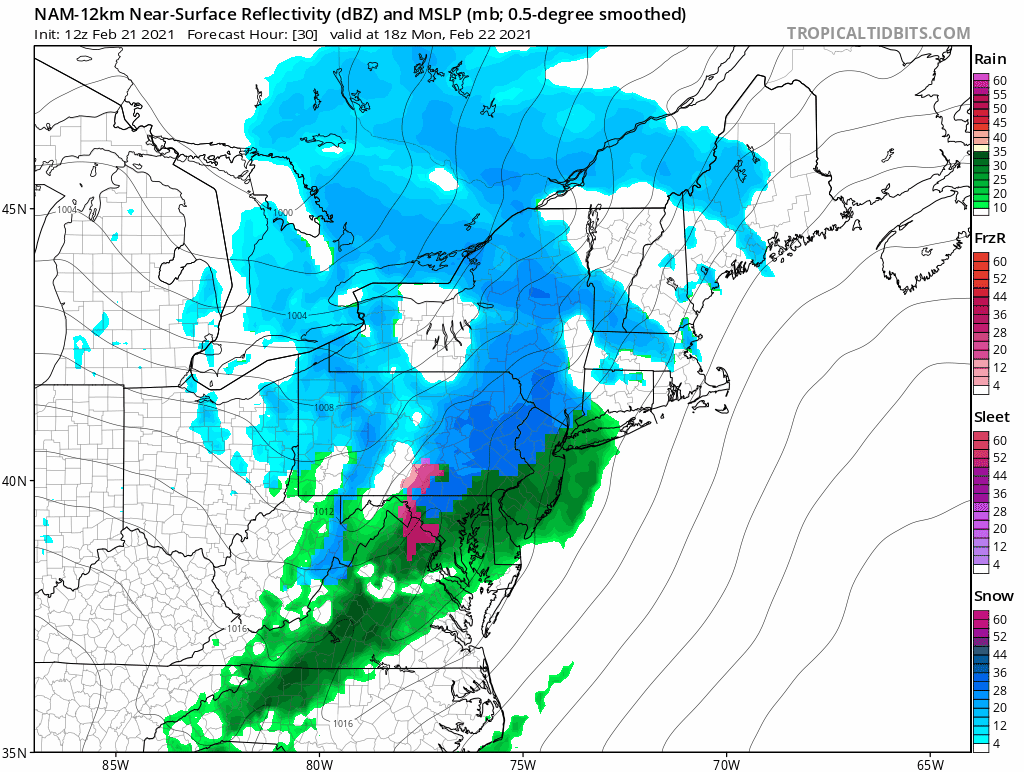
A weak storm system traversing the northern portion of the country will swing through New England tomorrow afternoon. A quick burst of snow and rain is expected. Locations north and west of 495 will likely start as snow. South and east of 495 is likely all rain.
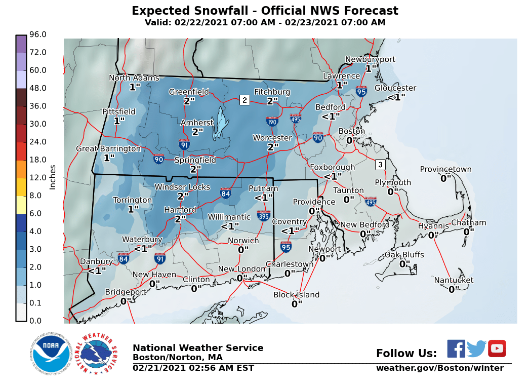
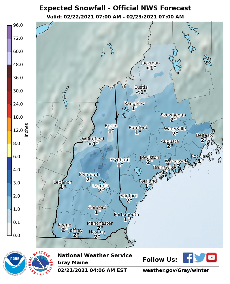
In general 1-2″ are expected in those locations where snow falls. Adding to the existing snow pack.
-Chris
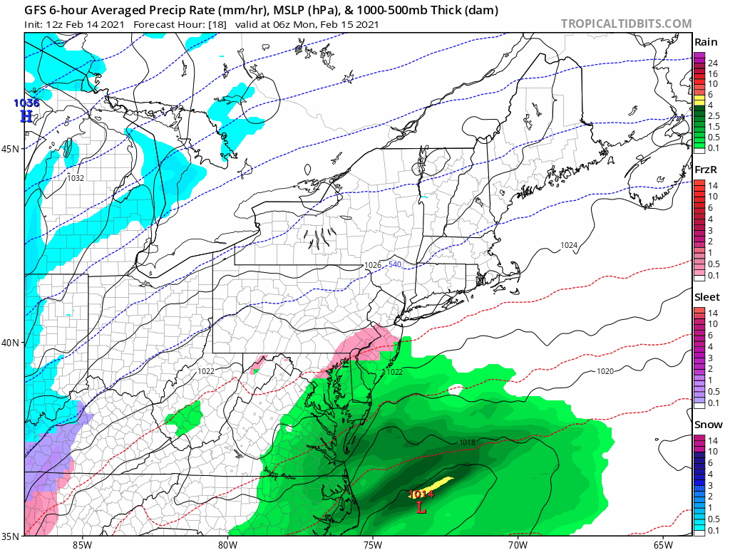
The active weather pattern continues here in New England as yet another storm system is marching northeastward from the Gulf Coast. Currently gathering Gulf moisture and bringing rain, snow and ice to Texas and Louisiana, a storm system will slowly traverse up the Appalachian Trail over the next couple days before eventually sliding south of New England.
Thursday morning the storm system will be on approach from the southwest with snow overspreading the area from south to north throughout the day. With high pressure to the north, cold air will be locked in place and precipitation will fall as mainly snow.
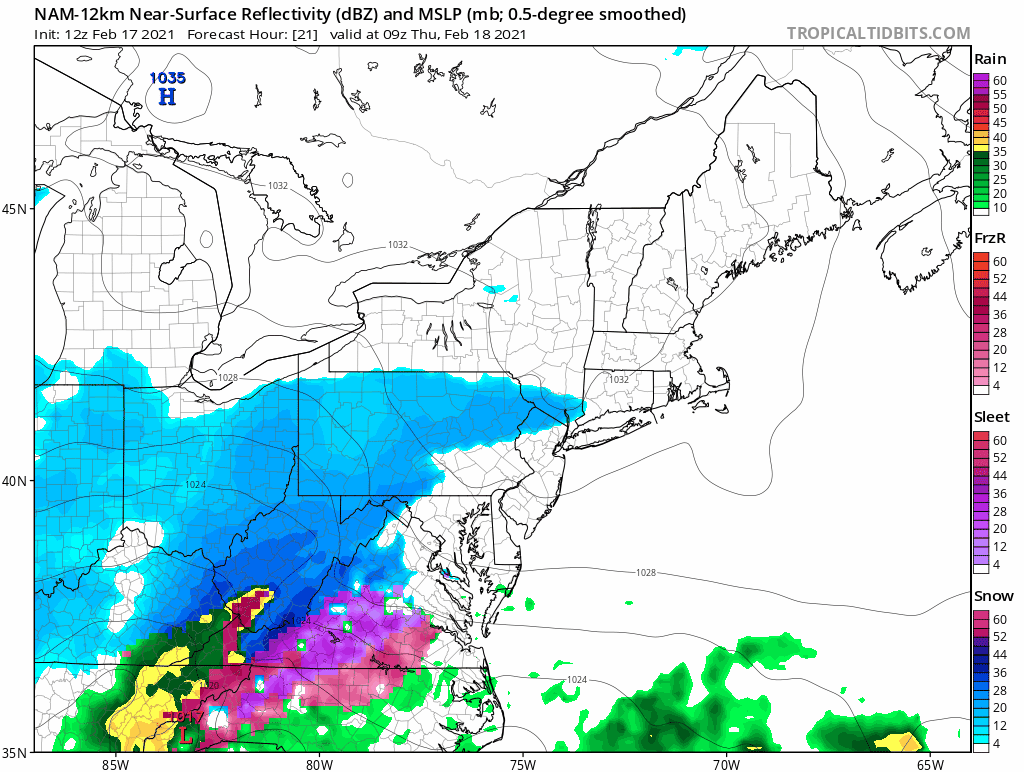
The above loop is 30 hours long and many locations have snow flakes in the air for perhaps greater than 20 hours. However, the total amount of liquid that falls from the sky isn’t too significant with most locations between 0.25 – 0.75″ of liquid equivalent.
Using a rough 10:1 snow to liquid ratio gives a general 3-6″ snowfall for the area. With higher amounts to the south and lower amounts north. In general, this system as currently expected is more of a prolonged mood or snow globe snow event. Flakes may be in the air for a long time, but ultimately there isn’t much to shovel.
-Chris
Below is the active alerts map from the National Weather Service. All blues and pinks represent winter weather advisories, watches or warning of some kind. Now this is a map that you don’t see every day. From Texas to Maine winter storm watches and warnings are flying while Montana to Kansas to Wisconsin are under Wind Chill Warnings.
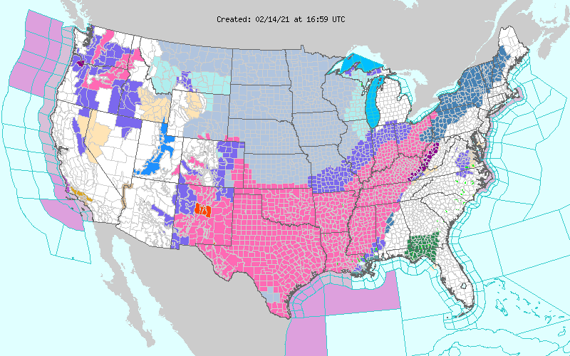
You may notice that southern New England appears to be missing out on the fun based on the map above. Just because there isn’t a shading doesn’t mean the weather is going to be quiet.
Monday
Monday starts quiet and should be overall. During the afternoon a few flurries, periods of drizzle or sleet should start to show up. But the primary slug of precipitation is moving northeast through the Mid-Atlantic.
Tuesday
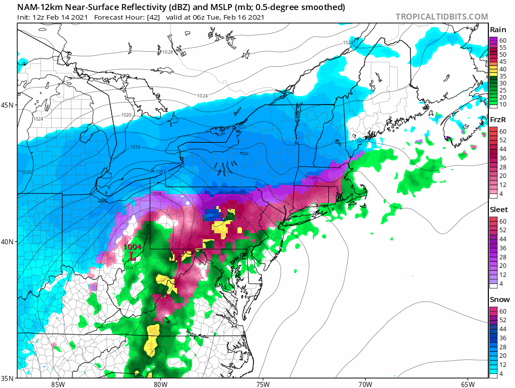
Overnight Monday into Tuesday morning is when the first system moves through the region. The low pressure center should pass along the south coast allowing for above freezing temperatures to move into southern New England. This above freezing air will move in aloft first and then at the surface. Most places start as either snow or sleet before transitioning to sleet, freezing rain or plain rain.
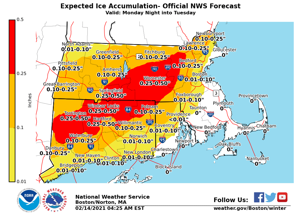
There is an increasing threat of freezing rain for those locations that stay below freezing at the surface. Below is the current projection from the National Weather Service. First things first: any amount of freezing rain is enough to cause dangerous travel conditions. Google what happened in Dallas this week. Secondly, while this amount of ice isn’t extreme, it could be enough to cause a power outage or two. Just something to be prepared for.
Temperatures Tuesday afternoon do not warm very much as the storm departs so any slippery conditions could persist after precipitation stops. Best to let road crews apply salt, sand and other chemicals first before travelling.
Wednesday is quiet and cold.
Thursday
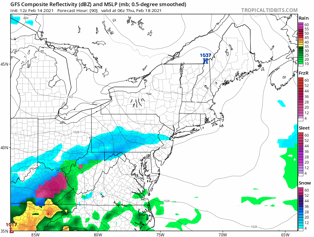
Another storm system is in the forecast for Thursday afternoon and overnight. An area of low pressure moving up the Appalachian Trail will bring a period of snow, sleet, freezing rain and rain to the region. For southern New England, this one should have more snow to start than the Monday/Tuesday system, but does not look like an all snow storm at this point. More details to come on this one a little later.
-Chris
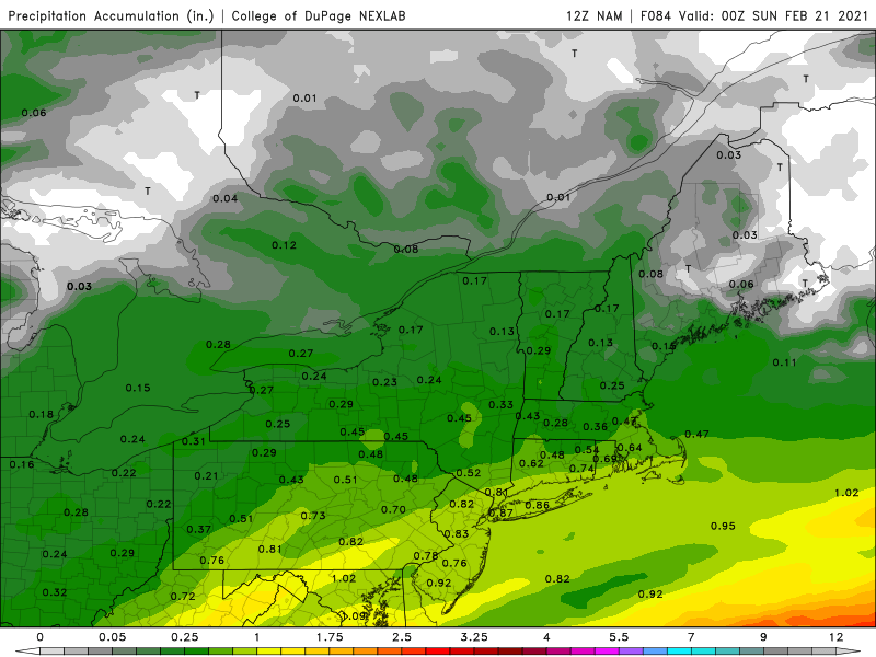
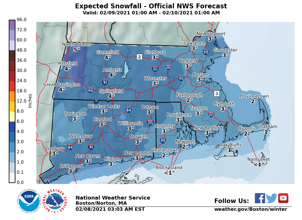
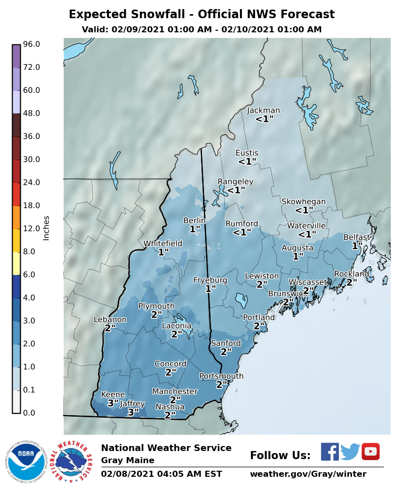
As we shovel out from yesterday’s round of snow another one follows quickly on its heels. This one will be lighter in intensity and amounts. Moving in from west to east snow falls during much of the work day Tuesday across the region.
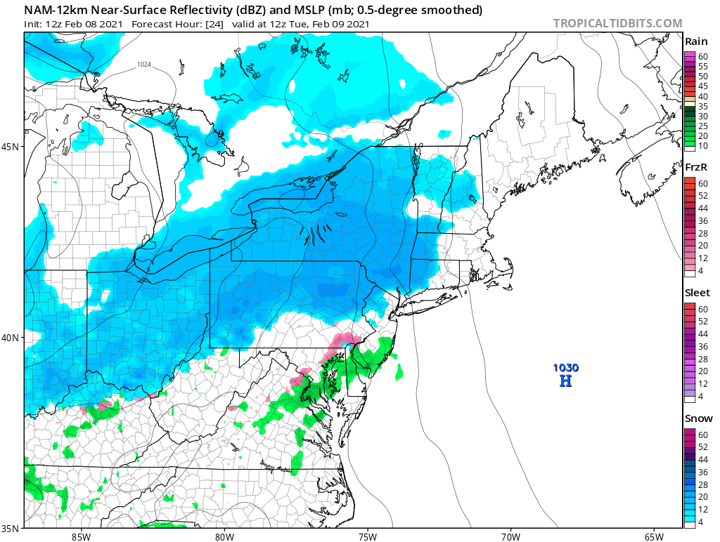
There isn’t a lot of moisture associated with this weak system, so while it snows most of the day, there isn’t a lot of moisture falling from the sky. In the end a southern New England region wide 2-3″ sounds about right. Just enough to add to the pack.
-Chris
As Tom Brady prepares for his 10th Superbowl a round of snow will likely impact southern New England. A very active weather has established itself across the North American continent and the next disturbance in the pattern passes by the region Sunday.
For the last two days or so the forecast for Sunday has been steadily trending towards a snowier solution. What was once expected to pass harmlessly out to sea has trended significantly northwest. Shown in the image below is total precipitation through 1am Monday for the last 8 (2 days) model runs for the GFS model. Note how the precipitation has steadily shifted northwest.
For reference, any blue shading is >0.5″ of liquid precipitation which roughly correlates to 5″ of snow. So what could lead to such a trend? DATA! Any forecast system is only as good as the initial data put into the system. At the start of the above trend loop, the storm system is located approximately here south of Alaska:
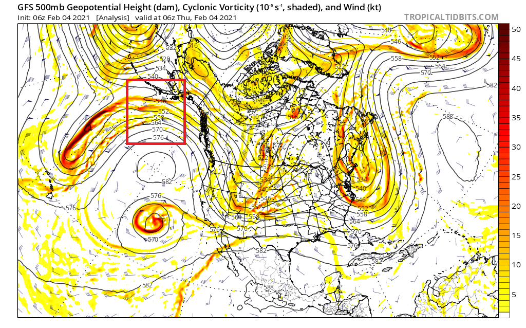
Now when this mornings computer model runs come in, the storm system is located approximately here over Washington state:
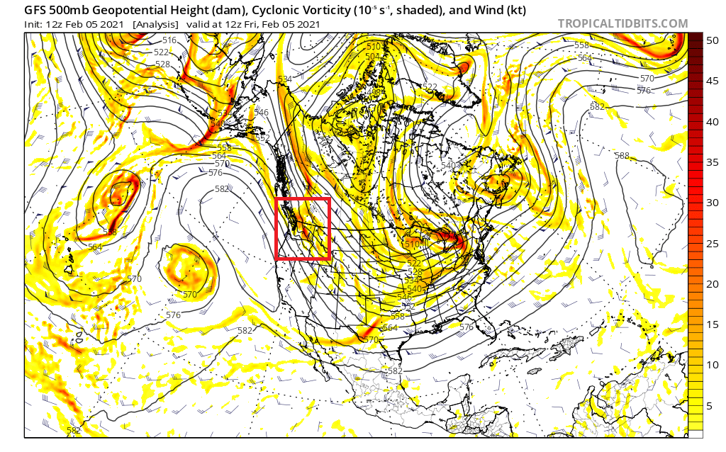
The key obvious difference being that the storm system is no located over land and not the open ocean. Satellites and aircraft do a decent job of sampling the atmosphere is remote locations, but there is no substitute for sampling the atmosphere over land. Over land is where meteorologists routinely launch balloons that sample the atmospheric conditions as they ascend to the heavens.
Now that the storm system is located over land, the data input into the model is much better, giving confidence to forecasters that Sunday afternoon will be a snowy one.
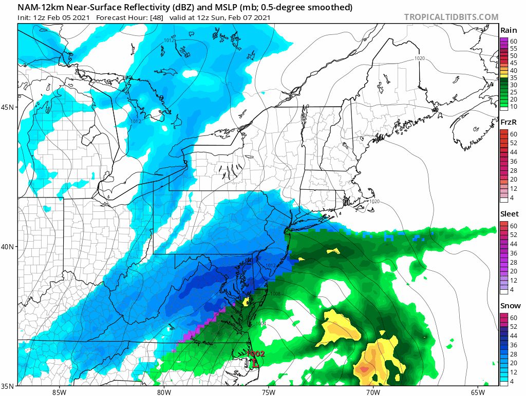
One thing is for certain with this system…it is trucking northeast. The loop above is only 13 hours long and snow in most locations only lasts for 6-8 hours. So while this system has lots of moisture associated with it and snow will fall at a decent rate, accumulations are limited by duration.
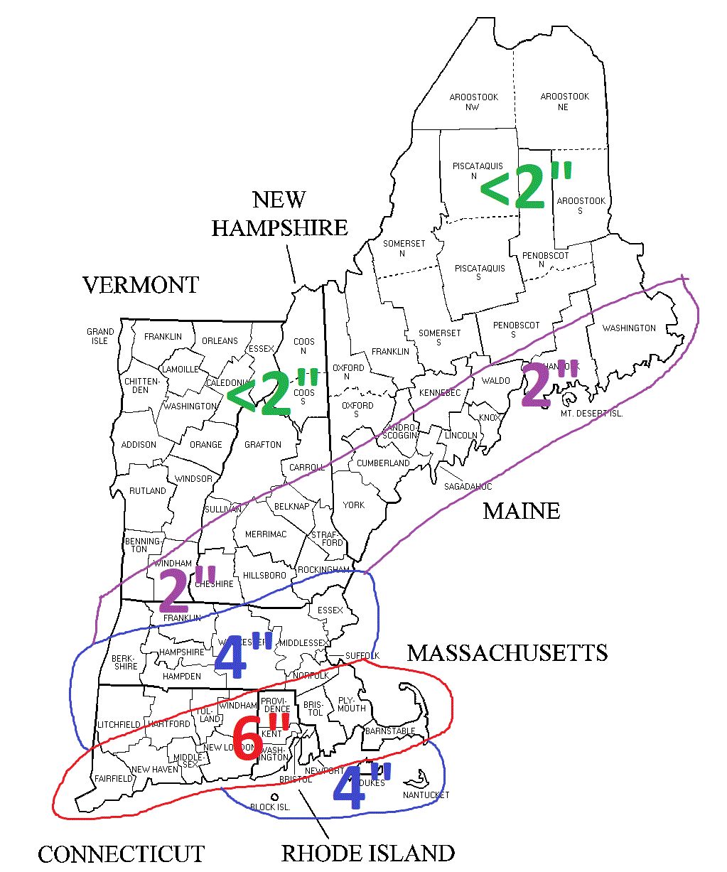
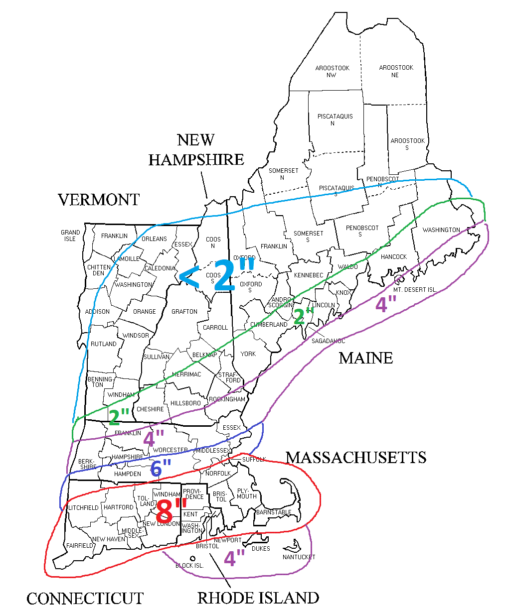
Right now, here are my current thoughts in terms of snowfall:
-Chris
