You’ve probably noticed that January 2021 has been quite boring in the weather department. It is quite difficult to remember such a dull, average month. Outside of a heavy rain event on January 16th, since January 2nd, only 1 other day featured a daily precipitation >0.1″ at the Worcester airport.
Speaking of the Worcester airport, as of January 25th, the observation site is running 6.2 degrees above average for the month and has only received 3.6″ of snow (compared to an average of 13.7″ for 1/1 to 1/25). In both departments, the next week should help to bring those values closer to normal (slightly).
A storm system that is bringing a foot of snow to Lincoln, NE today will drift eastward through the Ohio River Valley Tuesday/Wednesday and bring periods of light snow to the region.
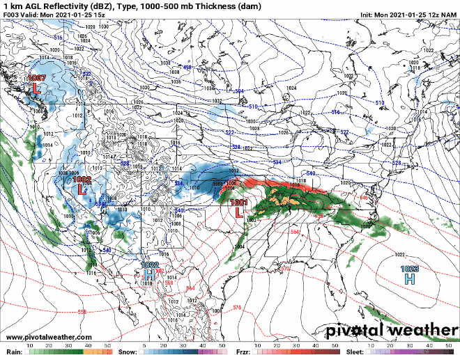
You’ve probably noticed that the storm system in question isn’t the most organized. In fact, it’s basically a hot mess. But even a hot mess can bring enough moisture to whiten the ground. Starting late Tuesday afternoon through pretty much the end of the week, periods of off and on light snow and flurries will occur.
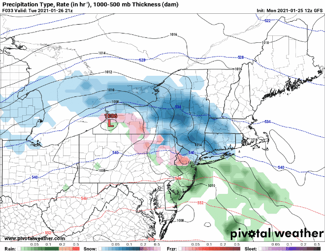
The image above is a zoomed in view of the forecast from late Tuesday afternoon through Thursday morning. As for accumulations…well not too much. A general 1-3″ for the entire region should suffice in this instance.
If hoping for something a bit more significant in terms of snowfall, keep an eye on the February 1-3 timeframe. Many of the computer guidance models are hinting at something during this period.
-Chris
