Hello all! Long time no blog. But then again the weather has been pretty boring across New England the last couple months. The area is actually just pulling out of the pretty significant drought. Most locations were classified as experiencing severe or extreme drought conditions earlier this fall.
That will change going forward as we continue to transition from summer to winter. Temperatures are certainly getting colder and more instances of cool/damp weather are moving in.
Aside from an occasional sprinkle, all eyes this week are on Thursday/Friday. Hurricane Zeta is currently down in the Caribbean on its way to landfalling in the Yucatan Peninsula tonight followed by the Gulf Coast later this week.
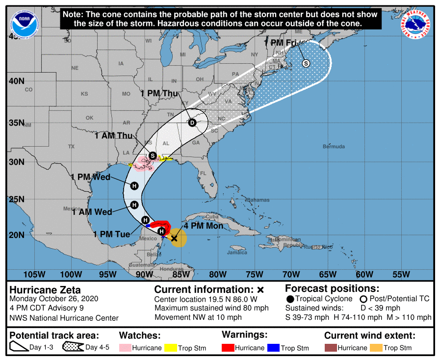
After landfalling along the Gulf Coast, Zeta will be picked up by the jet stream and bee-line for the southern New England coast. A period of heavy rain moves in from the southwest Thursday afternoon.
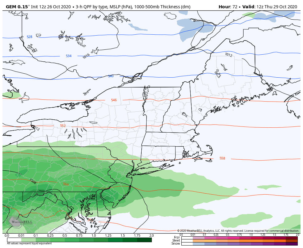
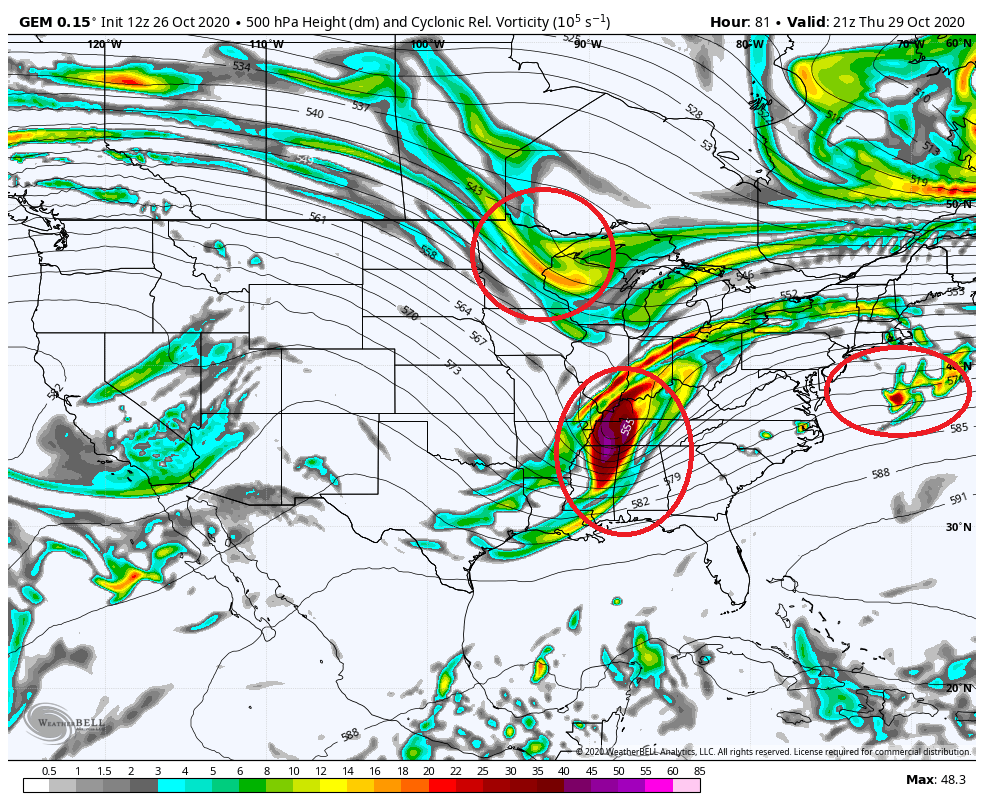
At the same time, two energetic systems follow immediately behind Zeta’s remnants and generate a second heavier period of precipitation overnight Thursday into Friday morning. Shown below for reference is a plot of the upper atmospheric energy late Thursday afternoon. I have circled the three players in the system.
Overnight Thursday into Friday as the next period of heavier precipitation reorganizes cold air will filter southward out of Canada and may flip the rain over to snow from north to south.
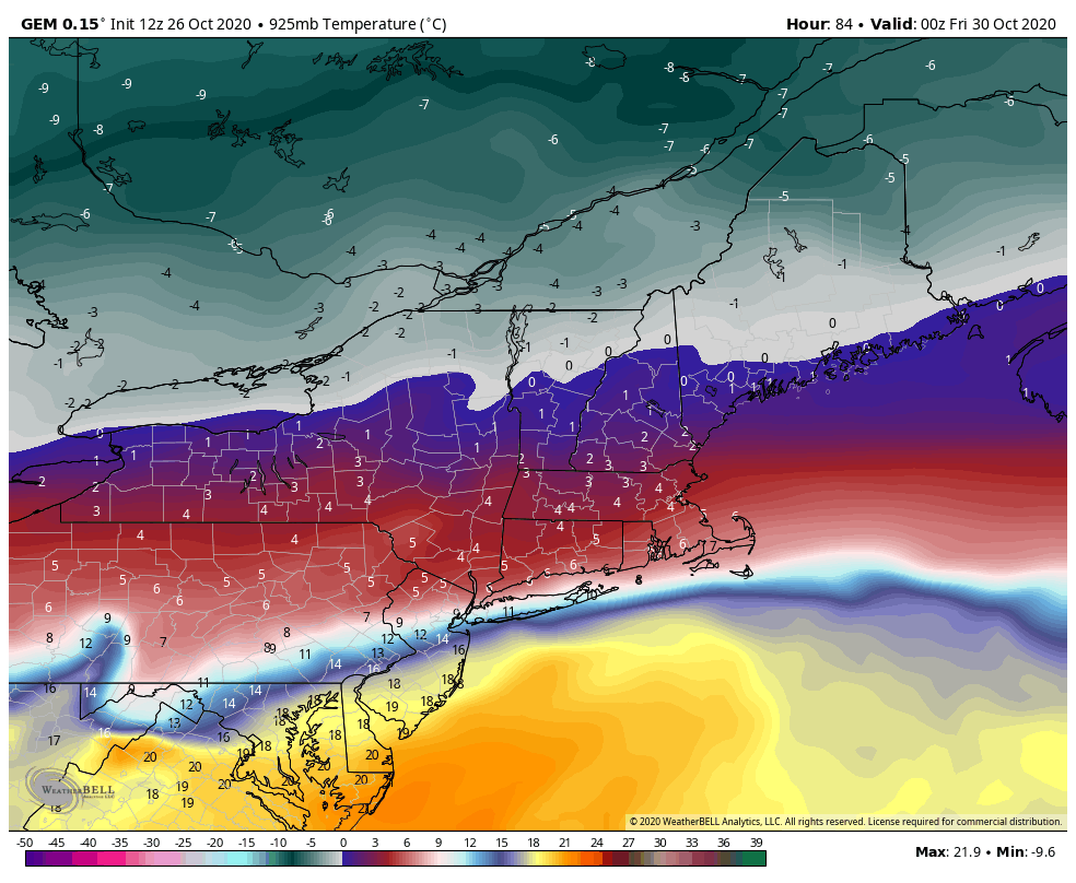
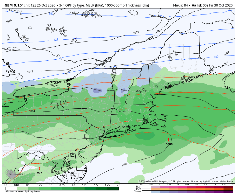
The atmospheric column may cool enough that most locations may end as snowflakes on Friday. Accumulations may be possible outside of 495 and particularly north of route 2.
Definitely the first interesting storm system of the late fall and worth keeping an eye on.
-Chris
