Note: based on information presented on 11/15/18.
For the last few years, on the Thursday prior to Thanksgiving, I have given a presentation at work regarding my expectations for the upcoming winter. Previously I had not taken the time to blog my thoughts, but this year I have decided to do just that. So, without too much hoopla, here are my thoughts regarding Winter 2018-2019 in the Boston area.
I suppose the first question that needs to be addressed is: how exactly does one develop a seasonal forecast? It is true that there are weather models that predict seasons at a time, but models have their limitations (too many to list here). Perhaps the best avenue is to attempt to correlate the current state of the climate with years past and develop expectations for this upcoming winter season. To develop those expectations, I am going to rely heavily on the current state of the El Nino-Southern Oscillation (more commonly known as simply El Nino), the Northern Hemisphere snow pack, the solar cycle and I’ll throw in a seasonal model forecast or two.
El Nino-Southern Oscillation (ENSO)
ENSO refers to a recurring climate pattern across the equatorial Pacific Ocean. El Nino and La Nina are the warm and cool phases of the pattern that exhibit themselves by either warmer or cooler than average sea surface temperatures across the Pacific Ocean, especially along/near the equator. Each ENSO phase produces mostly predictable disruptions of temperature, precipitation, and wind patterns across the globe.
The U.S. Climate Prediction Center has issued an El Nino Watch and is expecting that an El Nino will form and persist through the Northern Hemisphere winter and into spring.
So, what does a traditional wintertime El Nino pattern look like for the U.S.?

North American Wintertime El Nino Pattern
A typical wintertime El Nino pattern for the U.S. features an active southern jet stream (red arrow) that helps to bring an influx of Pacific moisture to the southern states. The polar jet stream often times gets in on the act as well by delivering shots of arctic air to the Midwest and Northeast. Should these two jet streams sync up over the eastern two-thirds of the continent, then an active and snowy pattern is possible.
Model projections for the strength of the El Nino project a three month average sea surface temperature departure of around +1 degree Celsius for December, January, & February with a slight weakening heading into spring.

El Nino Forecast
Searching the archives for past El Nino occurrences with a DJF SST anomaly of approximately +1 degree Celsius, that coincided with a slight weakening for JFM produced five potential analogues. Presented below are those identified seasons and the snowfall observed in Boston. The 2019 values are based on my interpretation of the model forecast above. Also, for reference, Boston averages 43.7″ of snow per year.

A deeper analysis will be required to determine what happened in 1995, but even including that season produces an above average snowfall total for the area.
North Hemisphere Snow Pack
With an establishing El Nino predicted for this upcoming winter, there should be an abundance of moisture available for storm systems traversing the continent to tap into. But will there be enough cold air around for these storms to produce snow? To answer that question, let’s take a look at the state of snow coverage in the Northern Hemisphere.
As of November 11th, the total area of the Northern Hemisphere that is covered by snow is near the top when compared to the past 14 years. What this tells me is that there is cold air available across much of the top half of the planet.

Northern Hemisphere Snow Cover
Particularly when looking at North America, where snow cover is on par with the winter of 2014-2015. And if you were in Boston during February 2015, you need not be reminded of what happened that year.

North American Snow Cover
And to add a visual to how much of the hemisphere is covered, any area covered beige below had snow cover on November 14th.

Northern Hemisphere Snow Cover
Solar Cycle
Did you know that the Sun is on a cycle? The amount of magnetic flux (energy) that rises to the Sun’s surface varies with time; known as a solar cycle (lasting approximately 11 years). Probably more commonly known as the sunspot cycle since sun spots represent areas of high magnetic flux and can be quite visible.

Solar Cycles
The sun is currently nearing the minimum of solar cycle 24 (since 1755). Research suggests that the slight decrease in solar energy increases the potential for the polar vortex to be disrupted and for outbreaks of arctic cold to drop south out of the high latitudes.
To prove that sunspots are at a minimum, below is the sunspot image from the 3rd week of November with nary a spot to be found.
(found here: https://www.spaceweatherlive.com/en/solar-activity/sunspot-regions)
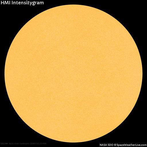
Current Solar Image
Model Seasonal Forecast
Millions of dollars are spent annually to improve weather prediction models. So it would be rude to not acknowledge them. Below are a pair of images showing temperature and precipitation anomalies as predicted by the November 14th model run of the National Center of Environmental Prediction’s Climate Forecast System model.

CFS Temperature Anomaly December -> February

CFS Precipitation Anomaly December -> February
This model run for the winter months forecasts below normal temperatures for Southern New England with average precipitation.
Summary
In summary, for Winter 2018-2019 I am expecting average temperatures (leaning slightly below) with above average snowfall; 50-55″ for Boston (15-25% above normal). The signal for increased moisture from the developing El Nino and available cold do to a robust Northern Hemisphere snow pack are too big to ignore and I’m expecting a snowy winter around these parts.
-Chris
