Good morning everyone! As mentioned yesterday, today holds the potential for some rather strong thunderstorms. So I wanted to give you an update of what we know very early this morning.
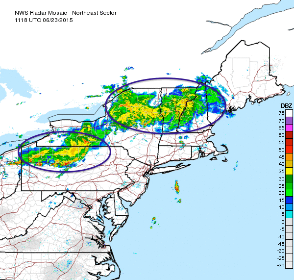
Northeast Radar as of 7:30 am
Two key elements are leftover from yesterdays storms which in the end produced 14 tornado reports across Michigan and Illinois. The large batch of showers and storms across Northern New England will likely be the downfall of any severe weather up there. It will bring much needed rain, but severe chances will be limited do to lack of solar heating.
Southern New England is where the forecast becomes tricky. The whole key to our severe chances today lie with the second batch of thunderstorms across Northern Pennsylvania and southern New York. This system is marching east and if it maintains itself into SNE (sometime around 1230-1 pm) then it will severely limit our thunderstorm potential for the day.
IF the thunderstorm complex survives the trip, then it will rob the atmosphere of most of its instability and due to the timing of a little after noon; the atmosphere will not have sufficient time to recover and our severe chances will be squashed.
IF the thunderstorm complex doesn’t survive the trip or makes a hard right turn to the south and Southern New England is allowed to bake in sunshine for a few hours, then the chances of severe thunderstorms is greatly increased.
As for a timeframe today, keep an eye to the sky starting about noon. It could be that all we get is the leftover thunderstorms from PA/NY around noon. Or we could get something bigger a bit later. Time will tell.
-Chris
