This stretch of wintry weather has been incredible right? Three storm thats have brought a good portion of the region a foot and a half of snow or more. Countless records falling left and right. The city of Boston for example has broken its records for most snow in a 10, 20, 30 and 40 day period. Febraury of 2015 is currently tied for 2nd for most snow in a Febraury……it’s current the 11th. A gambling man would bet the farm on breaking the record.
Speaking of becoming the snowiest February on record, there’s a chance that the record falls on Thursday. Fortunately only 0.4″ is needed to break that mark. For Thursday a clipper type system will be dropping southeast through the Great Lakes and will bring a period of snow showers to the region during the afternoon. At this time a new storm center will begin to organize to our southeast. Fortunately it appears that it will form just far enough away that most of the region will be spared a significant snowfall. Only down on the Cape and Islands could they possibly see several inches of snow.
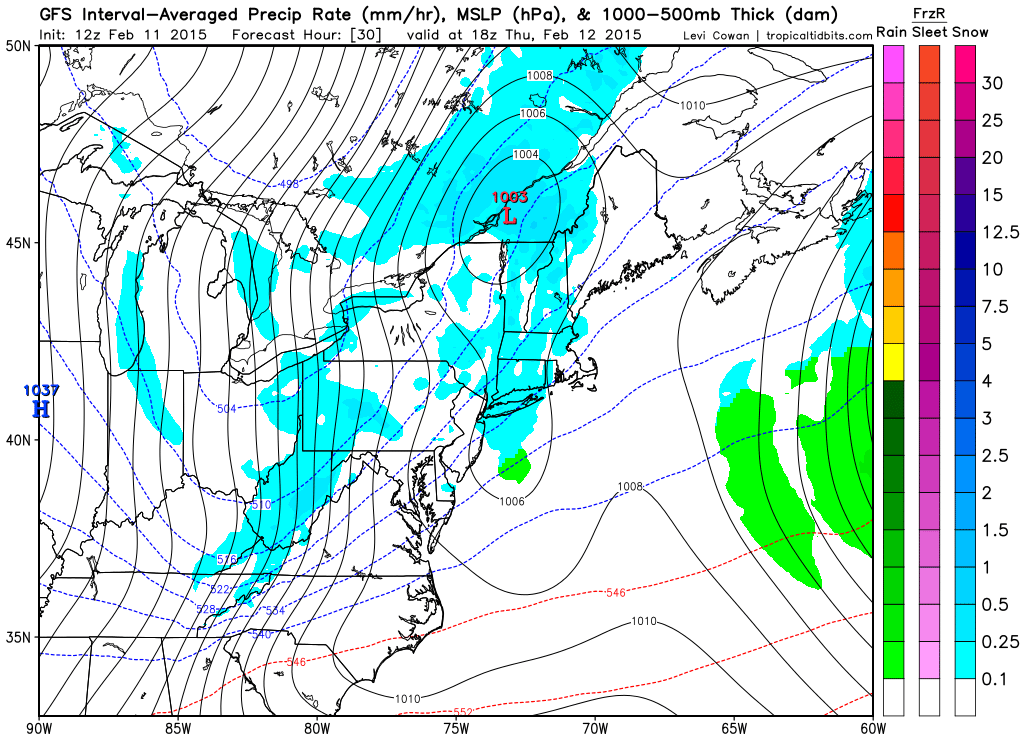
1 pm Thursday Afternoon Courtesy of Tropical Tidbits
The image above is vaild for 1 pm Thursday afternoon and it shows that weak area of low pressure passing along the Canadian border bringing a few snow showers to the region. Also in the image if you look just south of Long Island you see an almost bowl shape to the 1006 mb contour. That is the new area of low pressure beginning to take shape. With our next image, let’s fast-forward 12 hours:
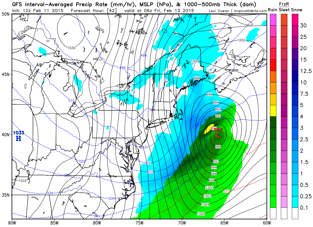
1 am Friday Morning
12 hours later and we have a fully developed powerful cyclone off the coastline. This one however is just far enough away to only really brush the Cape and Islands. The snowfall forecast for both the Thursday afternoon snow showers and Friday morning coastal storm look like this according to the NWS in Taunton.
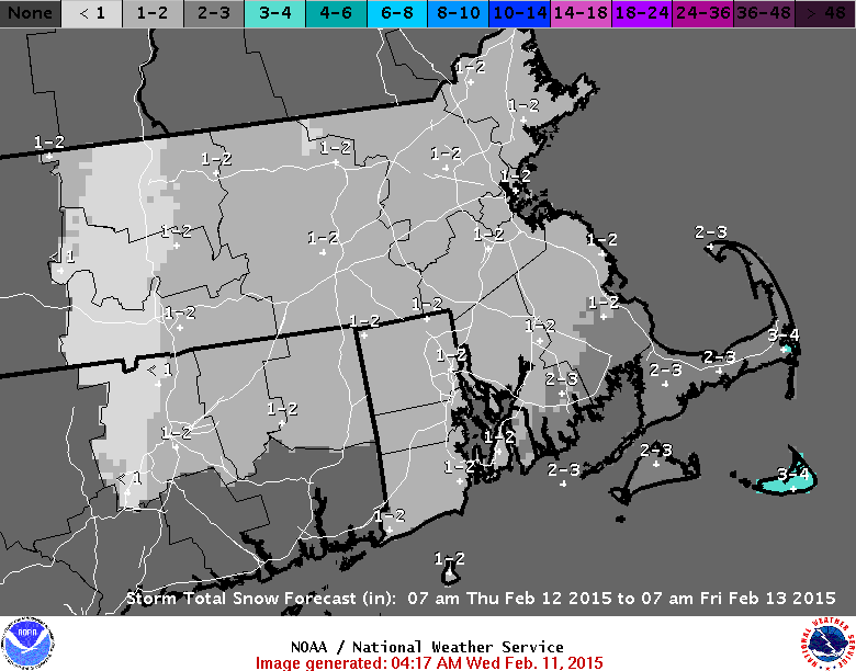
Total Snowfall
Like I said, nothing that we shouldn’t be able to handle.
But Thursday night is only half of the title to this blog. Something much bigger is potentially lurking for the second half of the weekend. As the majority of you reading this are friends of mine on Facebook you probably saw my post for Monday which read like this: “I want everyone to remember that I said the Sunday into Monday storm chance holds the biggest potential.” The only portion of this statement that might be incorrect is the Sunday into Monday part. It’s starting to look like more of a late Saturday into Sunday potential.
And at this point in time the only specifics I want to give is the potential timeframe of the system. The potential is there for a significant winter storm impacting Southern New England late Saturday evening and into Sunday.
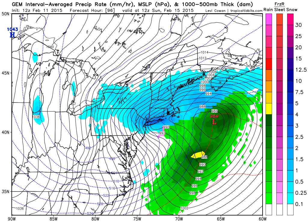
To show you want potential might possible lie ahead I will leave you with three last images from the three main computer models. In order the images are from the GFS (American), CMC (Canadian), and ECMWF (European). All three images are valid for the same time: 7 am Sunday morning. Just a note: the GFS & CMC are sea level pressure and precipitation; while the ECMWF is sea level pressure and 850 mb winds. I’d show you Euro precip, but I can’t. The Europeans are mean when it comes to their stuff.
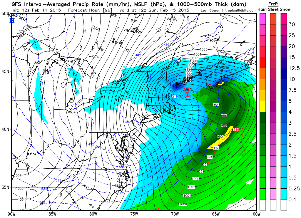
7 am Sunday GFS
7 am Sunday CMC
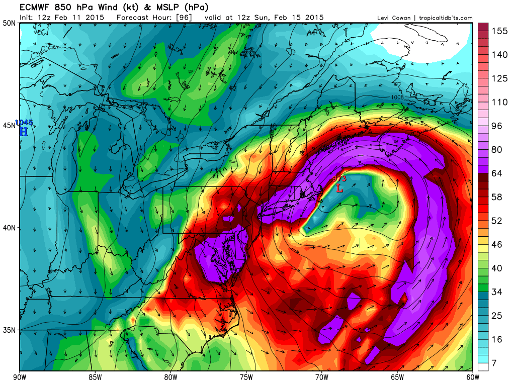
7 am Sunday ECMWF
One last note: Yesterday morning both the GFS and CMC advertised a Blizzard for Thursday night while the ECMWF did not. The ECMWF looks to end up being correct. Typically the ECMWF is everybodies go to forecast model. In the scenarios above, the ECMWF is the worst and is a 100% full blown Blizzard.
Will it be right again? We’ll soon find out.
-Chris
