Hey would you look at that! More snow! I’m starting to think that Mother Nature is determined to make the Meteorologist the most hated person in Southern New England this month. After much of the region recevied nearly 40″ of snow in a 7 day period last week, which was followed by bitter cold, it appears that much of the region is in for more snow.
However the evolution of this system is going to be a bit different than the majority of our storms. This storm is going to come in pieces and be really drawn out. The region is likely to experience prolonged periods of light snow from early Sunday morning through Tuesday morning.
The first piece of the storm moves through this afternoon in the form of an arctic boundary dropping south out of Canada. This boundary will drape itself along or just south of Long Island. With this boundary in place ripples of energy will move along it and deliver the region with periods of snow.

Weather Prediction Center Forecast Surface Chart
The image above illustrates the scenario for the next few days. With the cold front stalled south of the region numerous pieces of energy shown here as the red low pressure centers along the front will move south of the region and bring an extended period of snow.
After a few snow showers this afternoon the first real period of snow moves in early tomorrow morning.
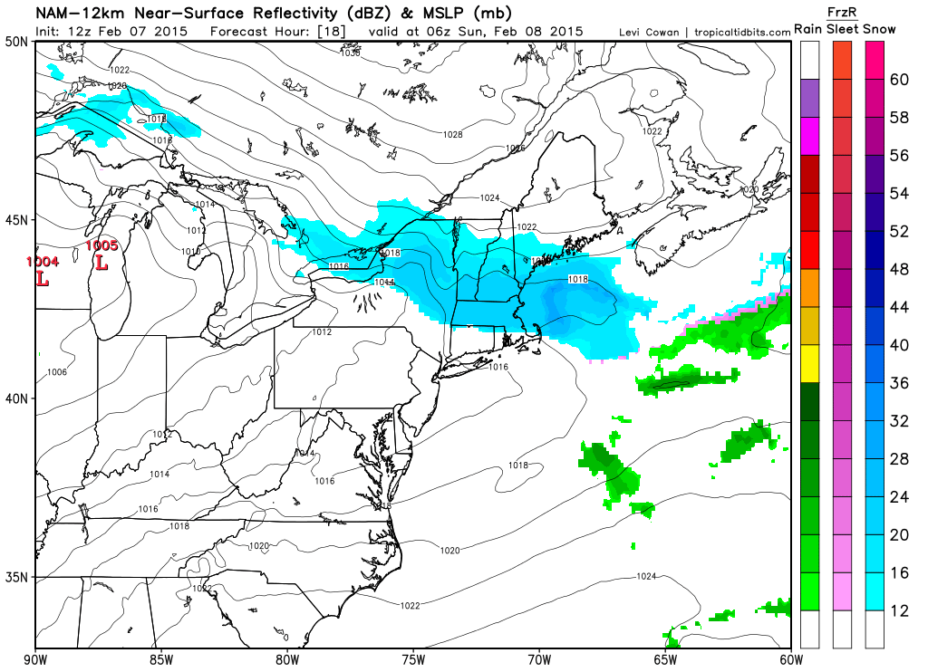
Sunday Morning Snowfall courtesy of Tropical Tidbits
Sunday afternoon there will be a lull in the action as precipitation becomes more scattered.
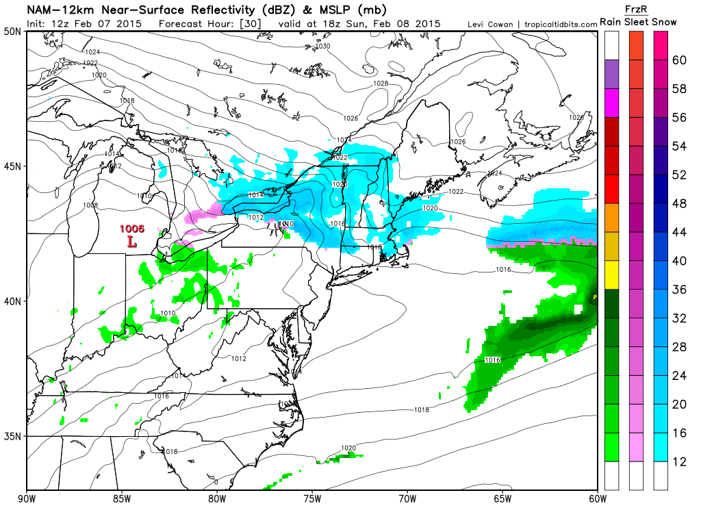
Sunday Afternoon
But by Sunday evening precip will fill back in and light to moderate snow will be widespread.
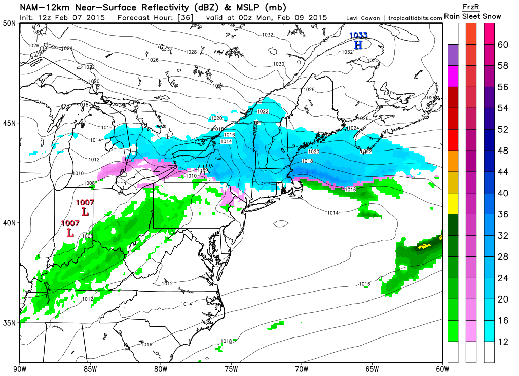
Sunday Evening
Light to moderate snow will take over the region through to Tuesday morning as evidenced by the following series of images.
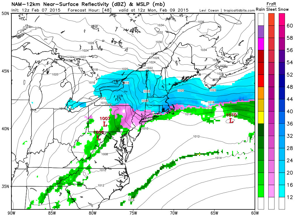
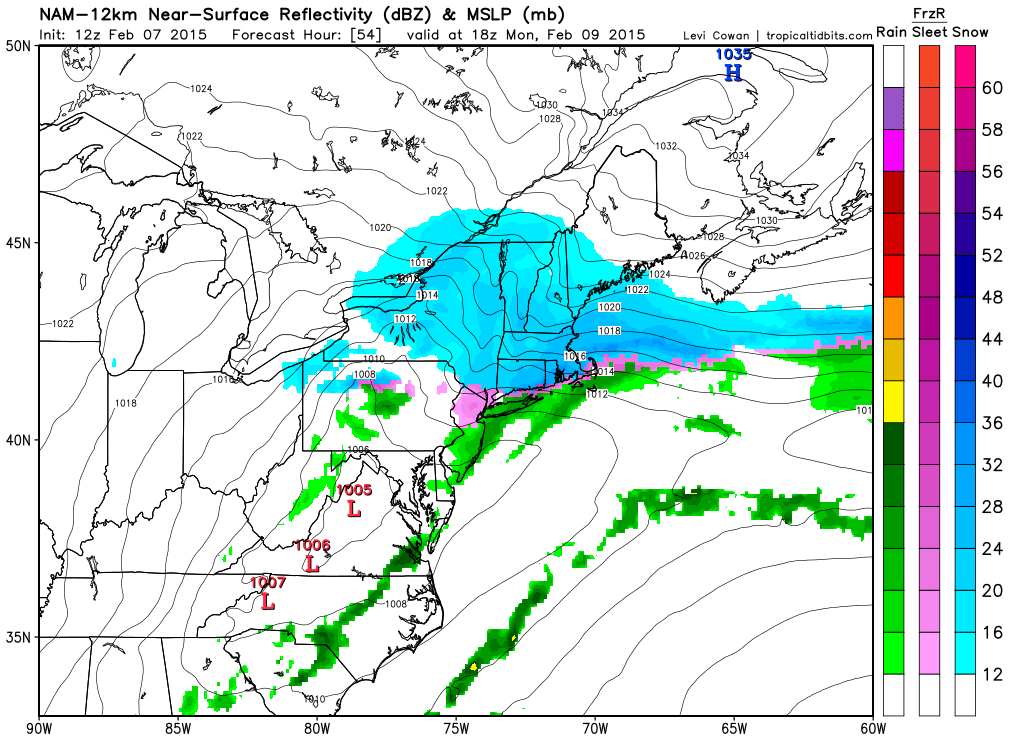
Monday Morning
Monday Afternoon
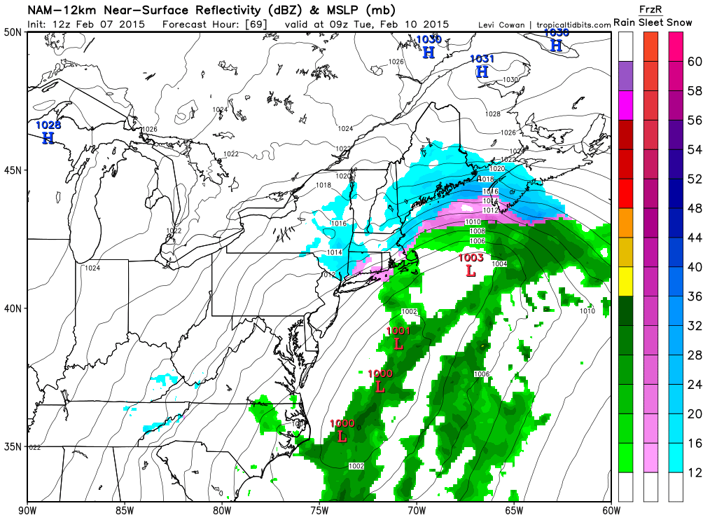
Tuesday Morning
Finally by Tuesday morning the snow will begin to wind down as the last in the line of storms moves offshore and pulls away. When all is said and done much of the region will be looking at another foot of snow.
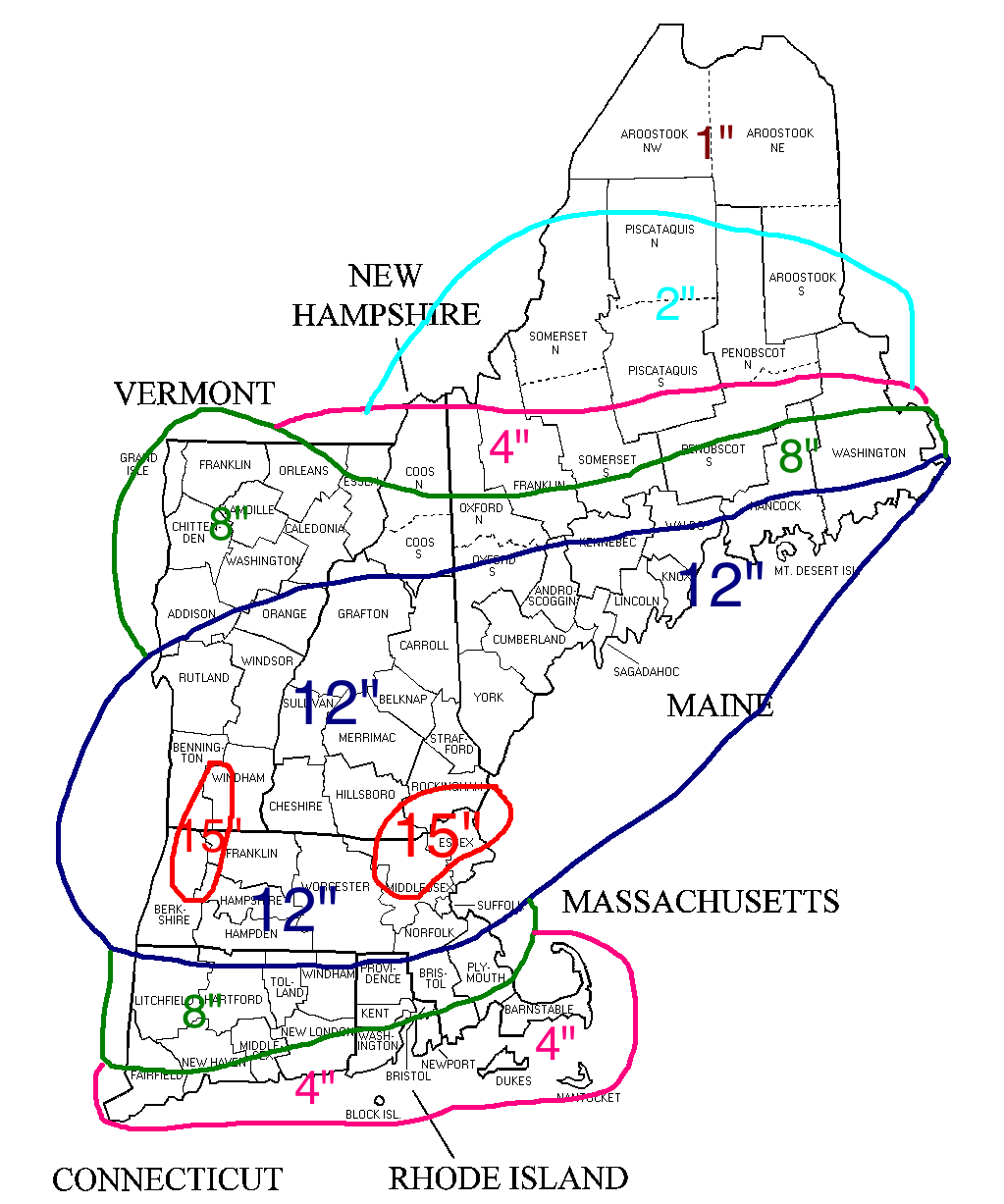
Snowfall forecast through Tuesday Morning
-Chris
