
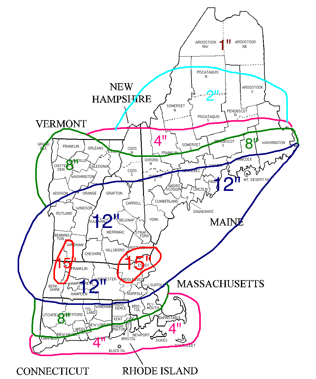
Total Storm Snowfall
Don’t really have the time for a complete detailed blog so I will give you the short version. Snow moves in Saturday evening. Storm really starts to crank after midnight. Blizzard conditions are possible between midnight and noon on Sunday.
The wind aspect of this system might be the most impressive part. This storm will likely be the equivalent of a category 2 or 3 hurricane just east of the Cape. Wind gusts across the region should be near 40-50 mph. Slightly higher nearing the coast. Cape Ann and Cape Cod and the Maine coastline could see gusts nearing hurricane force.
This will be a very cold storm with temperatures in the single digits and teens and snowfall will be very difficult to measure due to the combination of fluffy snow with howling winds.
Winds will continue to crank Sunday afternoon after the snow has wound down. When all is said and done a general 6-12″ has fallen. Some spots get less; some get more. Someone on the Maine coastline will get a silly snowfall number.
-Chris
This stretch of wintry weather has been incredible right? Three storm thats have brought a good portion of the region a foot and a half of snow or more. Countless records falling left and right. The city of Boston for example has broken its records for most snow in a 10, 20, 30 and 40 day period. Febraury of 2015 is currently tied for 2nd for most snow in a Febraury……it’s current the 11th. A gambling man would bet the farm on breaking the record.
Speaking of becoming the snowiest February on record, there’s a chance that the record falls on Thursday. Fortunately only 0.4″ is needed to break that mark. For Thursday a clipper type system will be dropping southeast through the Great Lakes and will bring a period of snow showers to the region during the afternoon. At this time a new storm center will begin to organize to our southeast. Fortunately it appears that it will form just far enough away that most of the region will be spared a significant snowfall. Only down on the Cape and Islands could they possibly see several inches of snow.
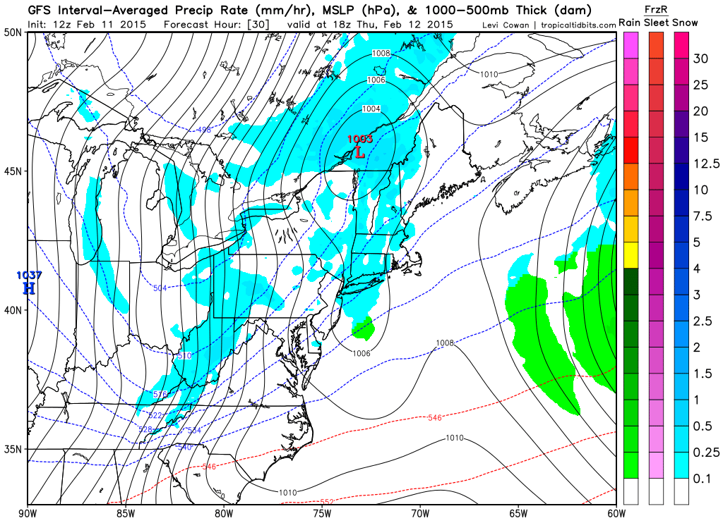
1 pm Thursday Afternoon Courtesy of Tropical Tidbits
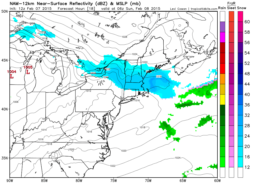
The image above is vaild for 1 pm Thursday afternoon and it shows that weak area of low pressure passing along the Canadian border bringing a few snow showers to the region. Also in the image if you look just south of Long Island you see an almost bowl shape to the 1006 mb contour. That is the new area of low pressure beginning to take shape. With our next image, let’s fast-forward 12 hours:
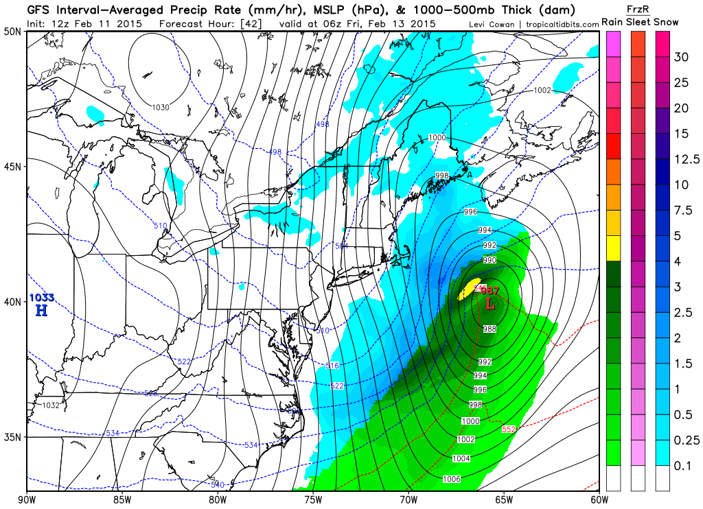
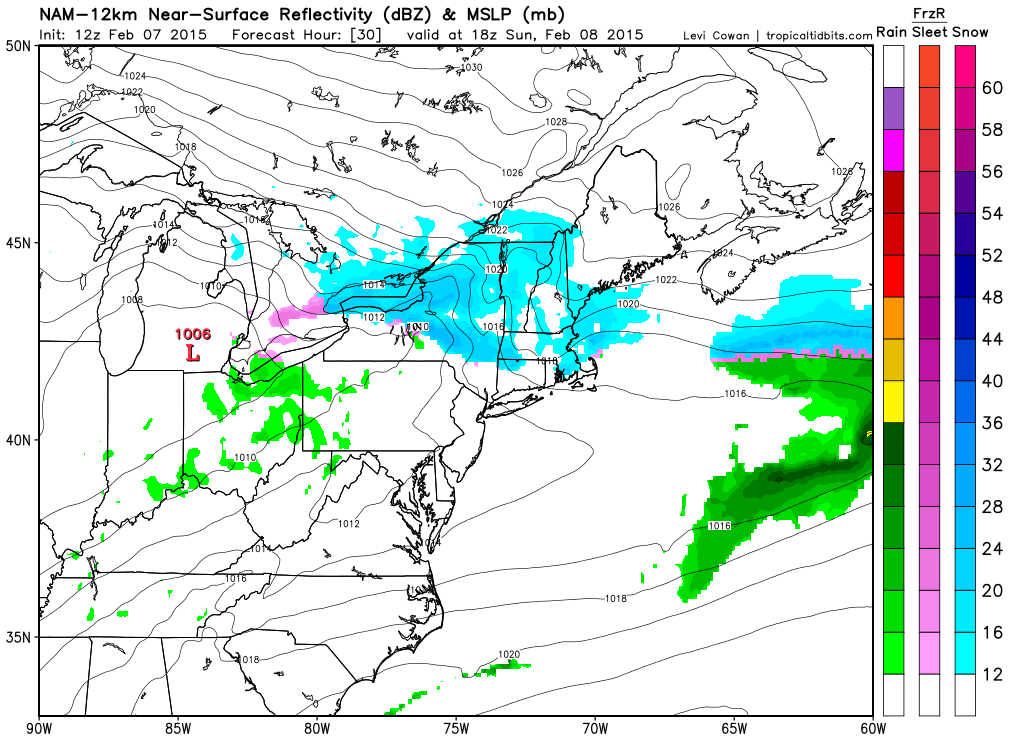
1 am Friday Morning
12 hours later and we have a fully developed powerful cyclone off the coastline. This one however is just far enough away to only really brush the Cape and Islands. The snowfall forecast for both the Thursday afternoon snow showers and Friday morning coastal storm look like this according to the NWS in Taunton.
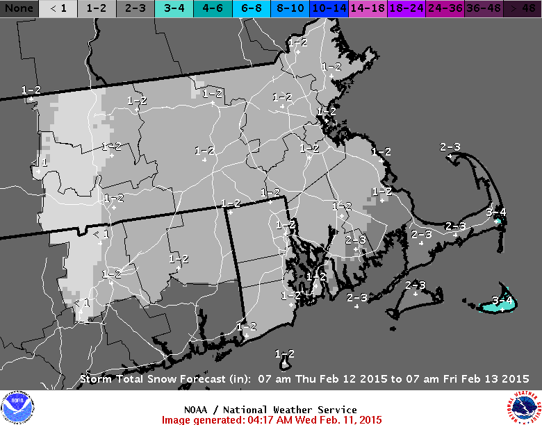
Total Snowfall
Like I said, nothing that we shouldn’t be able to handle.
But Thursday night is only half of the title to this blog. Something much bigger is potentially lurking for the second half of the weekend. As the majority of you reading this are friends of mine on Facebook you probably saw my post for Monday which read like this: “I want everyone to remember that I said the Sunday into Monday storm chance holds the biggest potential.” The only portion of this statement that might be incorrect is the Sunday into Monday part. It’s starting to look like more of a late Saturday into Sunday potential.
And at this point in time the only specifics I want to give is the potential timeframe of the system. The potential is there for a significant winter storm impacting Southern New England late Saturday evening and into Sunday.
To show you want potential might possible lie ahead I will leave you with three last images from the three main computer models. In order the images are from the GFS (American), CMC (Canadian), and ECMWF (European). All three images are valid for the same time: 7 am Sunday morning. Just a note: the GFS & CMC are sea level pressure and precipitation; while the ECMWF is sea level pressure and 850 mb winds. I’d show you Euro precip, but I can’t. The Europeans are mean when it comes to their stuff.
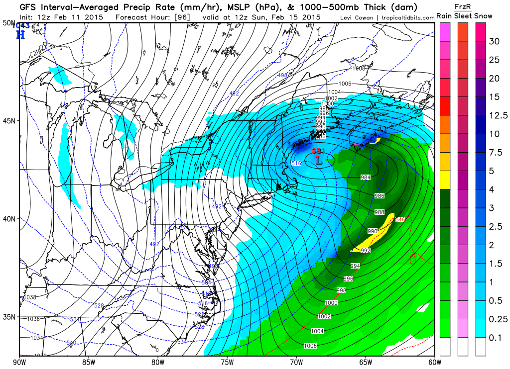
7 am Sunday GFS
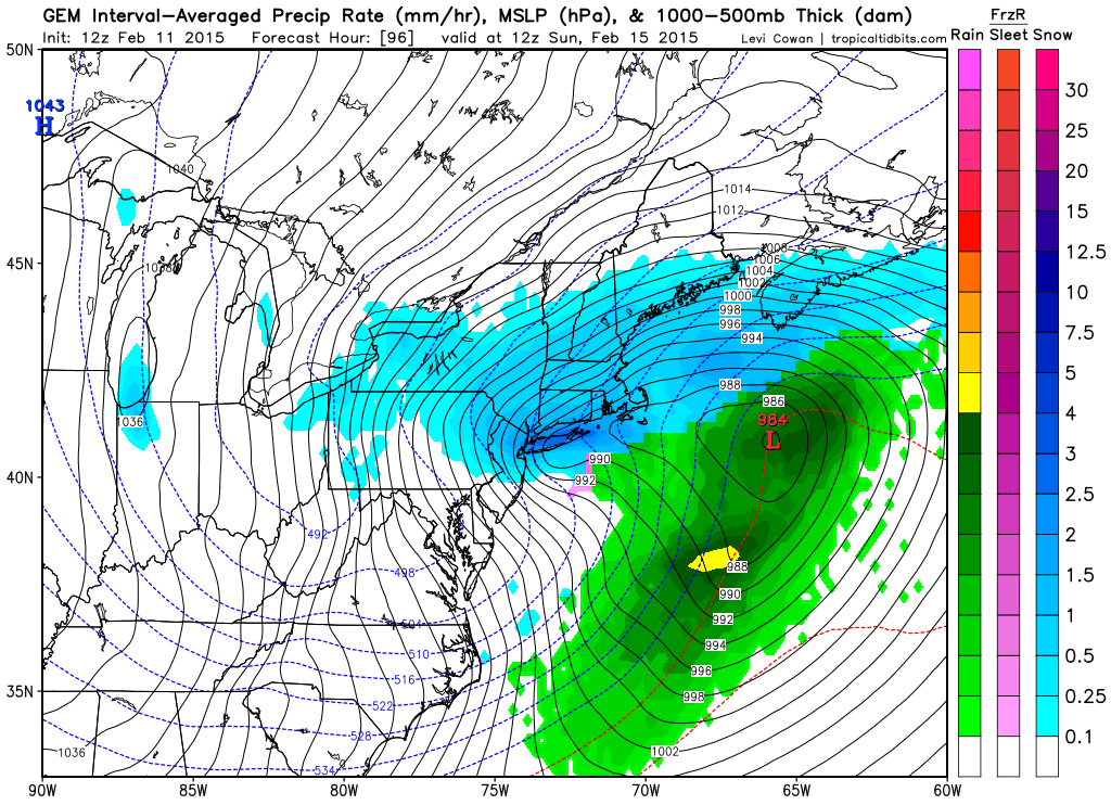
7 am Sunday CMC
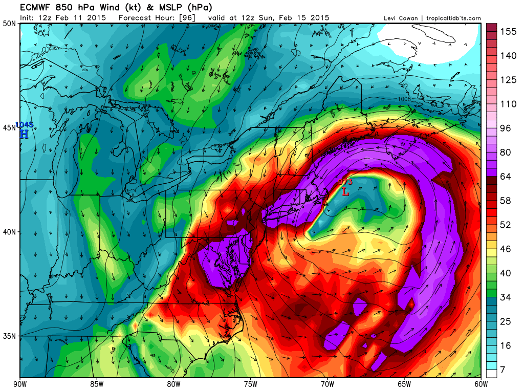
7 am Sunday ECMWF
One last note: Yesterday morning both the GFS and CMC advertised a Blizzard for Thursday night while the ECMWF did not. The ECMWF looks to end up being correct. Typically the ECMWF is everybodies go to forecast model. In the scenarios above, the ECMWF is the worst and is a 100% full blown Blizzard.
Will it be right again? We’ll soon find out.
-Chris
Hey would you look at that! More snow! I’m starting to think that Mother Nature is determined to make the Meteorologist the most hated person in Southern New England this month. After much of the region recevied nearly 40″ of snow in a 7 day period last week, which was followed by bitter cold, it appears that much of the region is in for more snow.
However the evolution of this system is going to be a bit different than the majority of our storms. This storm is going to come in pieces and be really drawn out. The region is likely to experience prolonged periods of light snow from early Sunday morning through Tuesday morning.
The first piece of the storm moves through this afternoon in the form of an arctic boundary dropping south out of Canada. This boundary will drape itself along or just south of Long Island. With this boundary in place ripples of energy will move along it and deliver the region with periods of snow.

Weather Prediction Center Forecast Surface Chart
The image above illustrates the scenario for the next few days. With the cold front stalled south of the region numerous pieces of energy shown here as the red low pressure centers along the front will move south of the region and bring an extended period of snow.
After a few snow showers this afternoon the first real period of snow moves in early tomorrow morning.
Sunday Morning Snowfall courtesy of Tropical Tidbits
Sunday afternoon there will be a lull in the action as precipitation becomes more scattered.
Sunday Afternoon
But by Sunday evening precip will fill back in and light to moderate snow will be widespread.
Sunday Evening
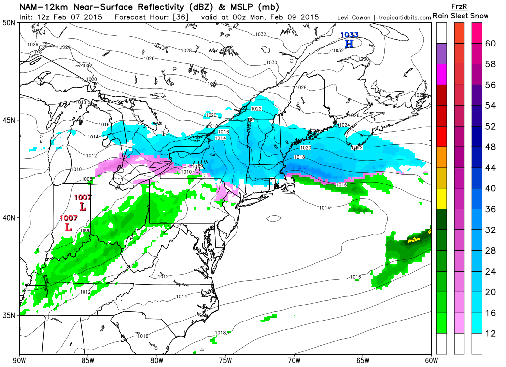
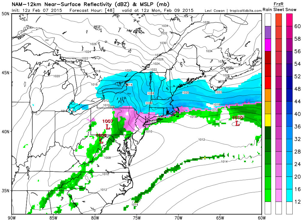
Light to moderate snow will take over the region through to Tuesday morning as evidenced by the following series of images.
Monday Morning
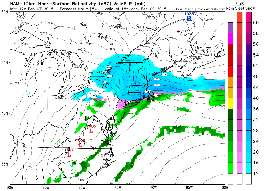
Monday Afternoon
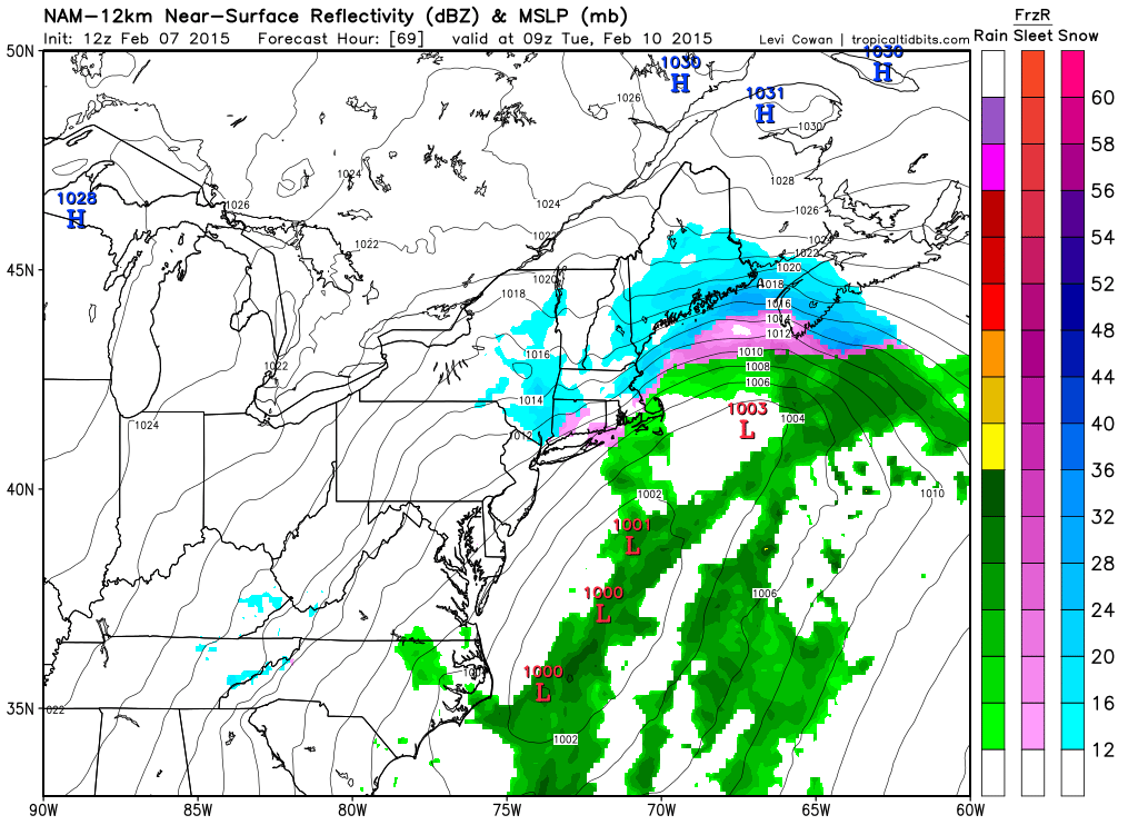
Tuesday Morning
Finally by Tuesday morning the snow will begin to wind down as the last in the line of storms moves offshore and pulls away. When all is said and done much of the region will be looking at another foot of snow.
Snowfall forecast through Tuesday Morning
-Chris
