Another winter storm is on the way for Monday and this looks to be a significant one. Right now it looks like much of the region can expect 8-12″ of snow.
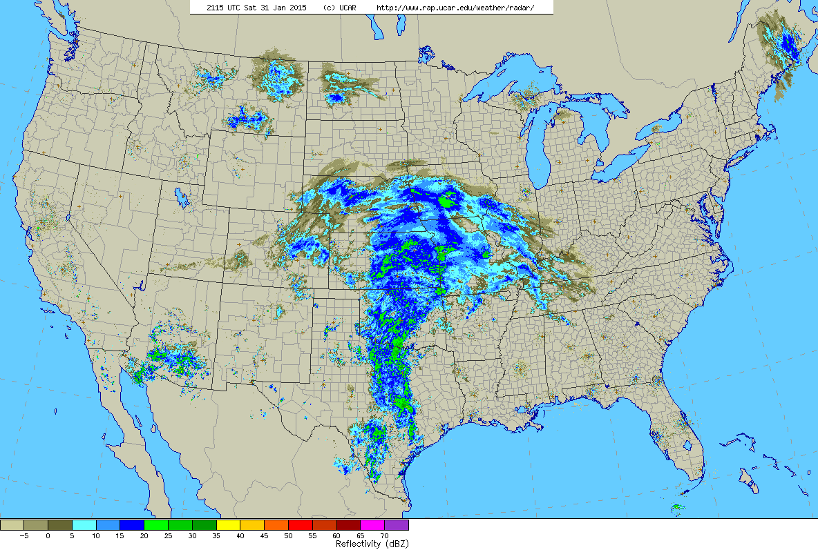
4 pm Saturday Radar
The image above is the current U.S. radar as of 4 pm Saturday afternoon. Our storm is gaining steam over the Plains states and is steadily moving east. Along it’s path it will dump upwards of a foot of snow from Iowa to Maine.
Snow will begin to overtake the region early Monday morning from west to east between 1-3 am. Snow will be heavy at times during the day on Monday before tapering off late Monday evening. When all is said in done a general 8-12″ should blanket Southern New England with slowly decreasing amounts to the north and along the South Coast.
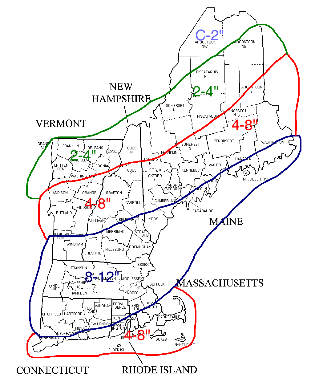
Snowfall through Monday Evening
Amounts are lower along the south coast due to potential mixing with sleet or rain at some point. It’s this potential mixing and just how far the mixing line makes it north that is keeping this map rather broad. If confidence increases overnight a more detailed map will be made.
-Chris
