Boy that was a good one huh? 15-30″ for everyone east of Worcester County. That was awesome and something we likely won’t do again for quite awhile.
But while our memories of the Blizzard of 2015 are still fresh in our mind; how about we throw a little more snow on top of the snow pack.
That’s right another system is headed our way for tomorrow morning and will linger through until Saturday morning. But thankfully this time it won’t be that big of a deal for most places not in the state of Maine.
Sometime around midnight tonight light snow will overspread much of the area as shown below with the 06z image from the RGEM model courtesy of Tropical Tidbits.
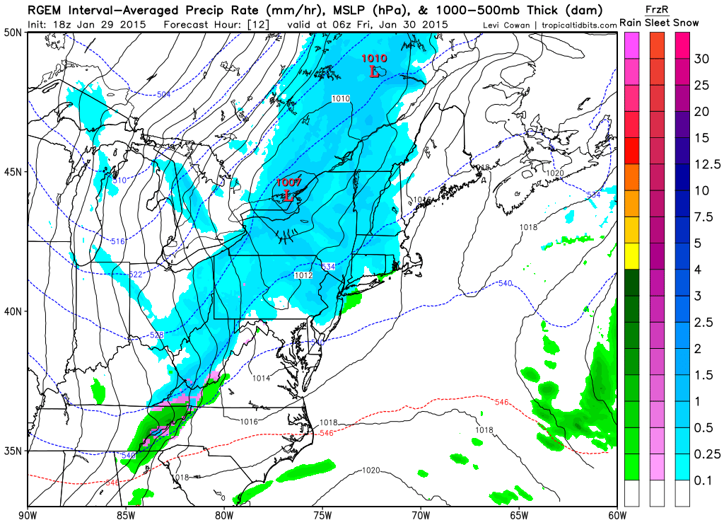
1 am Friday Morning RGEM
Light snow should last through much of the morning and will eventually become much more spotty in nature by the afternoon.

7 pm Friday RGEM
By tomorrow evening the snow should have all but tapered off across Southern New England. The state of Maine and northern New Hampshire however will continue to receive light snow. Snow will be heavier at times along the Maine coast and central Maine. Represented by those darker shades of blue in the image above.
Eventually however one last round of light snow should spin back into eastern Massachusetts for early Saturday morning.
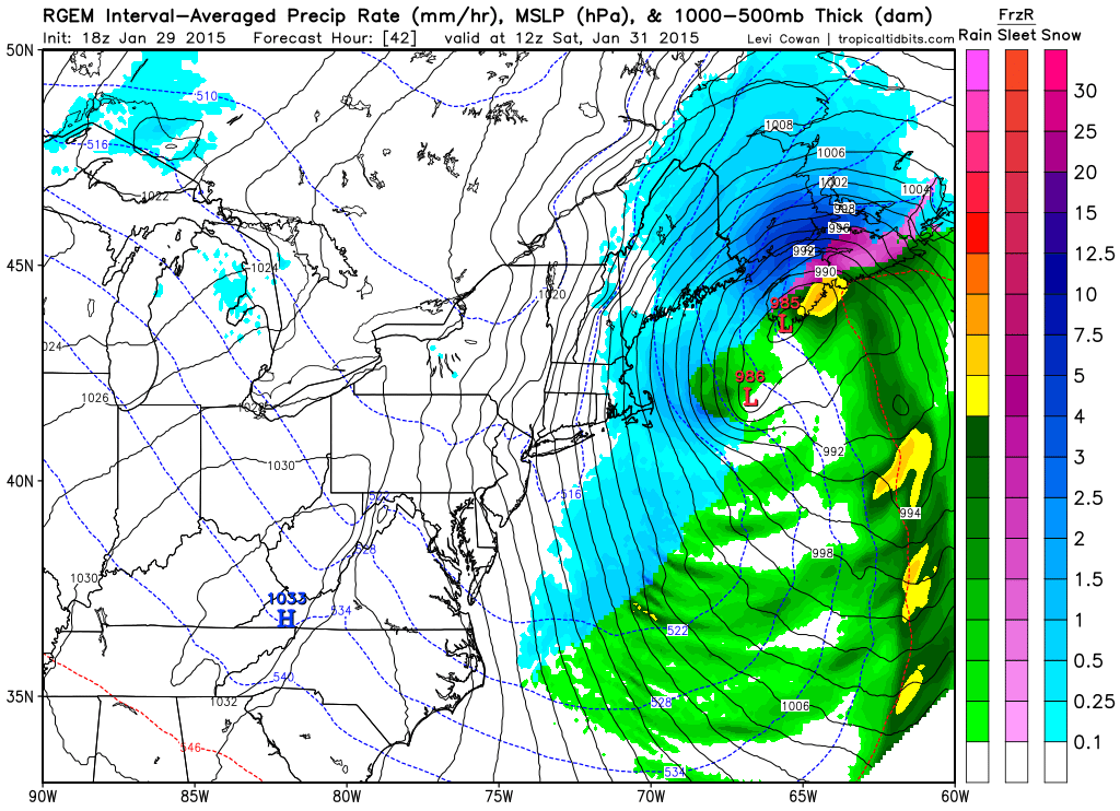
7 am Saturday RGEM
The storm will pull away during the morning hours on Saturday. When all is said and done much of the region will have picked up a few inches. Slightly higher amounts along the north shore, merrimack valley, southeast New Hampshire and Maine are expected.
Due to time constraits I’m cheating a little bit with the snow totals forecast and defaulting to the National Weather Service. In order are the snow accumulation forecast from the Taunton, Gray, and Caribou offices.
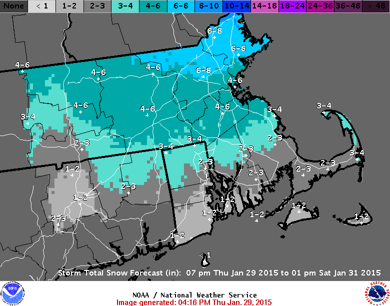
NWS BOX Snow Forecast Map

NWS GYX Snow Forecast Map
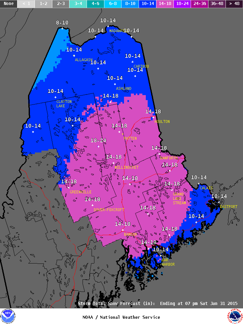
NWS CAR Snow Forecast Map
Still keeping an eye on a potential storm for Monday. Right now it looks to only brush us as it passes south of the region, but it is close and will need to be monitored.
-Chris
