Everything is a go for the Blizzard of 2015. Currently the storm is taking shape off the North Carolina coast and will begin the process of bombing out and slowly drifting northward.
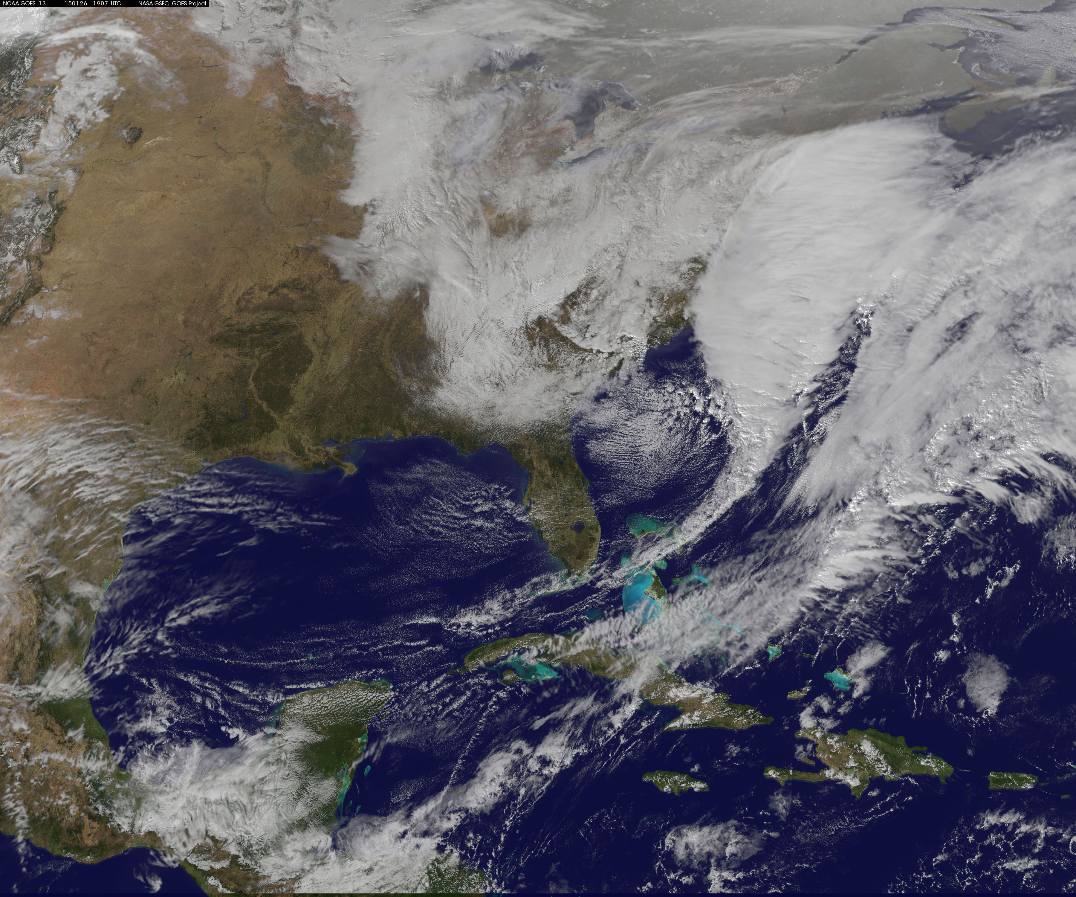
2 pm Visible Satellite
That large expanse of clouds that is hiding the East Coast under there somewhere. At some point this evening the storm center should eventually take on the look of a hurricane with an eye-like feature in the center.
Overall the forecast is going according to plan. If you want all the details scroll down to yesterdays post. But the summary version can be found next:
-Heavy snow moves in after the evening commute tonight. 1-1.5 feet of snow fall between midnight tonight and 8 am tomorrow morning. When all is said in done moset locals will see between 1.5 and 2 feet of snow. Below is the simulated satellite for 4 am tomorrow morning. At this point snow is adding up at 2-3″ per hour everywhere.
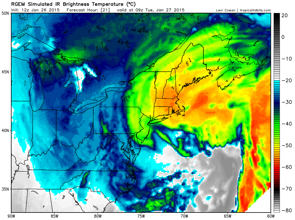
4 am Tuesday Simulated Satellite from RGEM
-Heaviest snow ends early Tuesday afternoon. Lingering showers and periods of light snow last through to very early Wednesday morning.
-Widespread wind gusts of up to 50 mph will be felt throughout the region starting early tomorrow morning and lasting throughout the day.
-Power outages are possible everywhere due to the strong winds. Outages are likely across southeast Massachusetts, Rhode Island and Cape Cod.
-Many of the beaches along our coastlines will likely be re-shappen by this system due to its slow moving nature and continuous northeast fetch.
Last pre-storm snowmap is included below. Model guidance is beginning to hone in on a jackpot region for the zone between Boston & Providence. It seems that these locals will likely receive some enhancement due to the coastal front and up to 3 feet of snow is possible here.
There could potentially be another zone where up to 3 feet could fall. This would be from north-central Connecticut northwards through Worcester County and into southern New Hampshire. But this zone is not as immediately obvious as the one across southeast Mass.
When all is said and done this one will likely make it’s mark in the record books and could be a top 5 snowstorm for Portland, Boston, Worcester, Providence, Hartford & New York City.
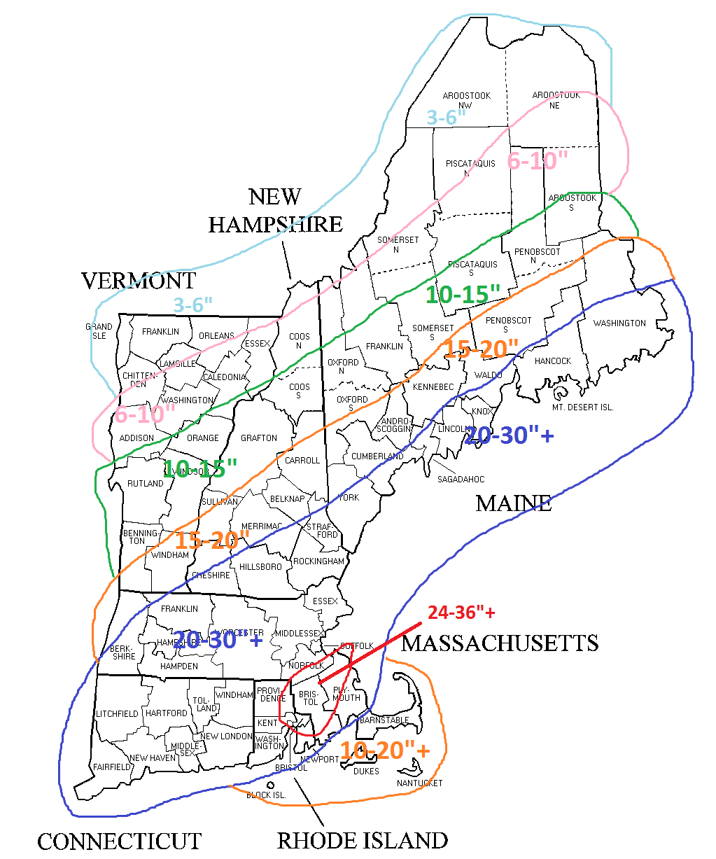
Total Storm Snowfall Forecast
-Chris
