By now I am sure that you have heard that a storm is coming for tomorrow. I mentioned it back on Tuesday and over the last few days things have become a bit clearer, but never really become as clear as one would hope.
The threat of a storm is there, but this one comes with a lot of tricky details that really won’t be realized until after the storm is underway.
Of importance to this forecast are the storms track, push of mid-level warmth and the expansion of the precip shield on the northwest side. If one or all of these don’t go according to plan then this forecast will be a major bust. But then again that is the fun of making a forecast. Trying to predict something that ultimately we really can only make an educated guess at.
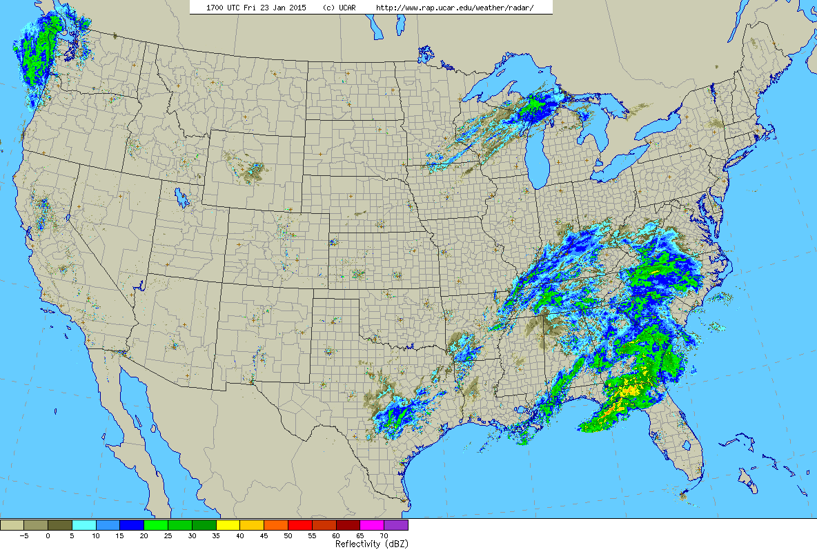
Current US Radar. 12 EST Friday
Currently our storm is the unorganized looking batch of showers and storms over the southeast states. As this system moves northeast and exits the North Carolina coastline it will begin to organize and rapidly intensify. As the storm’s center passes just southeast of Nantucket it should through back enough moisture to give much of Southern New England some snow during the day on Saturday. Starting around dawn snow will break out for much of SNE. As the storm nears places south of the Mass Pike and inside of 495 should experience a period of sleet and/or plain rain. But once the storm really starts to intensify, everyone should eventually flip back to snow sometime during the afternoon.
One key ingrediant is missing with the current atmospheric set-up and that is an area of High Pressure to our north. Without this high pressure temperatures in the middle levels of the atmosphere should warm to a level that snow will change to sleet or rain for most at some point Saturday. Eventually though cold air will wrap back into the storm and the flip back to snow will occur.
The storm is out of our hairs by Saturday night allowing for the clean up to begin.
Now let’s get to the point that everyone cares about. How much are we getting. See the map below. I would like to state that this is quite a low confidence forecast. Especially for the three and five inch regions of Southern New England. Reason being that if we fail to see the push of warm air aloft, then snow totals in these areas will bust low. But then again on the northwest side of the forecast, if the precip shield does not evolve as currently thought, those numbers will bust high.
But hey, what does it matter? We weather men and woman are never right anyways……
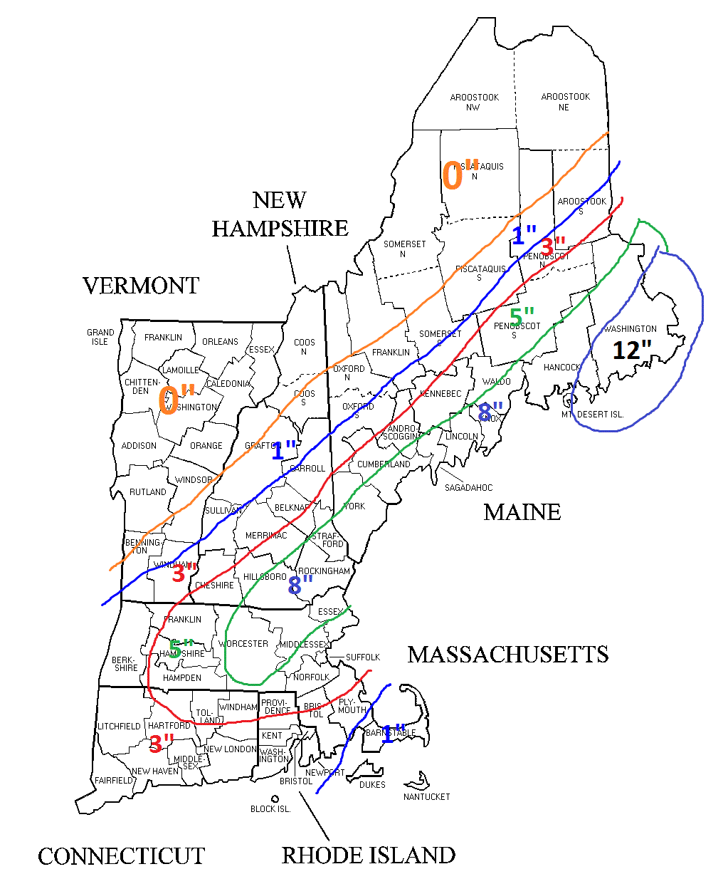
Total Snow Accumulations
-Chris
