Raise your hand if you have been wondering where the heck all of the snow has been this winter? Just like every single one of you that raised your hand I too have been wondering where the snow has gone. The theme in the computer guidance this year has been to advertise a storm system around the Day 7 timeframe, but never have it come to fruition.
But it appears that things may be about to change. The computer guidance is advertising two storm threats over the next 7 days that could in the end bring significant impacts to the Southern New England area.
The first storm system is set to begin taking shape along the Gulf Coast states on Friday. See the image below courtesy of Levi Cowen over at Tropical Tidbits.
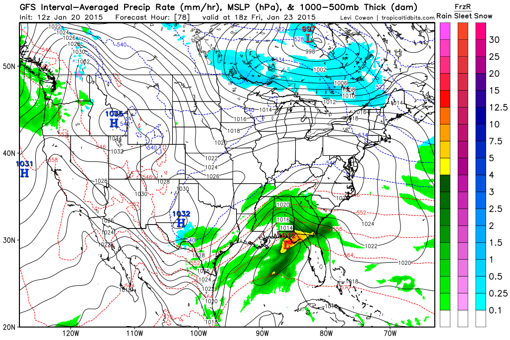
1 pm Friday Afternoon – GFS
Eventually this storm system will traverse the Southeast states and exit the North Carolina coastline and track northeast passing south and east of the island of Nantucket overnight Saturday into Sunday. See below:
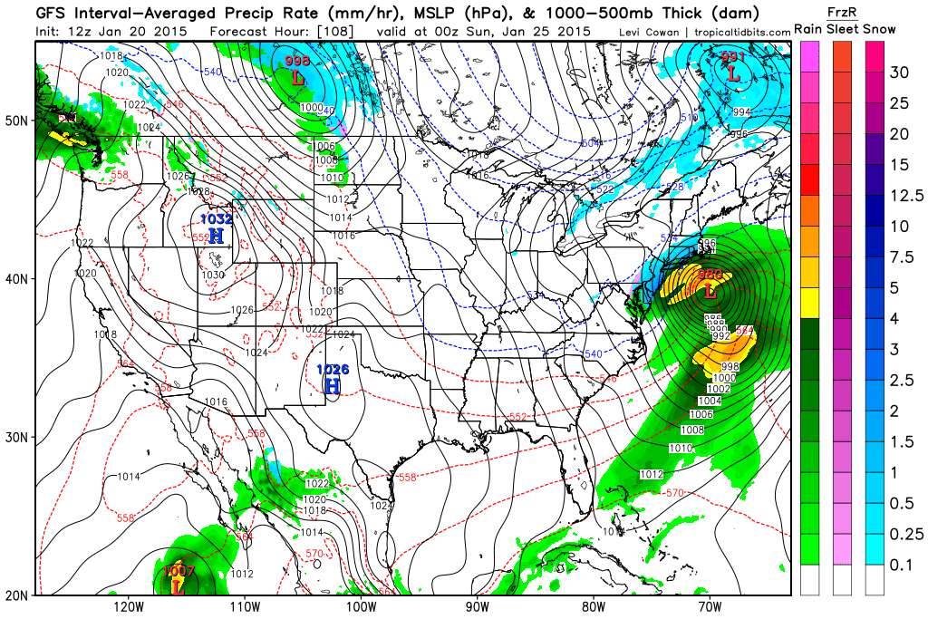
7 pm Saturday Night – GFS
The real question is: will the storm pass close enough to SNE to bring significant impacts? As currently modeled the storm looks to impact southeast MA, Cape Cod and the islands. But it is so close to being so much more for the rest of SNE that is absolutely needs watching.
If the storm track were to shift 50-75 miles west over the next 4 days (very possible) then all of SNE (away from the coast) would be looking at an extremely intense 12 hour snow blitz Saturday night.
But since we are 4 days away from the possible onset of the system, many details can change and the eventually outcome is far from being known. At this time, the Saturday night timeframe just bears watching.
Saturday night isn’t the only storm threat on the horizon though. Following Saturday’s potential is an equally potent set-up for Tuesday. As our weekend storm exits northeast into the Canadian Maritimes a potent piece of energy associated with a clipper type system will drop southeast across the midwest and beline for the mid-atlantic coast line.
Once the system begins to sniff out the warm waters off the East Coast a new area of low pressure will begin to take shape off the Carolina coast.
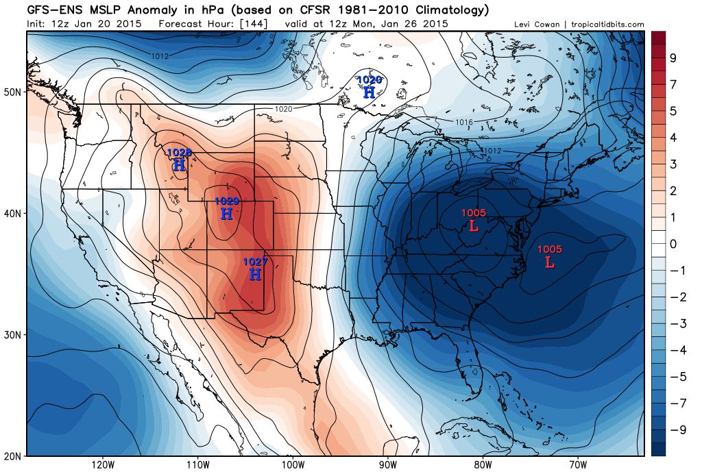
7 am Monday – GEFS
From here the low should track north-northeast passing just east of Nantucket during the day on Tuesday.
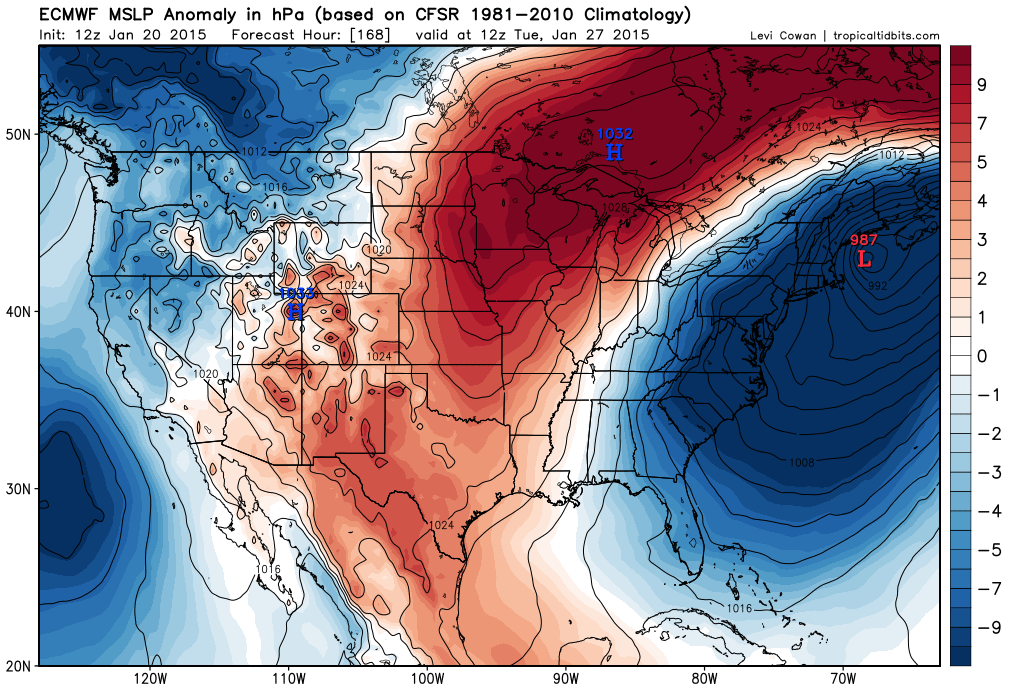
7 am Tuesday – ECMWF
The purpose of this post is to just highlight the potential that for storminess in the next 7 days. Right now it appears there are two CHANCES for snow in the forecast. First being Saturday night with the second coming on Tuesday. Meaning that these two chances are 4 and 7 days away respectively. A LOT can change in that amount of time. All we can say now is that there is a CHANCE.
But being honest, these two storm threats are the best that we have seen all winter long with both having the potential to bring significant impacts to the region.
Only time will tell so stay tuned.
-Chris
