Today’s rain is brought to you buy an anomolous upper level trough that dropped south out of Canada and is now progressing through the Great Lakes.
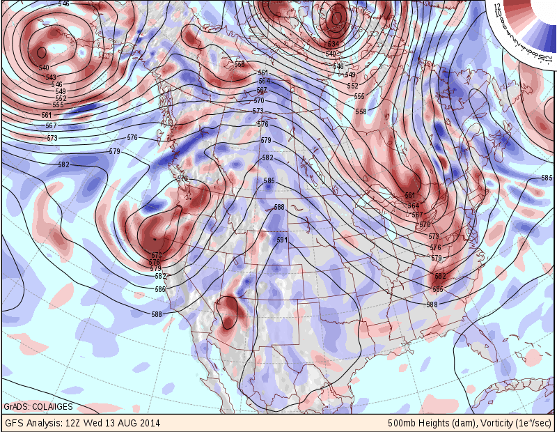
500 mb Heights
The image above is the 12 z analysis that clearly shows an extreme dip in the upper level pattern over the eastern Great Lakes. A pattern such as this is not typical for this time of year, but is more of a winter-type atmospheric evolution. (Side Note: If this pattern holds through this winter: then look out!!)
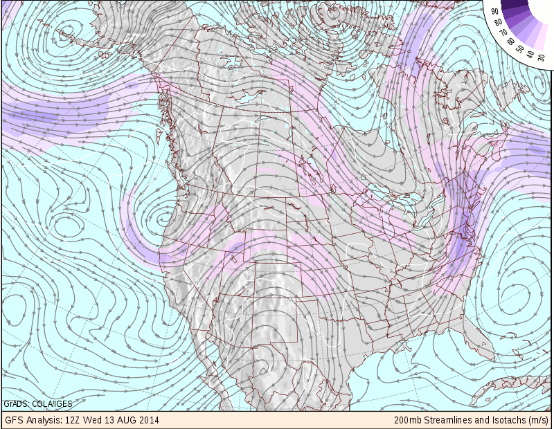
200 mb Streamlines
The image above is the 12z analysis of the upper level wind pattern. While this one is a little more difficult to read the key components are the shades of purple moving over New England; representing a region of stronger winds aloft. And the lines with arrows (known as streamlines) represent the flow of air aloft. If you look closely over Southern New England you notice that the lines appear to be getting further apart from one another. This seperation of the wind field aloft is called Divergence. To make things simple divergence aloft is associated with rising air motion. Rising air motion is what is needed to create clouds and rain.
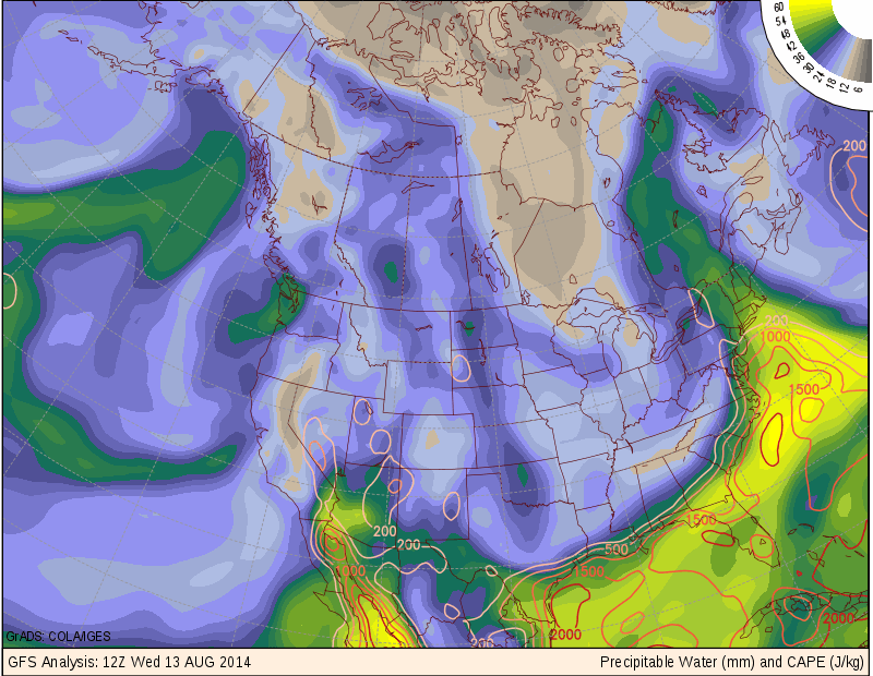
Precipitable Water
The combination of the upper level trough which is good for storm development with the divergence aloft which is also good for storm development are only two ingrediants into this rain events receipe. The third one is very moisture heavy air. The green and yellow shadings represent very high moisture laden air; meaning that when it rains, that a lot of water is going to fall from the sky. The image above combined with the 200 mb wind image seem to promote the idea that our air is coming from the Gulf of Mexico.
All 0f these factors combined to produce a record breaking event on Long Island this morning where more than a foot of rain fell in some locations. The follwing image is of doppler radar estimated rainfall amounts from the National Weather Service. Flooding this morning on Long Island was widespread.
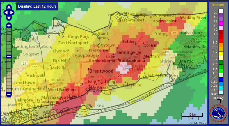
Radar Estimated Rainfall Totals
Today is just a rainy and windy day all around. Things get better for the weekend.
-Chris
