If you were looking for the weekend of the year, then this might be the one. This mornings rain has pushed offshore and in fact the sun as come back out. The storm system that produced todays rain will drift off to the northeast and linger near Nova Scotia. Unfortunately for the state of Maine this means that clouds and chances of rain will linger through the weekend.
For the other 5 states in New England high pressure near the Great Lakes will drop in and provide what is going to be a most excellent weekend. Now that we have reached the month of June we have entered Meteorological summer (June 1 – August 31) and this weekend looks to be the first true beach weekend of the summer. After a mostly cloudy start on Friday as today’s storm drifts northeast the rest of the weekend should feature few clouds and ample sunshine. Afternoon highs on Saturday and Sunday should reach into the mid-80s; even at the shore as the wind direction will be out of the northwest.
The following three images are the daily forecast maps from the Weather Prediction Center for this weekend.
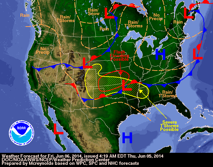
Daily Forecast Map for Friday
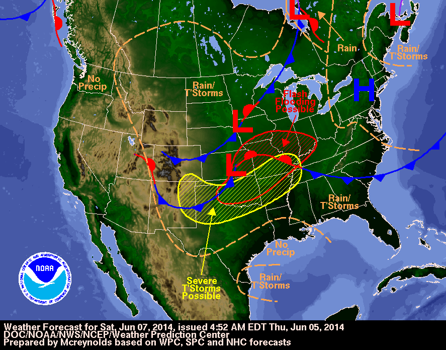
Daily Forecast Map for Saturday
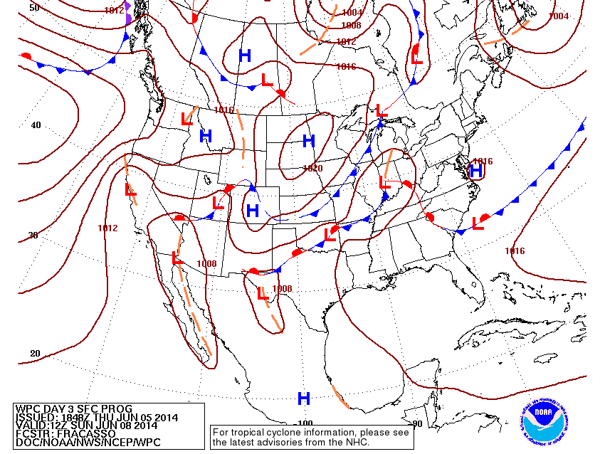
Daily Forecast Map for Sunday
The three images are helpful in that they depict the two synoptic features in play this weekend very well. The low pressure center that brought todays rain that slowly drifts northeast and lingers near Nova Scotia. And the high pressure center that drifts east from the Great Lakes that provides the excellent conditions for this weekend.
ENJOY!!
Weekend Forecast
Friday: Mostly cloudy to start, but becoming partly cloudy with high temperatures 70-75. Northwest winds at 5-10 mph.
Saturday: Few clouds with afternoon highs near 85. Northwest winds 0-5 mph.
Sunday: Few high clouds moving in with afternoon highs near 85. Southwest wind 5-10 mph.
Next Week: Warm to start with highs in the mid 80s on Monday; chance of an afternoon storm. Tuesday brings cooler conditions with highs in the low 70s. After that the rest of the work week will feature highs either side of 80 with a chance of a shower or storm on Wednesday and Friday.
-Chris
