Now that the Blizzard has passed and the Cape has made it out ok we can turn our sights towards Spring. But before we get there we have some unsettled weather to get through. I am going to show you two images from two of our computer guidance models. Each image represents that piece of guidance’s depiction for total precipitation between 8 pm last night and 8 am Tuesday morning.
The first image is from the European model and paints a picture where pretty much all of New England recieves a couple inches of precipitation between now and Tuesday morning. Southern New England and the Maine coast receive closer to three inches of precip.
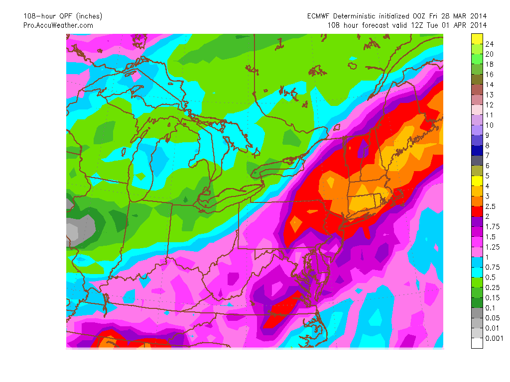
ECMWF Total QPF through 12z Tuesday
The second image is from the American GFS model for the same timeframe. It too is basically giving all of New England at least a couple inches of precipitation. This time with Western New England receiving upwards of three inches of precip.
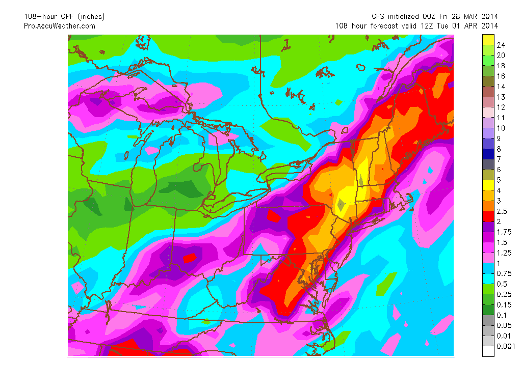
GFS Total QPF through 12z Tuesday
Either way that you look at it a lot of water is about to fall on our heads. All of this being caused by an extremely slow moving storm system pushing off the East Coast. Below is the current infrared satellite image. The colors represent cloud top temperature. The bluer the shade, the taller the cloud. The taller the cloud, the more significant the storm is.
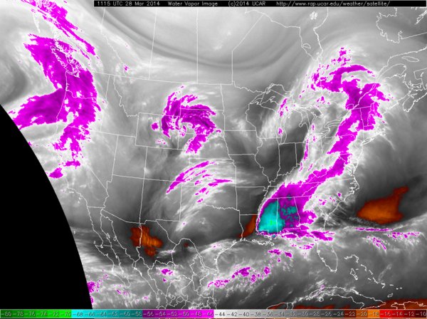
Current IR Satellite Image
This afternoon will feature the occasional rain shower/downpour associated with the batch of purple shading to our west in the image above.
During the day on Saturday is quiet. Highs during the day may well reach to near 60. Late Saturday afternoon/night heavier rain will overspread the region. This rain is associated with the brighter blues that are forming along the Gulf Coast. It will rain heavy through late Sunday afternoon. From Sunday afternoon through say Monday evening there will be times of steadier rain, but it will come in bursts.
When all is said and done by Tuesday night, most of the region will have recieved 2-3″ of rain. Would not be surprising if someone in Southern New England picked up 4-5″ of rain if things work out perfectly over the entire period.
The good news is that this storm system isn’t snow. The air mass in place is just not cold enough. Meaning we can trade in our shovels for umbrellas.
-Chris
