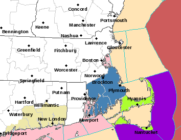
One extremely powerful storm is going to form off the East Coast Tuesday night and Wednesday morning. Fortunately the storm will pass just far enough offshore that the worst of the system will remain out to sea. Below is the current Watches & Warnings map from the Weather Service in Taunton. The light green shading represent Blizzard Watches. The lighter blue represents Winter Storm Watches. The red shading over the ocean represents a Hurricane Wind Warning.

Current Watches & Warnings
The Hurricane wind warning is very warrented. From a meteorological standpoint this system is going to explode off the Mid-Atlantic states. Undergoing such rapid strengthening that bombogenesis (24 millibars in 24 hours) will not be an accurate adjective. There is the potential that the storm will strengthen by 50 millibars in a 24 hours period.
In fact I am quite confident that as the storm passes by to the east of New England that it will likely develop an eye-like feature similar to a hurricane. Even if this feature does not occur, this system will likely produce some extremely epic satellite images. For my satellite sites, follow the links below:
http://wwwghcc.msfc.nasa.gov/GOES/goeseastconusir.html
From a meteorological standpoint it is quite dissappointing that the storm will miss us. It truly would go down in the record books if it were to directly hit us. Mostly for the time of year, but also for its strength. Below is the forecasted 850 mb wind speeds for 2 pm Wednesday afternoon. The European model is advertising an extremly large swath of winds of greater than hurricane strength.
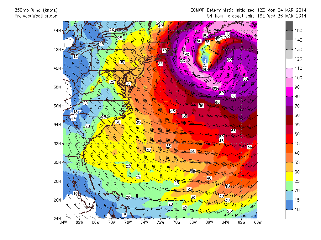
850 mb Wind Speeds
At the same time the surface pressure chart is projected to look like this. The color shadings are precipitation in the previous 6 hours.
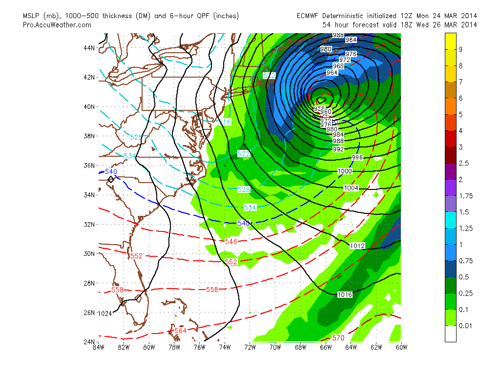
MSLP
Notice how the precipitation shield misses most of Southern New England and just brushes the outer Cape. And this is where the most snow will fall. Below is the forecast map from the Weather Service in Taunton.
Forecast Snow Map
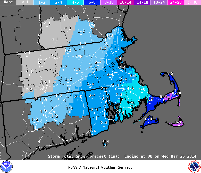
I’m sorry that I am being a bit unoriginal here and just using the forecast from the NWS. While this storm does fascinate me and I am excited to see it unfold, it is my opinion that its impacts outside of the Cape & Islands will be uneventful. Maybe just few higher wind gusts.
It is also my belief that the precipitation shield on the northwest side (us) of the low will feature a very sharp cutoff as the system bombs out. And that accumulation west of the Canal will be kept to a minimum.
Barring an unforeseen jog to the west in the computer guidance over the next 48 hours, we are just going to miss an amazing meteorological phenomena.
GOOD NEWS!!! This storm system will usher in a change in the atmospheric pattern. And Spring might finally begin to arrive with temperatures reaching into the 50s on Friday & Saturday. Yay!!
-Chris
