The relatively quiet stretch the we have been enjoying around these parts is going to come to an end Wednesday afternoon/overnight. While not impressive at the moment, the batch of snow showers over Idaho and Montana will go on to form a fairly potent area of low pressure that will pass through Southern New England Wednesday night. Below I have displayed the current U.S. radar to show where our storm is coming from and where it will be going.
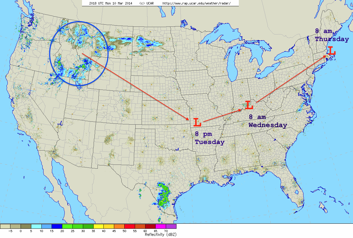
Current U.S. Radar w/Storm Track
This mornings GFS and ECMWF operational & ensemble model runs are in extremly good agreement with regards to the storm track/placement of the surface low pressure center between now and Thursday morning. Because there was such a good agreement between the two it was easy to base the forecast on a blend of the 4 different model solutions.
Timing: Precipitation moves in from west to east across southern and central New England during the late morning hours on Wednesday. Precipitation overspreads all of New England throughout the afternoon and last through the overnight. The heaviest of the precipitation is over by 8 am Thursday morning across SNE, mid-afternoon in NNE as the now fairly strong low pressure center pulls northeast.
Rain/Snow: This is going to be a mainly rain event for all of Southern New England. There is a chance that this may start as a bit of a snow/mix type deal near the Mass border with VT/NH as surface temperatures and temperatures aloft will be flirting with freezing. But either way it will transition over to rain for all of SNE. Right now my best guess on the furthest northward push of the rain/snow line is from Bennington, VT over the Keene, NH, through Manchester, NH over to say York, ME. Places north of the line will likely stay all snow and could see a good bit of it. Places south of this line should expect a good amount of rain that will eventually end as snow as temperatures crash Thursday morning.
Commutes: It appears that this storm will be such that two commutes will be impacted. The Wednesday evening commute will definitely be impacted and depending on where it is you are traveling you will be either faced with heavy rain(south) or heavy snow(north). The Thursday morning commute is a different story. The exact time that precipitation will end is a bit fuzzy at the moment. Right now it appears that the backside of the precip will swing through sometime around 8 am. Meaning that the morning commute will most likely be impacted by the last of the storm and by crews cleaning up.
Snow: As temperatures plummet early Thursday morning most locals will end with a period of snow. The timing for when the transition from rain to snow will occur is crucial to how much snow will fall and is also extremely tricky to nail down. Also difficult to forecast is the position of the rain/snow line. The map below reflects my best guess as to how things will play out. Obviously if things begin to trend away from what I show below then the map will have to change. But for right now this is what I am going to run with.
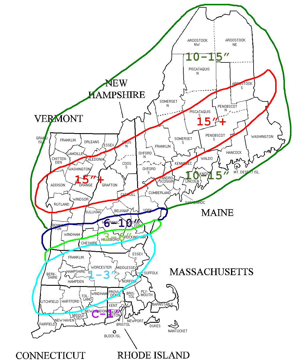
Total Snowfall through Thursday Morning
Thursday: Thursday is not going to be a particularly pleasant day. As the storm continues to strengthen and exits northeast temperatures are going to plummet throughout the day. The days high temperature will most definitely be recorded at midnight. Northwest wind gusts on the order of 35-40 mph combined with temperatures falling through the 20s and into the teens will make for a rather miserable afternoon. With lows Friday morning very likely in the single digits. While Friday will not be the warmest day with highs in the low 30s, Saturday is looking nice with temperatures rebounding to near 50.
-Chris
