Winter is never going to end….or at least it feels that way. Besides the random quick couple day warm up we have been experiencing below normal temperatures for the better part of three plus months now. And unfortunately things will continue.
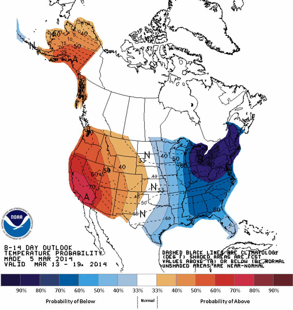
CPC 8-14 Day Temp Outlook
The image above is from the Climate Prediction Center. What this image shows is that we here in New England have a 70% chance of experiencing below normal temperatures for the next two weeks accorsing to the Climate Prediction Center.
The following three images are from the GEFS model guidance courtesy of the wonderful model page developed by the guys at Tropical Tidbits. What each images shows is the 5 day averaged temperature anomaly (how it relates to average).
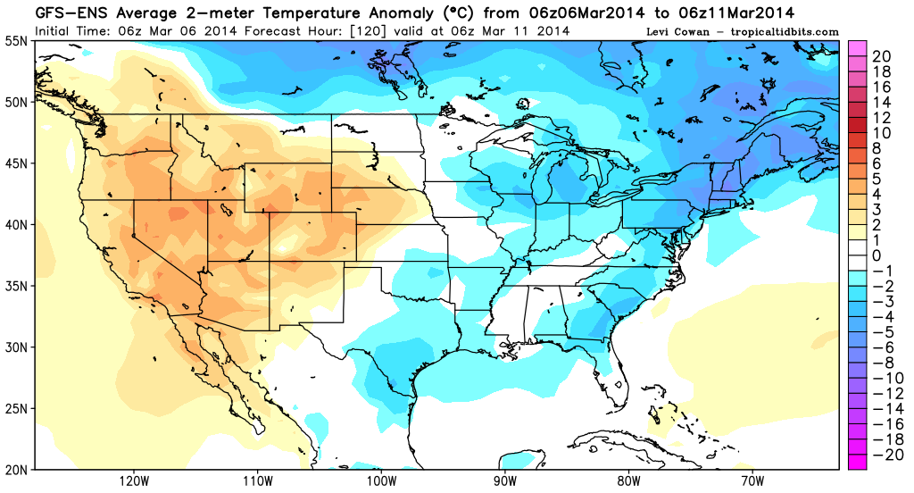
GEFS Temp Anom Days 1-5
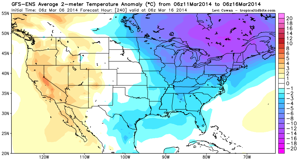
GEFS Temp Anom Day 6-10
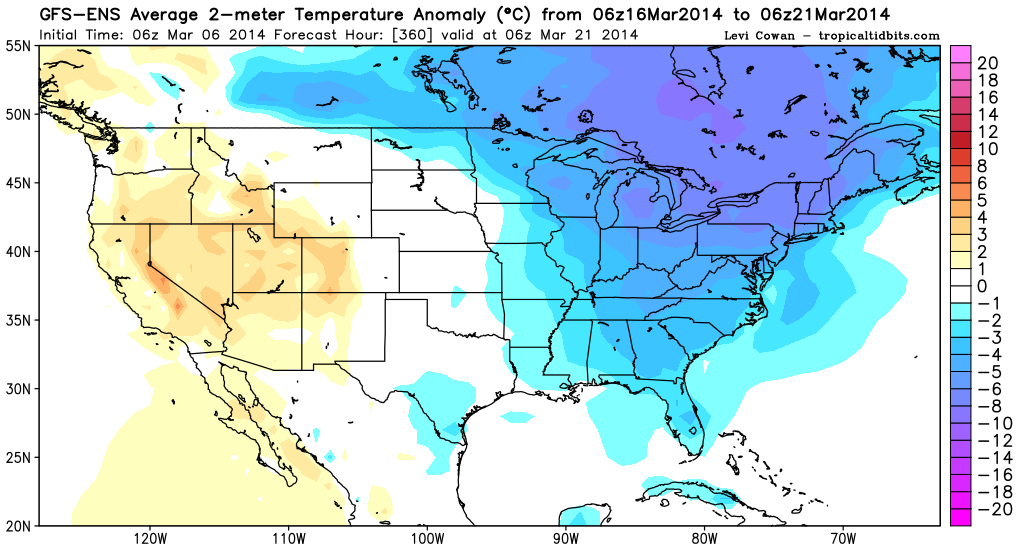
GEFS Temp Anom Day 11-15
As you can see based on the three images above the entire 15 day period is forecast to showcase below normal temperatures. Which after writing this sentence a frown has formed on my face. Typically I root for cold and snow, but at this point I have had it. Meteorological spring began on March 1 and damn it it is time for spring.
As for the other thing that we have had way too much of; snow. Our next real chance of snow isn’t for about a week. And I firmly refuse to answer any and all questions on said potential storm system until it is within 5 days.
There is something to look forward to in the near future. It appears that we may actually see high temperatures in the low 40s again this coming Saturday; followed by a colder Sunday and possibly low 40s again for early next week.
-Chris
