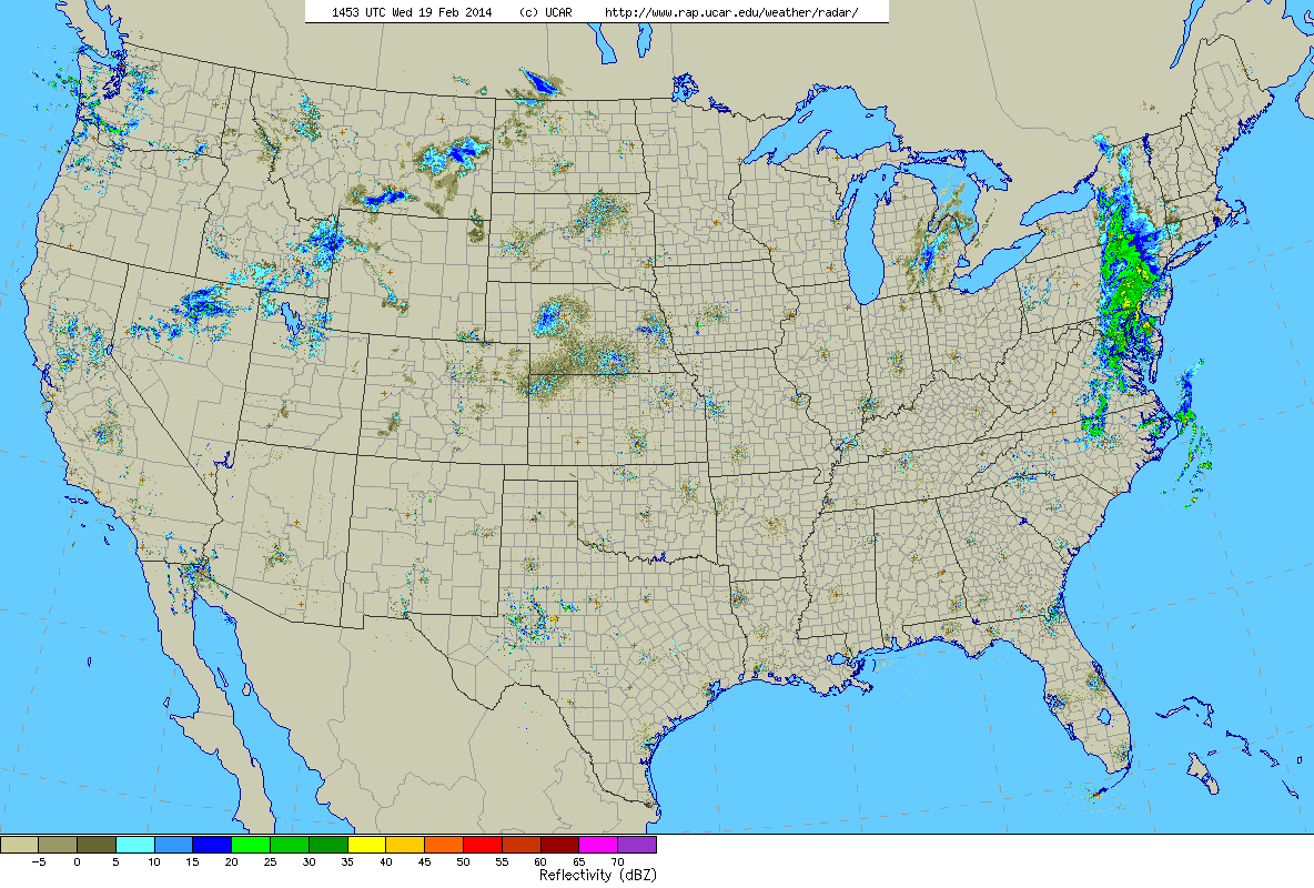
10 am Radar
One last batch of rain/snow is moving through today before we thaw out for a little bit. That batch of showers over eastern Pennsylvania will move through the region this afternoon. Let’s say from about noon through the evening we can expect period of rain and wet snow.
Here is the 10 am temperature map for Southern New England.
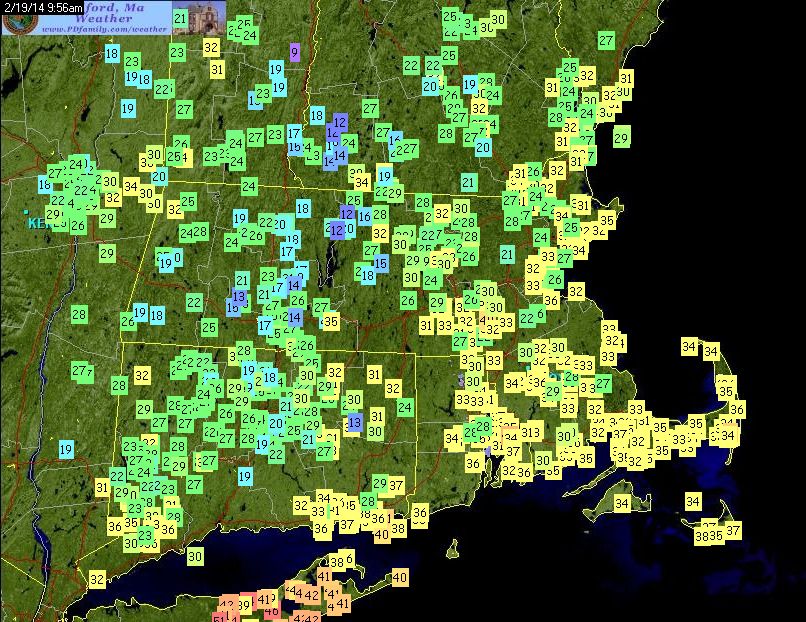
Surface Temperatures at 10 am
For all those south of the Mass Pike this should be a mainly rain event. While surface temperatures are cold enough for snow, temperatures aloft are warm enough to support rain. As we progress over the next couple of hours we should see temperatures across Southern New England rise above freezing.
BUT, it would not be surprising if the surface temps stuck below freezing in a few spots. If this does occur then there could be some areas of freezing rain as the rain drops fall into the below freezing air. If this happens then some slick spots can be expected. The most likely locations for the would be northern Connecticut through central Massachusetts along the Connecticut River Valley.
As those north of the Mass Pike they could start as snow. This snow should be very wet and heavy and accumulations should be minimal. A slushy inch or two at most. Temperatures aloft are just too warm.
Here is the latest snowfall forecast from the RAP model for the rest of today.
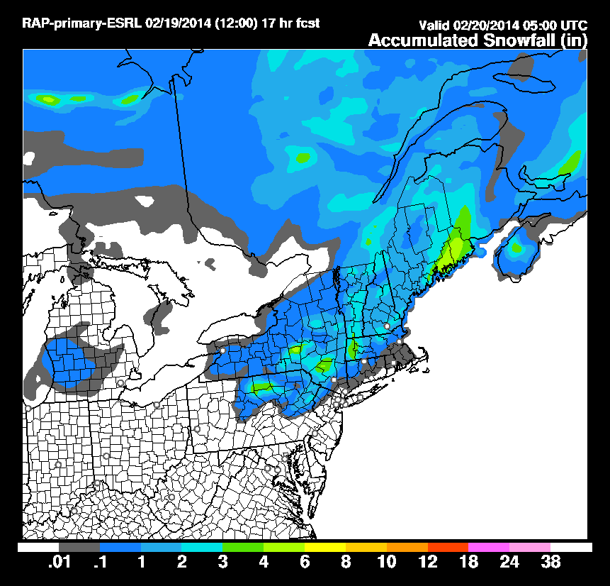
RAP Snow Forecast through 06z
Notice how next to nothing falls in Connecticut or Rhode Island. And even in Massachusetts only an inch or two falls in most places. Except for the Berkshires where the model has 2 or 3 inches falling. This model paints eastern Maine as the jackpot location again for the third storm in a row.
GOOD NEWS!!!
After this batch of precipitation we warm up! A very large and powerful storm will track to our west. And when I say west I mean like west of Chicago west. This puts us on the warm side and will allow warm air to move in from the southwest and allow us to thaw out for a while. Highs should be in the low 40s tomorrow and the upper 40s by Friday & Saturday and finally back to around 40 for Sunday.
Enjoy the warm up while you can as signs point at us going back to the freezer next week.
-Chris
