Another round of light snow is on its way for the daytime hours of Tuesday. Current our system is pushing through the midwest and it actually popping thunderstorms over Illinois based on satellite and lightning tracker.
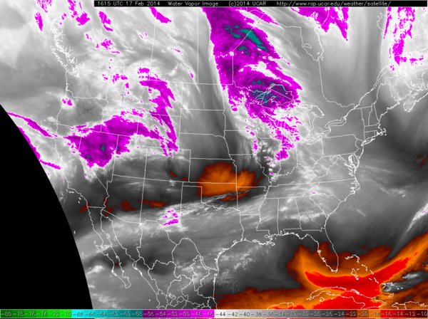
Current Infrared Satellite
This system will continue on a mainly easterly course and pass right along the southcoast before swinging up the coast towards downeast Maine. In doing so it will drop a few inches of snow for most. Higher amounts can be expected from northern Worcester County northeast along the Maine coastline.
The timing on this one is going to be a little tricky. The morning commute should not be a problem in the Boston area as snow may be falling but it will not have accumulated yet.. It is the afternoon and evening commute that is in jeopardy as this is when the heaviest of the snow will come down. Say from roughly 1 pm through 6 or 7 pm will be the heaviest of the snow. Not good for the those trying to get home from work.
As for how much snow is going to fall this event should be more minimal that the last couple. Presently Winter Storm Watches are up for northern portions of Worcester & Middlesex counties in Massachuestts as well as those adjacent counties in southeastern New Hampshire.
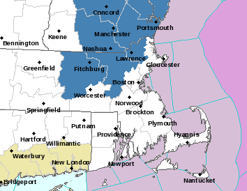
Current Winter Storm Watches
As for how much snow I expect see my map below. Thinking a stripe from Worcester to the eastern tip of Maine will receive the most snow. Somewhere right around 6 inches. With lowering amounts in either direction.
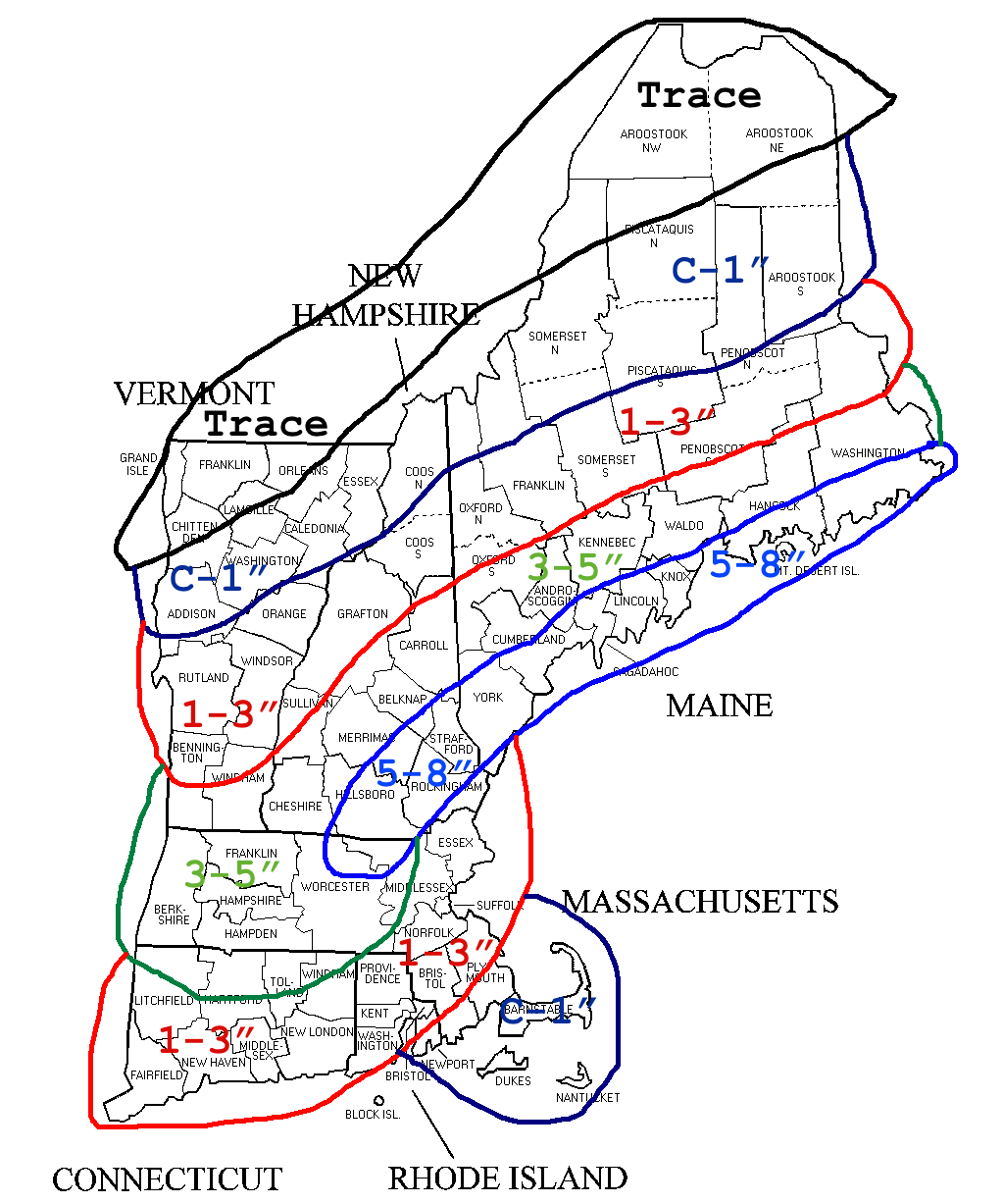
Tuesday 2-18 Snowfall
-Chris
