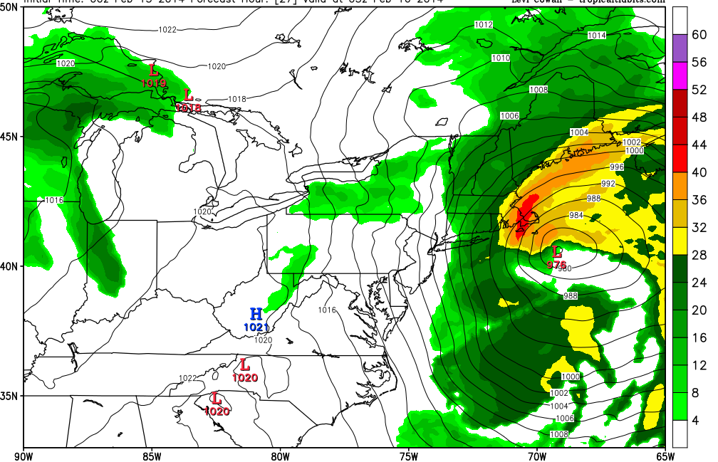
Tomorrow’s storm is literally going to explode off the East Coast. This rapid intensification is called bombogenesis. Yes that is a technical term in the meteorological world. It describes a storm system that strengths by more than 24 mb in 24 hours. Tomorrow’s storm looks to strengthen by 24 mb in roughly 12-15 hours.
Blizzard watches are up for all of Cape Cod & the Islands as well as the rest of the eastern shores of Massachusetts. And I am quite confident that Blizzard conditions will verify for at least the Cape & Islands. Moderately confident they will verify for places along the coast north of the canal.
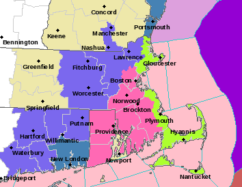
Current Watches & Warnings
The image above is the current watches & warnings for the Taunton National Weather Service forecast area. The green shaded areas represent the Blizzard Watch. Pink shade is Winter Storm Warnings. The light purple color is a Winter Weather Advisory.
As I preciously stated this should be an extremely intense, but quick hitting system. Snow starts flying around 5 pm. And the storm is gone by 5 am Sunday morning. It is those 12 hours in between that are going to be pretty nuts. Basically a winter hurricane is going to pass east of Cape Cod. This should make for some very cool satellite images.
It will also make for some very intense snowfall rates. Especially across Cape Cod. The image below is a simulated radar reflectivity from the NAM model. Anything in the yellow shading is very heavy snowfall, while the red shading is almost unseen snowfall rates. It is shaping up to be a wild night on the Cape.
Simulated Radar Reflectivity 10 pm Saturday
Besides the snow, it is going to be a wild night because of the wind. With such a rapidly strengthening system the winds will be rapidly strengthening as well. Places on the outer Cape will likely gust past hurricane strength at times overnight Saturday. Here is the NAM’s depiction of what the 10 meter wind gusts could potentially be.
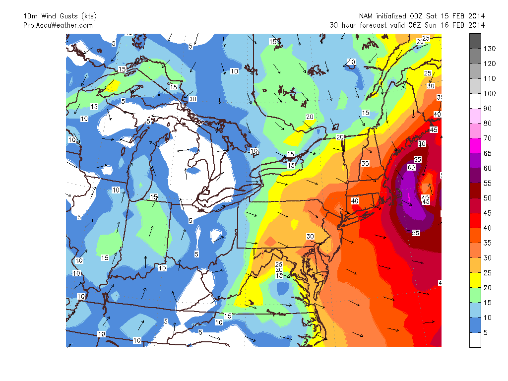
10 m Wind Gusts via AccuPro
Now the value is in knots. Take that value and multiply by 1.15. For example 60 knots = 69 mph. While not hurricane strength, winds just off the deck are sustained at 65 knots or greater. During the times of heaviest precipitation these winds can be dragged to the surface by friction.
As for how much snow we are going to get this is tricky. One fear that I have is that the western edge of the precipitation field is extremely sharp. Meaning that you could go from 18″ of snow in Plymouth County to less than 3″ in eastern Connecticut. But since this is something that is hard to determine before the system has developed my map is based on a more broad precipitation field.
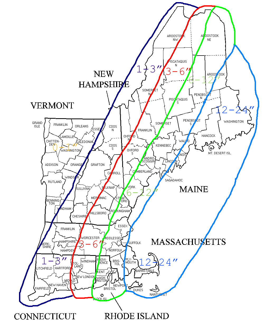
2-15 Snowfall
This is a tricky forecast to nail down how much snow is actually going to fall. If someone in eastern Massachusetts ends up in a band for a significant period of time, then they could end up pushing 2′ of snow. While places 5 miles away only end up with 12″.
But this doesn’t mean that places outside of eastern regions couldn’t end up in a similar band. A rogue band setting up to the west would ruin this forecast and is quite possible. Meaning that someone in the 3-6″ range could end up with double digits. Who knows?
Due to the intense banding nature that is going to happen I have had to leave the snow ranges a bit more broad than usual. I’m just unsure of where these bands will set up. I know that Cape or a part of the Cape will get nailed. But is it the whole Cape or just a half. Does Chatham get 2′ while Sandwich only sees 12″. Only time will tell.
But for right now this is what I have come up with. My fear is that the Cape ends up with 20″+ while anyone west of Worcester gets a few flurries. If this occurs I can say that I have warned you.
Likely one more update in the morning before the first flakes fly.
-Chris
