Everyone finished digging out from yesterday’s snow storm? Good. Well let’s get ready to do it again.
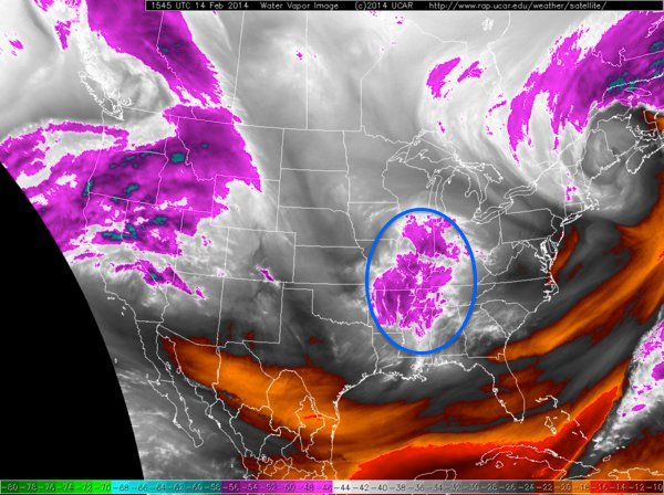
Current Water Vapor Image
This batch of clouds and precipitation over the western Ohio Valley is associated with a potent little piece of energy diving southeast out of Canada. One this piece of energy begins to sniff the Atlantic Ocean off the Carolina coast the surface low pressure center will begin to rapidly intensify. Intensifying from a mid-990 mb storm to a sub-970 mb storm in about 18 hours. Undergoing bombogenesis off the East Coast.
Now the key to this whole forecast is just how close this storm passes to New England. Let me start by saying that on its pass by the storm will be producing blizzard conditions. It is just a matter of if the storm passes close enough to bring those blizzard conditions over us.
The GFS American model has been consistent with its last 3 runs in doing this. While much of the other guidance is just a bit further offshore. However all model guidance throws enough precipitation back in SNE that accumulating snow is going to fall. The big question is just a matter of if the storm passes close enough to produce a quick hitting blizzard.
Unfortunately the true impacts from this storm might not be figured out until they are occurring. We are less than 24 hours from the first flakes flying and the computer guidance has not yet reach a good consensus on what is going to occur.
Right now this is what I am thinking. Kind of put the truth as to what will happen between the GFS and the rest of the guidance.
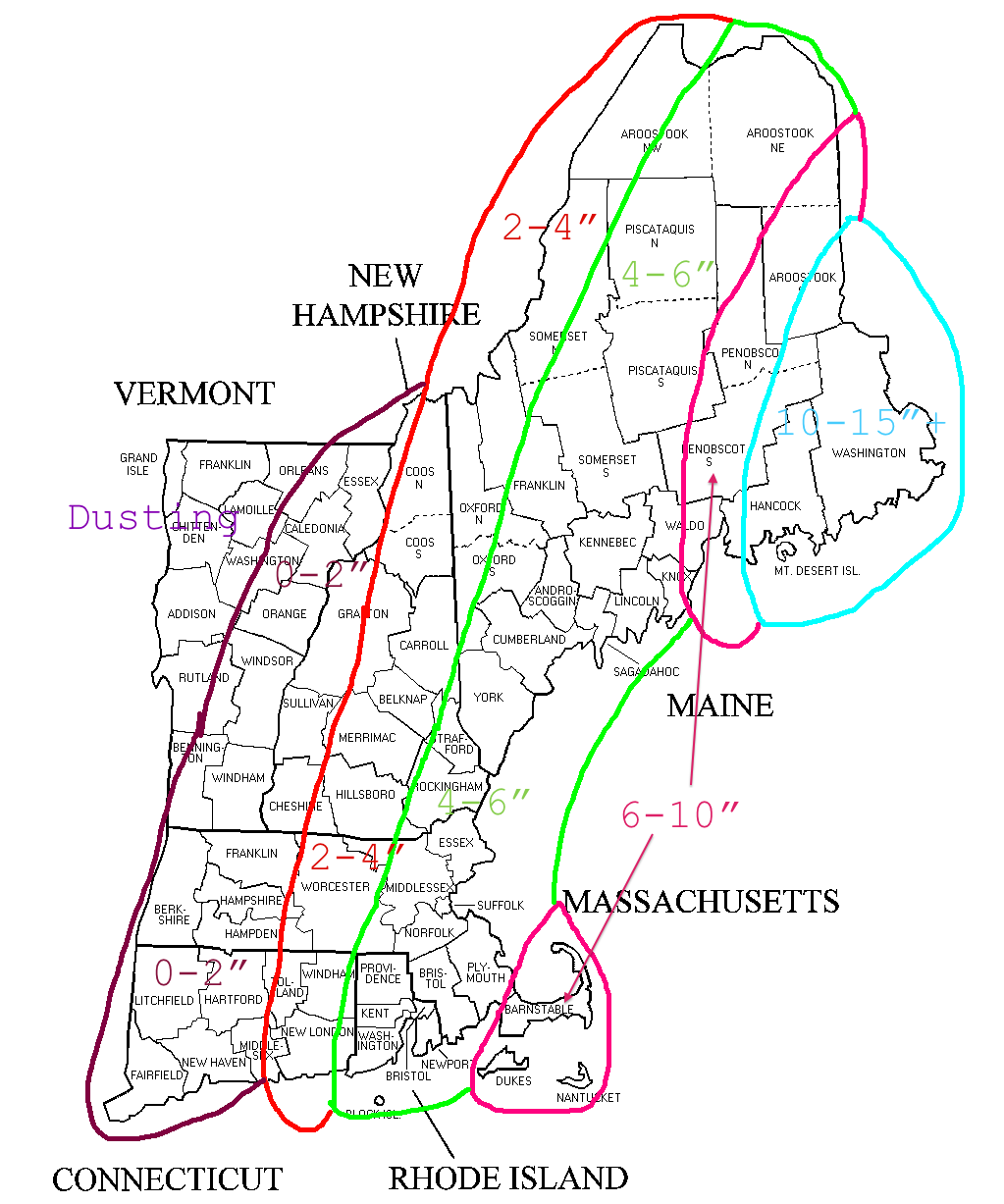
2-15 Snow Forecast
Remember that if this shift ever so slightly to the west then these numbers go up drastically. If things shift to the east, then the go down slightly.
Will hopefully have another update tomorrow morning with much more confidence.
-Chris
