This storm is truly a significant (possibly historic) one. Winter weather watches & warnings are in place from Mississippi to Maine with all places in between. Parts of Georgia & the Carolinas are receiving major snow and ice while central Florida is preparing for severe thunderstorms. Snow is to be expected from Charlotte to Washington to New York City to Boston points north.
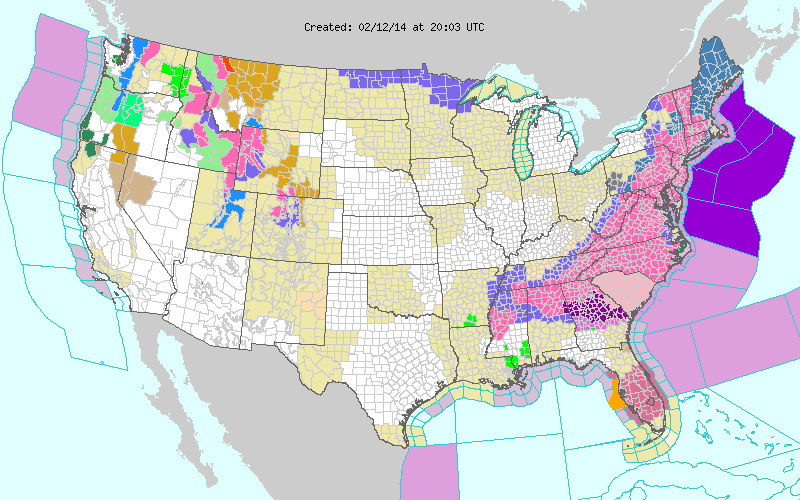
Current Watches & Warnings Map
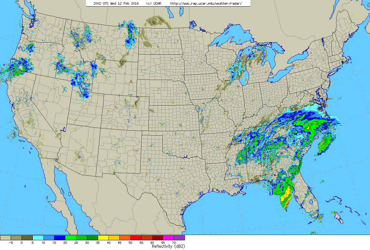
Current U.S. radar
The image above is the current U.S. radar with our storm impacting the southeastern states. Current mesoanalysis has our system as a 1008 mb low pressure center over the northwest Gulf of Mexico. After tracking across northern Florida the storm will then swing up the East Coast. Passing very near to Cape Hatteras, North Carolina. From here the storm should track very near the island of Nantucket and the outer Cape.
With a track like this and origins from the Gulf of Mexico warm air will be an issue. Meaning that there will be the dreaded rain/snow line. The placement of this rain/snow line is the key to the whole forecast and the detail that us meteorologist are agonizing over the most. A shift in this feature of 25 miles or so could be the difference between 4 inches of snow and 14 inches of snow.
As for what I expect the rain/snow line to do throughout the storm I have created the graphic below in which I have outlined my best guess at the location and orientation of the rain/snow line throughout the event.
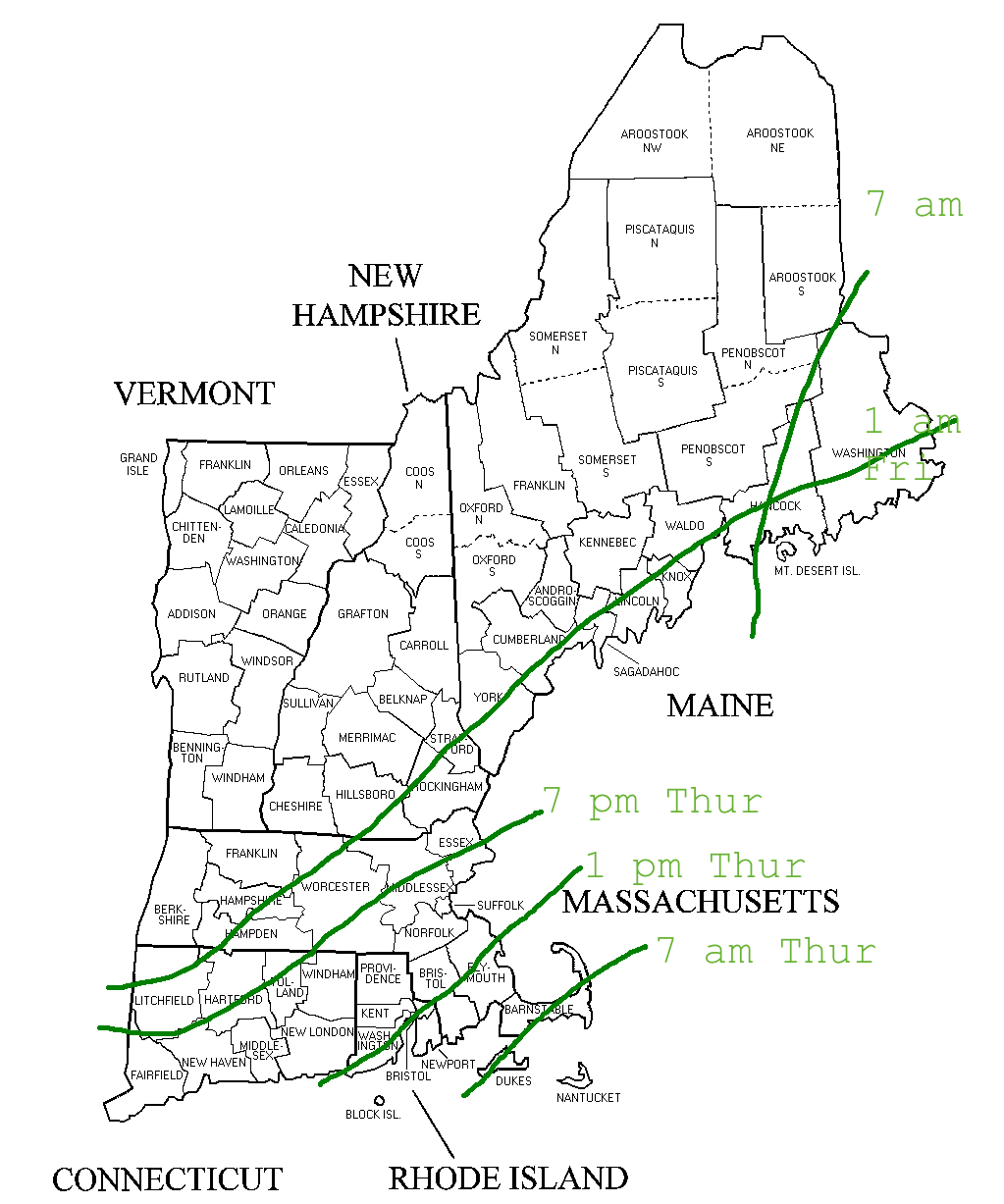
Rain/Snow Line
As you can see from the image above this storm is going to be quite the long duration event; unlike our last one where most got 8-12″ in 8 hours, most will get 8-12″ in 20-24 hours.
Timeline: Snow moves in north to south very early Thursday morning. It could be snowing along the southern shores by as early as 4 am. By 7 am snow has reached the Massachusetts Turnpike. All of Southern New England is snowing steadily by 10 am. By the time we reach early afternoon Central & Northern New England are getting in on the action. Precipitation is heavy through the afternoon and into the early evening.
Now this is where the forecast gets tricky & interesting. There is probably going to be a break in the action where precipitation rates let up and most of Southern New England flips over to a light snow or even drizzle. But as we reach say 10 pm Thursday evening things should pick up again as the primary area of low pressure rapidly intensifies southeast of Mantauk point on the tip of Long Island.
This rapid intesification could lead to a period of very heavy snowfall on the northwest side of the system. It is within this band of snow where our highest totals are found and I believe the placement of this band is outlined in my snow map below. The all ellusive and always impressive phenomena of thundersnow could make an appearance in this band if vertical motion is strong enough.
Snow exits Southern New England by 7 am Friday morning and the main show is over for Northern New England by early afternoon as the storm pulls off into southeastern Canada.
In its wake it will have left a mess. Heavy wet snow, sleet, possibly ice and heavy rain are all in store for Southern New England and the map below represents my best educated guess as to what the snowfall distribution will look like when all is said and done. Unfortunately in uploading my image one of my forecast ranges was chopped off. The range in green along the bottom left is supposed to read 6-10″.

Snowfall forecast
The jackpot amount of 12-18″ represents to my best abilities where I think the band of very heavy snow will set up and move throughout the night Thursday into Friday. A slight shift in this band to the northwest or southeast and the jackpot region will have to be adjusted as such.
Now can you see why this is a tricky forecast? Between the rain/snow line and the location of this potential band this was a tough map to make. It could go wrong in many ways or it could go perfect. Only time will tell.
One other impact I want to mention is the wind. With a rapidly intensifying system this will lead to some very strong wind gusts at times. Wind gusts across the region could possibly be as high as 40-50 mph at times overnight Thursday into Friday. Combined with the heavy wet snow that will be coating the limbs and power lines, power outages can not be ruled out.
But I would like to leave you with a glimmer of hope. The newest 8-14 day temperature outlook paints the East Coast and New England as having a high probability of seeing above average temperatures. Yay!!
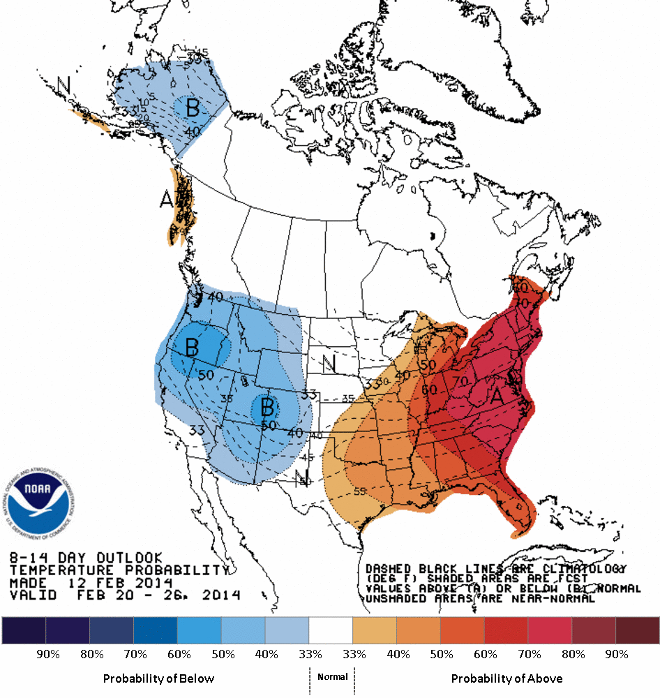
CPC 8-14 Day Temperature Outlook
-Chris
