After a minor snowfall event today a much more sizeable snowfall is on the way for Wednesday. Energy is gathering across parts of western Texas & Oklahoma. With origins in the southern states this system will not be starved for moisture. And while we do not have the coldest of air masses in place it will be cold enough that a good portion of the precipitation will fall as snow. Especially north of the Massachusetts Turnpike.
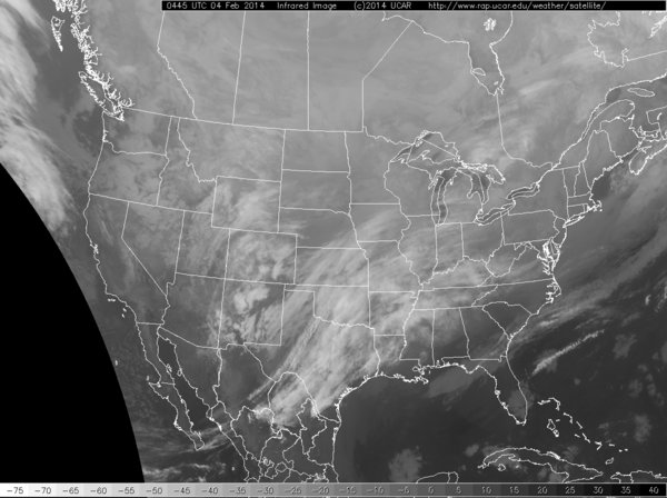
12 am Infrared Satellite Image
The image above is the current infrared satellite image at 12 am Tuesday morning. Our storm is the batch of clouds over the Texas/Oklahoma region. This storm system will track northeast toward West Virginia, picking up lots of Gulf moisture on the way. Once the storm center reaches West Virginia it will begin to take a more easterly track and skirt out south of Long Island and the Cape.
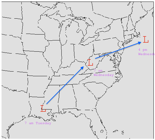
Forecasted Storm Track
With a storm track as the one shown above this will promote an surge of warm air at the mid-levels of the atmosphere. This surge of warm air is crucial to the forecast as those locations that are beneath this layer of warm air will either change over to sleet or plain rain for a period of time. Right now it appears that the surge of warm air will at least reach to the Mass/Connecticut border or even possibly as far north as the Mass Pike.
Those locations that stay all snow are easily looking at 6″+ and likely looking at around 10″. The timeline for this event is mainly during the day on Wednesday. Snow will breakout from southwest to northeast early Wednesday morning with southwestern Connecticut seeing flakes fly by as early as 1 am. It is snowing in Worcester & Hartford by 4 am; all of southern & central New England by 7 am. Snowfall will be heaviest from 7 am to 4 pm and will impact both commutes, especially the morning commute with snow in the air and possibly the evening commute in Boston depending on how long it takes for the snow to taper off.
Steady snow will taper off from west to east during the afternoon. Light snow and flurries could continue through the evening and into the overnight hours, but the vast majority of accumulations will be done by 6 pm.
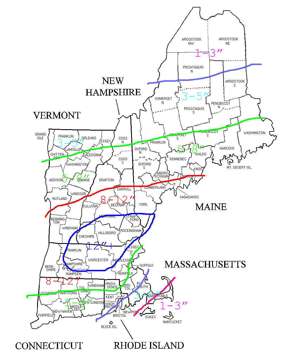
Snowfall Forecast
Right now it appears the jackpot region lies with those locations north & west of route 495 stretching from roughly Springfield northeast into southern Maine. It is these locations that will receive the best combination of cold air and precipitation amounts. Totals drop off to the north due to lower precipitation rates and drop off to the south due to wetter snowfall and eventual mixing with sleet and rain.
So there it is my initial snowfall map for Wednesday’s storm. I’m still keeping a very watchful eye on a potential storm for the second half of the weekend and early next week which is showing early indications that it could be substantially larger than the Wednesday system. But time will tell; one storm at a time.
-Chris
