A lot of talk has been made in the last couple of days about the long range pattern ahead through at least the 4th of July. Well now it is my turn to chime in. And I have to say that I agree with the outlook. It does appear that for the forseeable future there will not be a day where the chance of thunderstorms will not be in the forecast.
But why?
An anamolous highly amplified long-wave trough is going to move into a position just to the west of the East Coast along or maybe just west of the Appalachian Trail. What is amazing about this trough is that it is going to stay in this position for at least and if not more than a week.
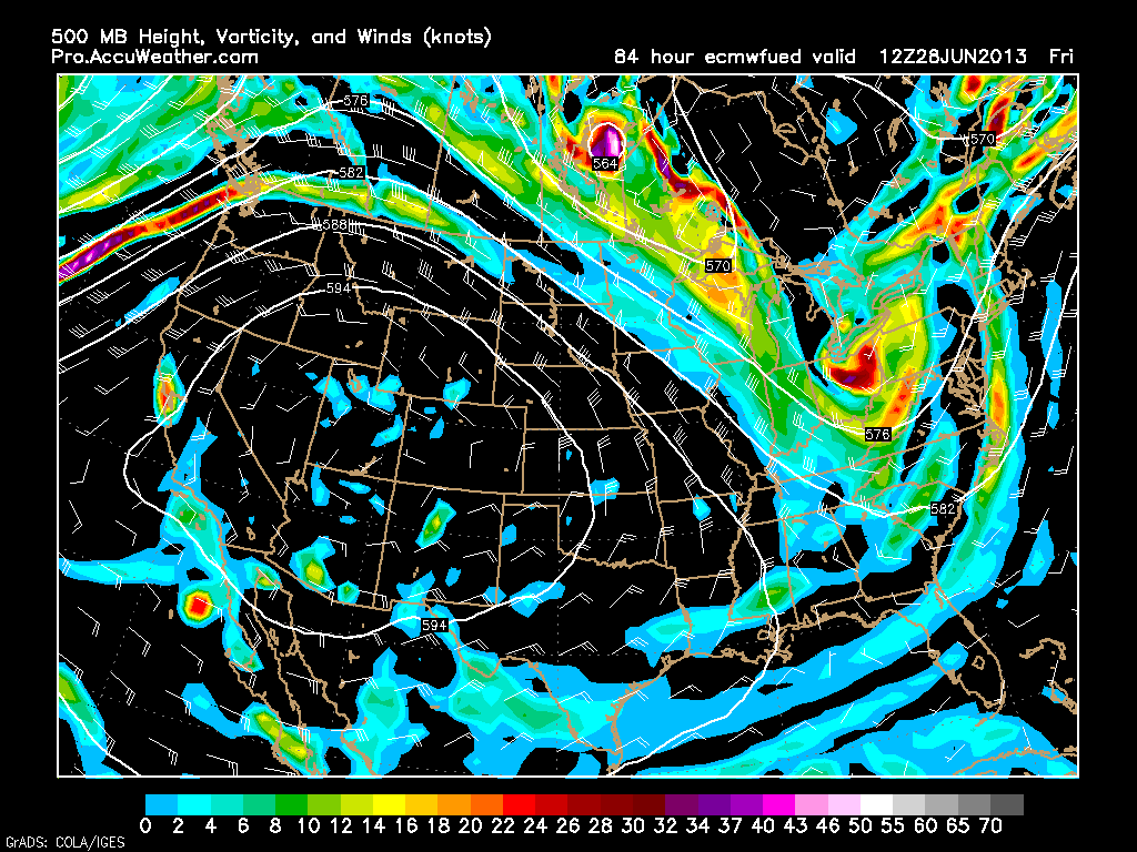
Here is the European Model’s depiction of the trough from Friday morning.
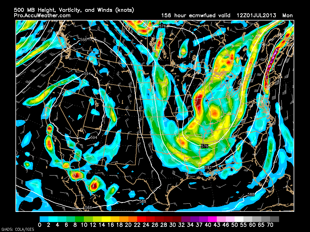
European Model’s depiction of the trough on Monday morning; July 1st.
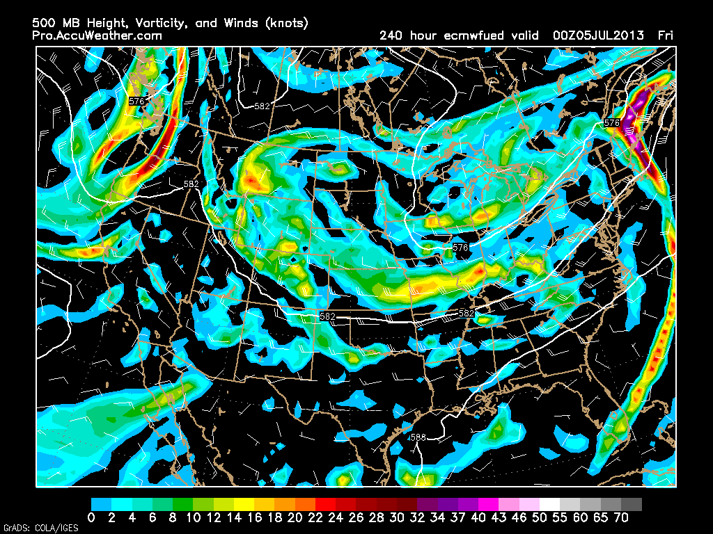
And finally at the end of the model’s run, here is the trough for Thursday evening; July 4th.
But what does all this mean?
What we are talking about is a trough. A trough in the upper atmosphere is a region with generally low atmospheric pressure. Well low pressure is a recipe for disturbed weather; i.e. rain and storms.
But what is also important is the position of the trough. With the axis (center) of the trough positioned to our west along and possibly just west of the Appalachian Mountains, this will allow for the trough to dip into the Gulf of Mexico and stream warm/moist air northward along the Eastern Seaboard.
Let us do a little math. Low pressure with warm/moist air is the recipe for many afternoons with scattered showers and thunderstorms.
Some afternoons will likely feature more widespread and sometimes severe thunderstorms as pieces of atmospheric energy rotate around the base of the trough and make their way up the East Coast.
But all is not bad. Temperatures will be much better than what we are currently experiencing. We can say goodbye to these temperatures in the low to mid 90s and hello to temperatures in the 70s to low 80s.
So looking ahead we can expect more comfortable temperatures that come with the chance of showers and storms everyday from now through the 4th of July. Right now it is difficult to determine if any day will be a complete washout, but there is always that chance. Will have to keep a watchful eye on the chances of a washout and the chances of severe weather.
Today’s Forecast
Partly cloudy with highs in the low to mid 90s. Humid! Afternoon showers and storms between 5-8 pm. Some storms may be severe. So just keep a watchful eye on the sky.
