Been kind of hot our hasn’t it? It’s not the heat that is the problem, it is the humidity. Well usually air masses such as the one that we are in now are ended by a cold front. And that cold front is the mechanism that ignites thunderstorms. Which is what we have in the forecast for today.
In fact the Storm Prediction Center has issued a Severe Thunderstorm Watch for most of New England. A watch means that conditions are favorable for severe weather. This watch is in effect until 8 pm this evening.
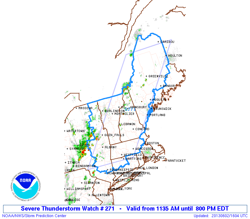
As you can see the watch covers most areas; excluding those areas immediately along the shoreline. SPC has declared the likelihood of tornadoes to be low, but the chances of severe wind are “Very High”. Also the chance of severe hail is moderate.
This afternoon could be a busy one. Storms have fired in Eastern New York state and they will make their way eastward throughout the afternoon. Storm will likely make it to the Worcester area by 3-4 pm. The 495 belt between 5-6 pm.
It is my expectation that the greatest likelihood for severe will be from Worcester westward as the line of storms will likely be dying as they push further east. That isn’t to say that we are off the hook. The main threat is damaging winds. So take your precautions just in case. Bring in loose furniture. Take down those patio umbrellas.
That way when the storm rolls through, if the weather does get bad, you aren’t running around in a lightning storm trying to pick everything up.
-Chris
