An area of low pressure off the North Carolina coast is going pass us offshore today. The storm’s rain shield has reached as far north as the Cape Cod canal. I do not expect it to push any further north. The rest of New England will experience a pleasant day with highs in the 50s.
A cold front is moving in from the northwest. At this present time it is located through Central Vermont and Eastern New York State. The front will bring with it the chance of a sprinkle and cooler temperatures.
The forecast for this coming week is a tricky one. Here’s why:
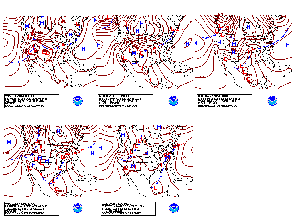
Notice how the frontal boundary never really gets all that far away from Southern New England. Which means that depending on which way it drifts and meanders, that will have an effect on our temperatures. Right now the early part of the week looks warm with highs in the 70s possible for Tuesday.
Towards the end of the period conditions will become a little more unsettled as the chance of a shower & possibly some rain pops back into the forecast.
On another weather related note. Keep an eye out for a severe weather outbreak next week across the Southern Plains and Mississippi valley.
7 DAY FORECAST
Today: Partly cloudy with highs in the mid to upper 50s. Northwest wind at 5-10 mph. Rain along the South Coast.
Saturday: Mostly sunny with highs around 45. West wind 5-10 mph.
Sunday: Partly cloudy with highs 50-55. Southwest wind 15-20 mph.
Monday: Partly cloudy with highs in the upper 60s. Winds light and variable.
Tuesday: Partly cloudy with highs around 70. Chance of a shower or storm.
Wednesday: Partly cloudy with highs in the mid 50s.
Thursday: Mostly cloudy with highs around 50. Chance of a shower.
Friday: Mostly cloudy with highs near 60. Chance of rain.
-Chris
