The overall forecast is on track. A large powerful storm is taking shape off the Virginia Coast. As the system drifts east it’s precipitation shield will expand to be large enough to include Southern and Central New England.
Precipitation should move in overnight tonight. It will be light at first, eventually picking up in rate later in the afternoon. Do not be surprised if it starts as rain. Also do not be surprised if at times it is snowing, raining, sleeting or all of the above. It is during the times of heavier precipitation that snow will be found.
As we get towards supper Thursday evening a few things begin to work in our favor for snow. The sun will be setting and precipitation rates will pick up. Allowing for snow to move in and to begin accumulating.
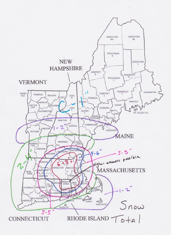
During the day Thursday accumulations will be minimal or non-existant. Overnight Thursday into Friday morning is when the accumulations will occur. (See map above).
The storm does not finally move away until Friday afternoon. Meaning that snow could possibly end as rain in some places Friday.
Looking further ahead, the weekend looks nice.
OTHER IMPACTS
Wind: This storm is going to be very windy. Winds just above our heads will be greater than 50 knots. Which means that we could see wind gusts on the order of 50 to 60 mph. Along the coastline gusts of 50 mph will be fairly frequent. Power outages are a definite possibility.
Waves/surge: The combination of a powerful system and a constant easterly wind for 2 or more days will create some very large waves over the North Atlantic. Some wave models are suggesting 20-30 foot waves will be the norm just offshore. Beach erosion is a certainty along with coastal flooding in areas that are prone to flooding.
Power Outages: As I mentioned in the wind section above, power outages are possible. The combination of very heavy wet snow and strong winds make for a good limb snapping/power line breaking combination. Areas south of Boston are more likely to lose power, but strong gusts are expected everywhere so power outages could occur anywhere.
Again the bulk of the accumulation snow is expected overnight Thursday and into Friday morning. So please do not think the storm isn’t coming if during the day Thursday if it is raining or the snow is not all that impressive.
-Chris
