The meteorological community has been a buzz today with what our computer guidance models are beginning to advertise. Remember in the last blog where I mentioned a large ocean storm for the Thursday time frame? Well for the longest time it looked as if the system would skirt to our south and only impact New England with large surf.
Well yesterday one of our computer guidance models came in with a rather substantial snowstorm for Southern New England. Through this afternoon that same model has only become more substantial in it’s potential impacts. BUT in addition, the other computer guidance models have taken steps toward the large impact scenario.
So right now what I would like to do is outline two different scenarios. Which I feel have equal chances of being correct.
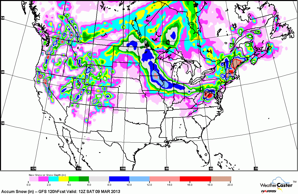
The first is the extreme solution. Which includes 1 to 2 feet of snow for some locations across Southern New England. This is the scenario being outlined by the GFS model, the SREF and now the NAM. Those colors over portions of New England range from 4-20″ of snow.
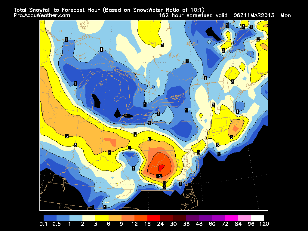
Meanwhile the other scenario is one in which the storm just skirts us to the south and while most of the region still sees some flakes, it is no where near the impact of what I described above. This scenario is being supported by the Euro, CMC and UKMET. As can be seen, this scenario only shows a couple of inches of snow.
Which one is right is the big question of course!!! Honestly there is a 50/50 chance that either scenario will happen and more than likely the truth lies somewhere in between. Will wait until tomorrow morning to issue a true forecast. Until then just keep in the back of your mind that a storm is coming and that it has the potential to be rather significant.
-Chris
