Last post I talked about the rain system that impacted us on Wednesday and I mentioned how the system was basically going to die and rot over our heads. Well it is now Friday and that same system is still sitting on our heads. Which is the reason for all the gray clouds and sometimes dreary look to the sky.
Well luckily this system has become just a nuisance and except for portions of Eastern Maine, just a cloud maker. This will be our weather for the next few days. Lots of clouds with the occasional break in the clouds allowing us to see the sun.
Below is the forecasted 500 mb vorticity map for 1 pm Friday afternoon. Notice how the system is still centered over New England. The system has really weakened and is represented by the black contour labeled 534.
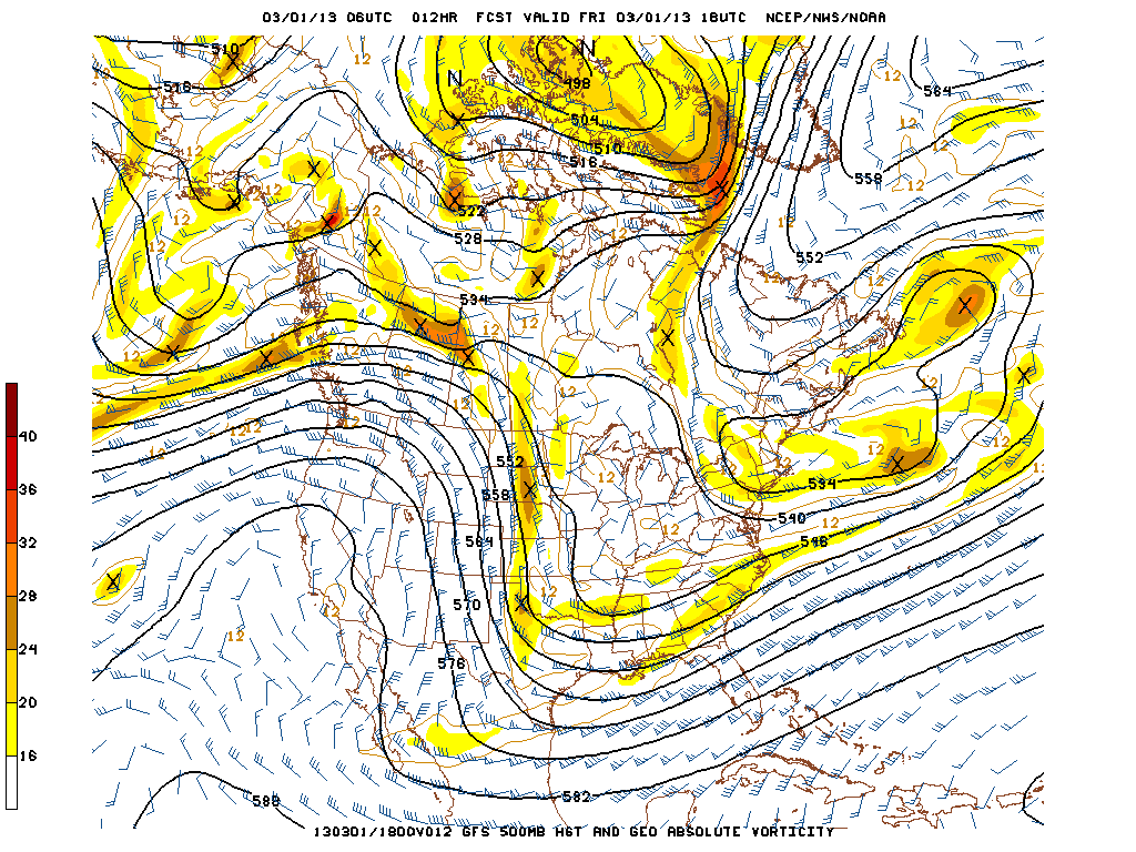
Also of note is the “tongue” like feature to our North and East. What I am describing is the shape the contours south of the tip of Greenland (the 564, 558, 552 black lines) make. From the top of the image towards Canada, they appear to make a tongue. The black lines (contours) and the blue-ish wind barbs are representative of the flow at this level of the atmosphere. What this is showing meteorologically is that the flow is congested over the North Atlantic and that storm systems trying to move off the East Coast have no where to go. We call this a blocking pattern. It is a pattern like this that allowed Hurricane Sandy to impact the East Coast. And a pattern like this that would allow for a rather significant snow storm if one were to form. *Hint* *Hint*
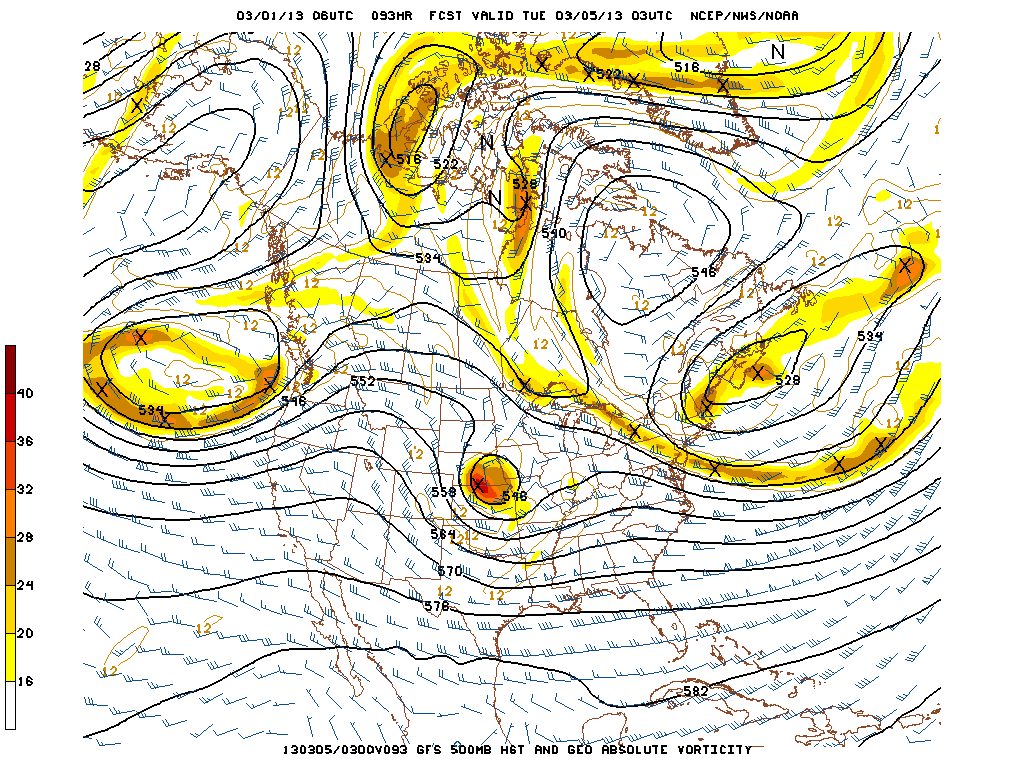
The next image is the forecasted 500 mb vorticity for Monday night at 10 pm. Just wanted to point out that our same storm system is still sitting and spinning just to our north and east. But I also wanted to point out that area of energy over Kansas and Nebraska. We may have to keep an eye on that one for later next week.
But for today and the weekend expect lots of clouds with the occasional gap that allows us to receive some sunshine. Daily temperatures will be in the low 40s each day. And eastern Maine will have to be weary of the occasional batch of light snow rotating around the system overhead.
Looking ahead to next week, Monday through Wednesday appear to be dry with highs in the 40-45 range. Thursday and Friday we will be keeping an eye on the system I mentioned above. Right now all computer guidance suggests that a significant storm will form somewhere off the East Coast. The question is really just to where. This one will definitely have to be monitored in the coming days.
7 DAY FORECAST
Friday: Mostly cloudy with the occasional break in the clouds. Light batches of snow for eastern Maine. Highs in the low 40s. West wind 5-10 mph.
Saturday: A repeat of Friday really. Mostly cloudy with those sporadic breaks showing the sun. Highs around 45. West-northwest wind 5-10 mph.
Sunday: Partly to mostly cloudy with highs around 40. West-northwest wind 0-5 mph.
Monday: Partly cloudy with highs in the low 40s. West winds 10-15 mph.
Tuesday: Partly cloudy with highs 40-45.
Wednesday: Partly cloudy with highs around 40.
Thursday: Mostly cloudy with a chance for snow. Keeping an eye on this one. Highs in the mid 30s.
-Chris
