De ja vu anyone? For what will be the third weekend in a row, a significant coastal storm is progged to form off the East Coast of the United States. Here is what the last two looked like:

Whether or not this upcoming system ends up looking like these two is yet to be determined; but I will say this: this weekends storm has the potential to be a significant, if not major snow storm for Central & possibly Southern New England.
For a while now the pattern has supported the potential for a storm this coming weekend; but it wasn’t until last night’s run that they began to advertise a system with major impacts.
This morning’s runs have come in and they continue to show the idea of a big storm. One difference being that we will likely have to closely monitor a rain/snow line with this one; whereas the last two weekend storms were all snow.
Places that stay all snow however could be looking at 12″+ of heavy wet snow. Places that begin as rain could possibly see half an inch of rain; followed by 6″+ of snow.
As always, finer details such as specific amounts, rain/snow line location and other potential impacts are to be determined as we get closer to the event.
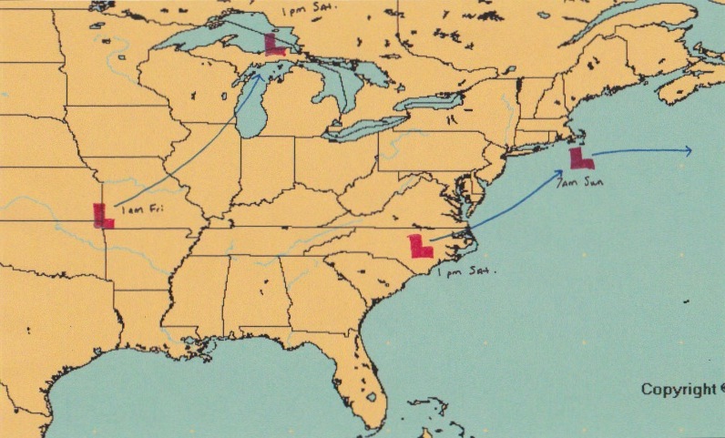
For a general overview of how this system will play out, see my handcrafted image below. The initial storm system will track from Oklahoma to the UP of Michigan where it will begin to die. While this is occurring, a new system will be forming near the Carolinas. This storm will then track northeast and pass very near to Nantucket.
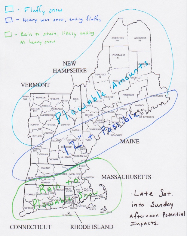
And as for a very early, very crude forecast for potential impacts here in New England; see map below.
Just wanted to give everyone a heads up that we look to make it 3 for 3 in the weekend snow storm department. And that this one also has the potential to significantly impact us.
-Chris
