After last weekend’s Blizzard the last thing most New Englanders want is another big snow storm. Luckily this weekend’s storm looks to form just a little too far to the East. But Eastern portions of New England; especially Maine where Blizzard watches are up, looked to be clipped by this system.
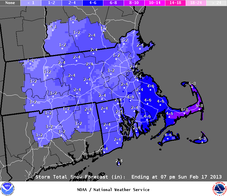
If you see snow flying this afternoon it should not be a surprise. We have a chance of light snow basically from now until tomorrow afternoon. Accumulations should be minimal at best. Tomorrow afternoon the big ocean system will make it’s closest pass to the region and could deliver a period of moderate snow. The further east one lives, the more potential snow they could see. For a perfect visual to this I have provided the National Weather Services snowfall forecast.
Not that extreme Southeastern Mass has a chance of around 4 inches of so and that Cape Cod could see 6″ or more.
After this snow on Sunday, we get a little bit of a break until Wednesday when a few snow showers appear possible. And as the pattern has shown, there is a chance of a weekend storm somewhere off the East Coast and this will have to be monitored going forward.
7 DAY FORECAST
Tonight: Light snow possible. Especially across far Eastern portions of New England. Overnight lows in the low 20s. Northwest winds 10-15 mph.
Sunday: Large Ocean storm passes us to the East. Should throw some moisture our direction. Accumulating snow likely across Eastern areas. Highs in the upper 20s. West-northwest winds 10-15 mph. Higher gusts likely on the Cape.
Monday: Partly cloudy with highs near 30. West wind 10-15 mph.
Tuesday: Partly cloudy with highs in the low 40s. Chance of a snow shower late afternoon. Southwest wind 5-10 mph.
Wednesday: Chance of light snow very early morning. Afternoon highs 35-40.
Thursday: Partly cloudy with afternoon highs 25-30.
Friday: Partly cloudy with afternoon highs in the low 30s.
-Chris
