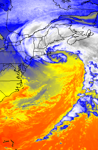
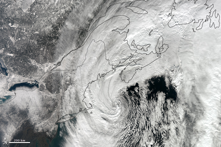
I just wanted to share a couple of my favorite images from the Blizzard of this past weekend. This storm is number 1 on my list for having the most impressive satellite images of any storm I have experienced to date.
Bringing a general 2 feet of snow to most; except central CT (where they got 3 feet), this one has gone down in the record books. The Blizzard of 2013 moved into the number 5 spot at Boston for most snow from a storm. While going down as number 1 at many locations such as Portland, ME and Hartford, CT.
But that storm is behind us now. On to the next one. Which will be here early Thursday morning. Luckily this one will not be big at all. In fact it will probably only affect those south of Boston. Places on the Cape could see a couple inches. While north of the canal might see a dusting to an inch.
After the next potential system is here for the weekend, but that is a big question mark right now!
7 DAY FORECAST
Tonight: Mostly clear with lows in the mid 20s. West wind around 10 mph.
Wednesday: Increasing afternoon clouds with highs in the low 40s. Light west winds 0-5 mph.
Thursday: Morning snow across extreme Southern New England. Only an inch or two really. Afternoon highs in the mid 40s. Light west winds 0-5 mph.
Friday: Partly cloudy with highs in the mid 40s.
Saturday: Chance snow shower. Otherwise mostly cloudy with highs in the low 40s.
Sunday: Looks like ocean storm should miss us to the south. Cold. Highs only in the mid 20s.
Monday: Partly cloudy with highs in the low 30s.
-Chris
