I will admit that I have been asleep at the wheel recently. But that is what happens when the weather is all in all pretty boring! The last 2+ weeks have brought nothing but mostly dry conditions and slightly above average temperatures.
These slightly above temperatures caused all of our snow to melt, which released a lot of moisture into the atmosphere. This moisture was trapped in the lower levels due to high pressure overhead. The combination of abundant moisture, high pressure and light winds is what led to the outbreak of fog across most of Southern New England.
Finally today the sun was able to break through and temperatures soared. This has been a possibility for the last few days, but we were never able to get the sun to make an appearance. Today it did and look what happened. Thankfully this is not going to last and winter will be returning soon.
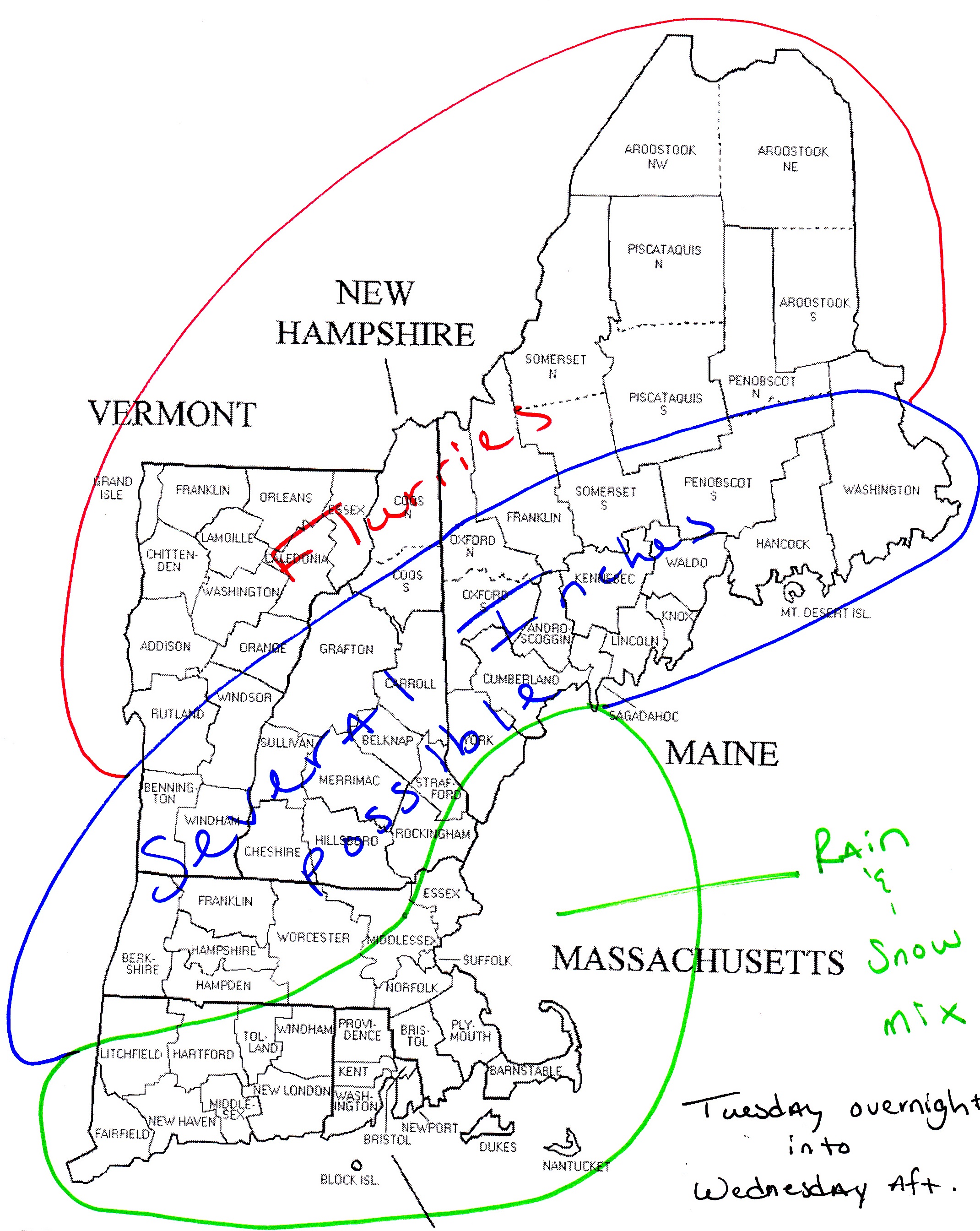
Computer guidance has trended northward fairly significantly with a plume of moisture that is gathering across the Southeast today. Look for this batch of precipitation to arrive overnight Tuesday and Wednesday sometime after 1 am. It will stick with us through the Wednesday morning commute and depart sometime after lunch.
As it appears right now, it will begin as snow in most communities due to the timing of very early morning onset of snowfall. As the sun comes up I am expecting for a rain/snow line to push northward and advance as far as possibly the CT/MA border and stretch east through Eastern Mass.
All locations can expect a coating, but those places that stay all snow could see a few inches. I’m hesitant to go too high on snow amounts due to the uncertainty around this system. Remember this system has only been on the radar for what seems like a few hours. And there are questions to how far north the precipitation extends.
Will feel much more confident in amounts after this evenings guidance comes in. With likely a more detailed snow map coming tomorrow morning. Stayed tuned.
7 DAY FORECAST
Tonight: Partly cloudy skies with overnight lows in the lower 30s.
Tuesday: Mostly clear. Chance of a sprinkle along the South Coast. Highs in the low 40s.
Wednesday: Precipitation moves in sometime very early during the morning hours. Starts as snow in most locals. Several inches possibly where it stays all snow. Daytime highs 30-35.
Thursday: Mostly cloudy. Highs in the low 30s.
Friday: Partly cloudy and cold! Highs in the upper 20s.
Saturday: Partly cloudy with highs around 40.
Sunday: Mostly clear with highs around 40.
Monday: Partly cloudy with highs around 40.
-Chris
